![](/images/other/stat-length.png)
![Randonnée Marche Hotton - Promenade de la pierre d'Hotton - Photo](https://media.geolcdn.com/t/1900/400/ext.pjpeg?maxdim=2&url=https%3A%2F%2Fmedia.geolcdn.com%2Ff%2F85633bca-0870-44be-ba21-a00acca6b2c8.jpg)
Promenade de la pierre d'Hotton
yvan bomal
Utilisateur
![Longueur](/images/other/stat-length.png)
Longueur
6,4 km
![Altitude max](https://static1.geolcdn.com/siteimages/upload/files/1508320355ic_sort_altitude_max_24dp.png)
Altitude max
268 m
![Dénivelé positif](https://static1.geolcdn.com/siteimages/upload/files/1508320355ic_sort_den_pos_24dp.png)
Dénivelé positif
111 m
![Km-Effort](/images/other/stat-length.png)
Km-Effort
7,9 km
![Altitude min](https://static1.geolcdn.com/siteimages/upload/files/1508320355ic_sort_altitude_min_24dp.png)
Altitude min
180 m
![Dénivelé négatif](https://static1.geolcdn.com/siteimages/upload/files/1508320355ic_sort_den_neg_24dp.png)
Dénivelé négatif
117 m
![Boucle](https://static1.geolcdn.com/siteimages/upload/files/16400158638029165_repeat_loop_refresh_sync_direction_icon.png)
Boucle
Oui
Date de création :
2020-11-07 11:09:59.775
Dernière modification :
2020-11-08 21:33:46.363
![Marche](https://static1.geolcdn.com/sitytour/trail-icons/101.png)
1h29
Difficulté : Très facile
![Escalade](https://static1.geolcdn.com/sitytour/trail-icons/907.png)
--
Difficulté : Très facile
![Scannez ce code QR pour ouvrir la randonnée dans l'application SityTrail](https://capi.geolives.com/qq0zvz2zws4bq2lad0pu/sitytour/trails/2595589/qr.png?size=200)
Application GPS de randonnée GRATUITE
À propos
Randonnée Marche de 6,4 km à découvrir à Wallonie, Luxembourg, Hotton. Cette randonnée est proposée par yvan bomal.
Description
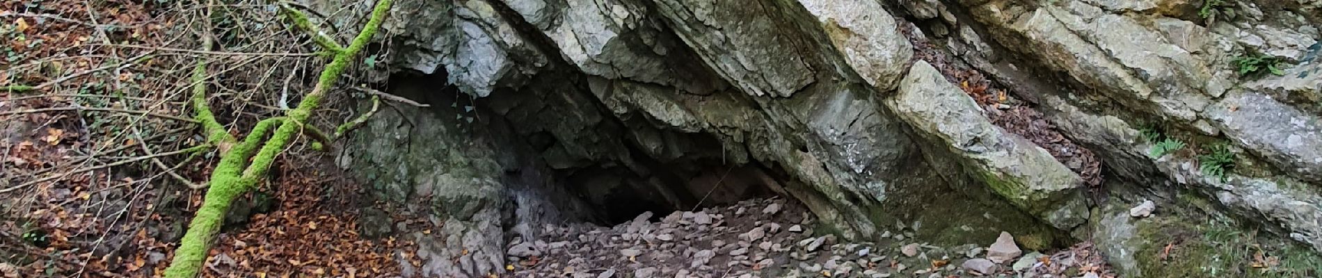
Du cimetière de Hotton aux Rochers de Renissart (pour les amateurs d'escalade n'oubliez le matos de grimpe) en passant par la résurgence de l'Isbelle voici une balade qui n'en laissera aucun indifférent.
Localisation
Pays :
Belgique
Région :
Wallonie
Département/Province :
Luxembourg
Commune :
Hotton
Localité :
Hotton
Départ:(Dec)
Départ:(UTM)
675202 ; 5571478 (31U) N.
Commentaires
Randonnées à proximité
![Randonnée Marche Hotton - RB-Lu-04_Marenne - Photo](https://media.geolcdn.com/t/375/260/ext.jpg?maxdim=2&url=https%3A%2F%2Fservices.sitytrail.com%2FGeolivesWS%2FDownloadMedia.ashx%3FTrailID%3D179613%26Media%3Dc1eccb03-838f-4466-b103-ba3011ffaee0.jpg)
![Marche Marche](https://static1.geolcdn.com/sitytour/trail-icons/101.png)
RB-Lu-04_Marenne
Marche
Moyen
(13)
Hotton,
Wallonie,
Luxembourg,
Belgique
![](/images/other/stat-length.png)
18,4 km | 24 km-effort
5h 6min
![](https://static1.geolcdn.com/siteimages/upload/files/16400158638029165_repeat_loop_refresh_sync_direction_icon.png)
Oui
![Randonnée Marche Hotton - RF-Lu-03 Sur la Calestienne, entre Ardenne et Famenne : Hotton - Photo](https://media.geolcdn.com/t/375/260/ext.jpg?maxdim=2&url=https%3A%2F%2Fservices.sitytrail.com%2FGeolivesWS%2FDownloadMedia.ashx%3FTrailID%3D407838%26Media%3D5ce28d25-1425-4e98-96ff-2c6c15aabb08.jpg)
![Marche Marche](https://static1.geolcdn.com/sitytour/trail-icons/101.png)
RF-Lu-03 Sur la Calestienne, entre Ardenne et Famenne : Hotton
Marche
Très facile
(3)
Hotton,
Wallonie,
Luxembourg,
Belgique
![](/images/other/stat-length.png)
11,7 km | 15,3 km-effort
3h 16min
![](https://static1.geolcdn.com/siteimages/upload/files/16400158638029165_repeat_loop_refresh_sync_direction_icon.png)
Oui
![Randonnée Marche Rendeux - Arboretum et Ourthe - Photo](https://media.geolcdn.com/t/375/260/ext.jpg?maxdim=2&url=https%3A%2F%2Fmedia.geolcdn.com%2Ff%2F114fab54-a809-4035-a129-83d982caf499.jpg)
![Marche Marche](https://static1.geolcdn.com/sitytour/trail-icons/101.png)
Arboretum et Ourthe
Marche
Moyen
(3)
Rendeux,
Wallonie,
Luxembourg,
Belgique
![](/images/other/stat-length.png)
9 km | 12 km-effort
3h 15min
![](https://static1.geolcdn.com/siteimages/upload/files/16400158638029165_repeat_loop_refresh_sync_direction_icon.png)
Oui
![Randonnée Marche Hotton - Fronville - Monteuville - Petihan - Photo](https://media.geolcdn.com/t/375/260/ext.jpg?maxdim=2&url=https%3A%2F%2Fservices.sitytrail.com%2FGeolivesWS%2FDownloadMedia.ashx%3FTrailID%3D1067628%26Media%3Dfix__20181106130901.jpg)
![Marche Marche](https://static1.geolcdn.com/sitytour/trail-icons/101.png)
Fronville - Monteuville - Petihan
Marche
Facile
(1)
Hotton,
Wallonie,
Luxembourg,
Belgique
![](/images/other/stat-length.png)
13 km | 14,8 km-effort
2h 11min
![](https://static1.geolcdn.com/siteimages/upload/files/16400158638029165_repeat_loop_refresh_sync_direction_icon.png)
Oui
![Randonnée Marche Hotton - Saint-Pierre - Photo](https://media.geolcdn.com/t/375/260/ext.jpg?maxdim=2&url=https%3A%2F%2Fservices.sitytrail.com%2FGeolivesWS%2FDownloadMedia.ashx%3FTrailID%3D204152%26Media%3D4d13859b-e8ea-464e-b6f5-80f7a1b7659d.jpg)
![Marche Marche](https://static1.geolcdn.com/sitytour/trail-icons/101.png)
Saint-Pierre
Marche
Facile
(3)
Hotton,
Wallonie,
Luxembourg,
Belgique
![](/images/other/stat-length.png)
10,9 km | 12,1 km-effort
2h 43min
![](https://static1.geolcdn.com/siteimages/upload/files/16400158638029165_repeat_loop_refresh_sync_direction_icon.png)
Oui
![Randonnée Marche Rendeux - promenade de lourthe - Photo](https://media.geolcdn.com/t/375/260/ext.jpg?maxdim=2&url=https%3A%2F%2Fservices.sitytrail.com%2FGeolivesWS%2FDownloadMedia.ashx%3FTrailID%3D338833%26Media%3Dfix__20140824184151.jpg)
![Marche Marche](https://static1.geolcdn.com/sitytour/trail-icons/101.png)
promenade de lourthe
Marche
Difficile
(3)
Rendeux,
Wallonie,
Luxembourg,
Belgique
![](/images/other/stat-length.png)
8,1 km | 11 km-effort
2h 35min
![](https://static1.geolcdn.com/siteimages/upload/files/16400158638029165_repeat_loop_refresh_sync_direction_icon.png)
Oui
![Randonnée Marche Rendeux - Montaigu - Photo](https://media.geolcdn.com/t/375/260/ext.jpg?maxdim=2&url=https%3A%2F%2Fservices.sitytrail.com%2FGeolivesWS%2FDownloadMedia.ashx%3FTrailID%3D264121%26Media%3De6783db9-1bdf-46f4-876d-878e9e4b81fa.jpg)
![Marche Marche](https://static1.geolcdn.com/sitytour/trail-icons/101.png)
![Randonnée Marche Hotton - De werpin a werpin via Trinal - Photo](https://media.geolcdn.com/t/375/260/ext.jpg?maxdim=2&url=https%3A%2F%2Fservices.sitytrail.com%2FGeolivesWS%2FDownloadMedia.ashx%3FTrailID%3D225931%26Media%3Dfix__20131007161453.jpg)
![Marche Marche](https://static1.geolcdn.com/sitytour/trail-icons/101.png)
De werpin a werpin via Trinal
Marche
Facile
(1)
Hotton,
Wallonie,
Luxembourg,
Belgique
![](/images/other/stat-length.png)
9,3 km | 12,4 km-effort
2h 38min
![](https://static1.geolcdn.com/siteimages/upload/files/16400158638029165_repeat_loop_refresh_sync_direction_icon.png)
Oui