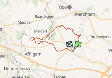
![](/images/other/stat-length.png)
![Randonnée Marche Asse - Asse 25 km - Photo](https://media.geolcdn.com/t/1900/400/93373654-1789-4a22-a980-4e4078e012f6.jpg&format=pjpeg&maxdim=2)
Asse 25 km
rvapeldo
Utilisateur GUIDE
![Longueur](/images/other/stat-length.png)
![Altitude max](https://static1.geolcdn.com/siteimages/upload/files/1508320355ic_sort_altitude_max_24dp.png)
![Dénivelé positif](https://static1.geolcdn.com/siteimages/upload/files/1508320355ic_sort_den_pos_24dp.png)
![Km-Effort](/images/other/stat-length.png)
![Altitude min](https://static1.geolcdn.com/siteimages/upload/files/1508320355ic_sort_altitude_min_24dp.png)
![Dénivelé négatif](https://static1.geolcdn.com/siteimages/upload/files/1508320355ic_sort_den_neg_24dp.png)
![Boucle](https://static1.geolcdn.com/siteimages/upload/files/16400158638029165_repeat_loop_refresh_sync_direction_icon.png)
![Marche](https://static1.geolcdn.com/sitytour/trail-icons/101.png)
6h08
Difficulté : Moyen
![Scannez ce code QR pour ouvrir la randonnée dans l'application SityTrail](https://capi.geolives.com/qq0zvz2zws4bq2lad0pu/sitytour/trails/2591829/qr.png?size=200)
Application GPS de randonnée GRATUITE
À propos
Randonnée Marche de 25 km à découvrir à Flandre, Brabant flamand, Asse. Cette randonnée est proposée par rvapeldo.
Description
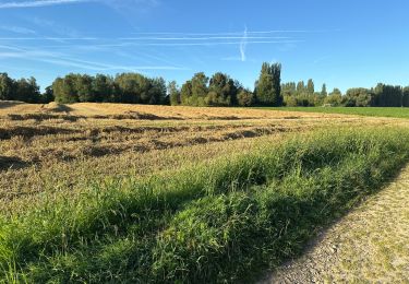
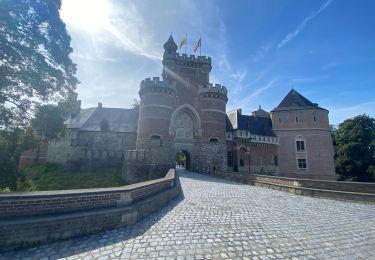
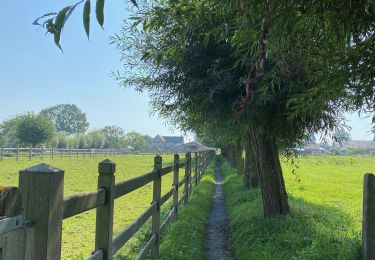
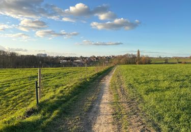
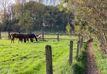
Parcours dans la campagne autour de Asse, parmi les pommiers, les champs de poireaux, de mais, les prés et les bois, dont le charmant Kravaalbos, et l’abbaye d’Afflighem.
Reis door het platteland rond Asse, tussen appelbomen, prei- en maïsvelden, weilanden en bossen, waaronder het charmante Kravaalbos en de abdij van Afflighem.
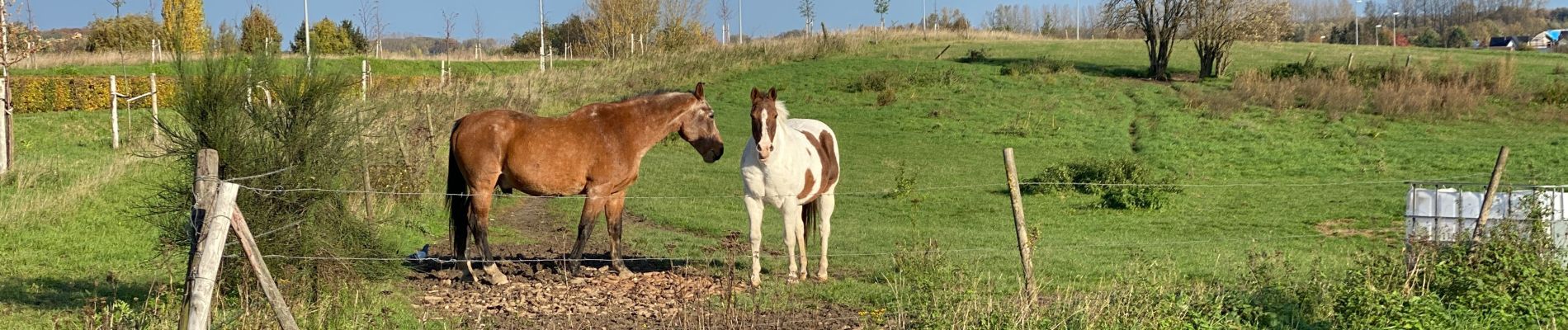
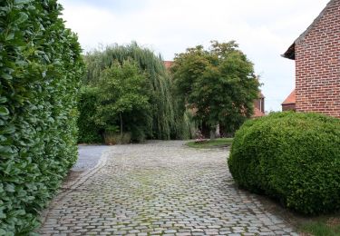
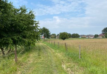
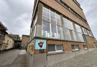
Localisation
Commentaires
Randonnées à proximité
![Randonnée Randonnée équestre Opwijk - Mazenzele- Meldert vanuit De Kleine Deugd - Photo](https://media.geolcdn.com/t/375/260/ext.jpg?maxdim=2&url=https%3A%2F%2Fstatic1.geolcdn.com%2Fsiteimages%2Fupload%2Ffiles%2F1524743154cheval.jpg)
![Randonnée équestre Randonnée équestre](https://static1.geolcdn.com/sitytour/trail-icons/301.png)
Randonnée équestre
![](/images/other/stat-length.png)
![](https://static1.geolcdn.com/siteimages/upload/files/16400158638029165_repeat_loop_refresh_sync_direction_icon.png)
![Randonnée A pied Alost - Kersenwandeling - Photo](https://media.geolcdn.com/t/375/260/ea2bda03-7aab-439e-ac2f-d6e170d9c15f.jpeg&format=jpg&maxdim=2)
![A pied A pied](https://static1.geolcdn.com/sitytour/trail-icons/100.png)
A pied
![](/images/other/stat-length.png)
![](https://static1.geolcdn.com/siteimages/upload/files/16400158638029165_repeat_loop_refresh_sync_direction_icon.png)
![Randonnée Marche Merchtem - Brussegem nord 7,3 km - Photo](https://media.geolcdn.com/t/375/260/c2a2b302-b3fd-44e8-9488-687c48558849.jpg&format=jpg&maxdim=2)
![Marche Marche](https://static1.geolcdn.com/sitytour/trail-icons/101.png)
Marche
![](/images/other/stat-length.png)
![](https://static1.geolcdn.com/siteimages/upload/files/16400158638029165_repeat_loop_refresh_sync_direction_icon.png)
![Randonnée Marche Asse - Kobbegem 9,5 km - Photo](https://media.geolcdn.com/t/375/260/2de11148-734b-4827-acd5-5954d6fd231a.jpg&format=jpg&maxdim=2)
![Marche Marche](https://static1.geolcdn.com/sitytour/trail-icons/101.png)
Marche
![](/images/other/stat-length.png)
![](https://static1.geolcdn.com/siteimages/upload/files/16400158638029165_repeat_loop_refresh_sync_direction_icon.png)
![Randonnée Marche Asse - Relegem 6,7 km - Photo](https://media.geolcdn.com/t/375/260/1ab31170-f8b5-400f-8065-9451c1820ffd.jpg&format=jpg&maxdim=2)
![Marche Marche](https://static1.geolcdn.com/sitytour/trail-icons/101.png)
Marche
![](/images/other/stat-length.png)
![](https://static1.geolcdn.com/siteimages/upload/files/16400158638029165_repeat_loop_refresh_sync_direction_icon.png)
![Randonnée Marche Ternat - S-GR Groene Gordel: Ternat - Halle - Photo](https://media.geolcdn.com/t/375/260/f34dd4c3-06f8-4b96-bd12-c0718d53382f.jpeg&format=jpg&maxdim=2)
![Marche Marche](https://static1.geolcdn.com/sitytour/trail-icons/101.png)
Marche
![](/images/other/stat-length.png)
![](https://static1.geolcdn.com/siteimages/upload/files/16400158638029165_repeat_loop_refresh_sync_direction_icon.png)
![Randonnée Marche Asse - S-GR Groene Gordel: Mollem - Ternat - Photo](https://media.geolcdn.com/t/375/260/6faef7af-0d0f-4faa-bb47-f1d7e98a3199.jpeg&format=jpg&maxdim=2)
![Marche Marche](https://static1.geolcdn.com/sitytour/trail-icons/101.png)
Marche
![](/images/other/stat-length.png)
![](https://static1.geolcdn.com/siteimages/upload/files/16400158638029165_repeat_loop_refresh_sync_direction_icon.png)
![Randonnée Marche Asse - Zellik 8,5 km - Photo](https://media.geolcdn.com/t/375/260/1e810e01-757b-48d4-b0eb-af3d4de90fe2.jpg&format=jpg&maxdim=2)
![Marche Marche](https://static1.geolcdn.com/sitytour/trail-icons/101.png)
Marche
![](/images/other/stat-length.png)
![](https://static1.geolcdn.com/siteimages/upload/files/16400158638029165_repeat_loop_refresh_sync_direction_icon.png)
![Randonnée Marche Asse - Asse 10,7 km - Photo](https://media.geolcdn.com/t/375/260/0cbdcab9-dd9e-496b-b40e-0779d93b5c23.jpg&format=jpg&maxdim=2)
![Marche Marche](https://static1.geolcdn.com/sitytour/trail-icons/101.png)
Marche
![](/images/other/stat-length.png)
![](https://static1.geolcdn.com/siteimages/upload/files/16400158638029165_repeat_loop_refresh_sync_direction_icon.png)