![](/images/other/stat-length.png)
![Randonnée V.T.T. Saillon - Lac de Fully par Dorénaz - Photo](https://media.geolcdn.com/t/1900/400/ext.pjpeg?maxdim=2&url=https%3A%2F%2Fstatic1.geolcdn.com%2Fsiteimages%2Fupload%2Ffiles%2F1524743154velo.jpg)
Lac de Fully par Dorénaz
otrement
Utilisateur
![Longueur](/images/other/stat-length.png)
![Altitude max](https://static1.geolcdn.com/siteimages/upload/files/1508320355ic_sort_altitude_max_24dp.png)
![Dénivelé positif](https://static1.geolcdn.com/siteimages/upload/files/1508320355ic_sort_den_pos_24dp.png)
![Km-Effort](/images/other/stat-length.png)
![Altitude min](https://static1.geolcdn.com/siteimages/upload/files/1508320355ic_sort_altitude_min_24dp.png)
![Dénivelé négatif](https://static1.geolcdn.com/siteimages/upload/files/1508320355ic_sort_den_neg_24dp.png)
![Boucle](https://static1.geolcdn.com/siteimages/upload/files/16400158638029165_repeat_loop_refresh_sync_direction_icon.png)
![V.T.T.](https://static1.geolcdn.com/sitytour/trail-icons/202.png)
5h32
Difficulté : Inconnu
![Scannez ce code QR pour ouvrir la randonnée dans l'application SityTrail](https://capi.geolives.com/qq0zvz2zws4bq2lad0pu/sitytour/trails/25911/qr.png?size=200)
Application GPS de randonnée GRATUITE
À propos
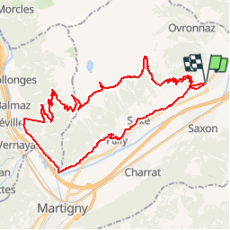
Randonnée V.T.T. de 44 km à découvrir à Valais, Martigny, Saillon. Cette randonnée est proposée par otrement.
Description
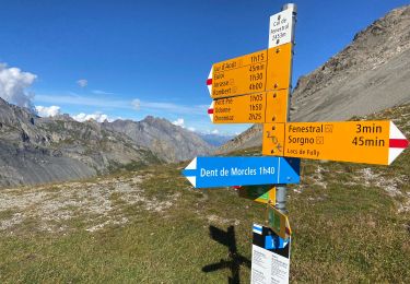
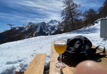
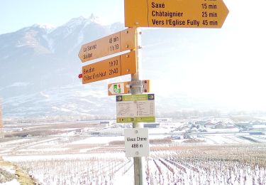
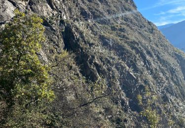
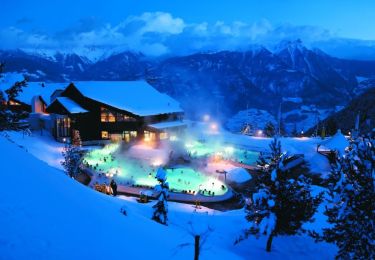
Départ prévu à Saillon. Après quelques km de plat, l''histoire de se chauffer un peu, nous allons sur les hauts de Fully en passant en bordure de la Chataigneraie puis nous suivons les sentiers des vignes jusqu''à Branson avant d''emprunter le sentier des Follatères (véritable coin de Méditerranée) nous menant à Dorénaz. de là, nous montons en téléphérique jusqu''à Alesse et c''est parti pour la grande montée jusqu''au portail de Fully (2260m). Le balcon du Rhône.. vous y êtes ! Une descente technique sur le lac nous amène au pied d''un dernier coup du cul dans un pierrier et hop c''est parti pour 1700m de descente jusqu''au bain de saillon pour une remise en forme (costume de bain pour les amateurs)...
Points d'intérêt
Localisation
Commentaires
Randonnées à proximité
![Randonnée A pied Fully - Tour du Grand Chavalard - Photo](https://media.geolcdn.com/t/375/260/dev_67507fd3-861a-4ef5-97f2-010a7f511665.jpeg&format=jpg&maxdim=2)
![A pied A pied](https://static1.geolcdn.com/sitytour/trail-icons/100.png)
A pied
![](/images/other/stat-length.png)
![](https://static1.geolcdn.com/siteimages/upload/files/16400158638029165_repeat_loop_refresh_sync_direction_icon.png)
![Randonnée Marche nordique Leytron - Ovronaz - Loutze - Ovronaz - Photo](https://media.geolcdn.com/t/375/260/ext.jpg?maxdim=2&url=https%3A%2F%2Fservices.sitytrail.com%2FGeolivesWS%2FDownloadMedia.ashx%3FTrailID%3D246200%26Media%3D20140201124820.jpg)
![Marche nordique Marche nordique](https://static1.geolcdn.com/sitytour/trail-icons/102.png)
Marche nordique
![](/images/other/stat-length.png)
![](https://static1.geolcdn.com/siteimages/upload/files/16400158638029165_repeat_loop_refresh_sync_direction_icon.png)
![Randonnée Marche Leytron - Cabane Rambert - Photo](https://media.geolcdn.com/t/375/260/ext.jpg?maxdim=2&url=https%3A%2F%2Fservices.sitytrail.com%2FGeolivesWS%2FDownloadMedia.ashx%3FTrailID%3D209855%26Media%3D20130803134530.jpg)
![Marche Marche](https://static1.geolcdn.com/sitytour/trail-icons/101.png)
![Randonnée Marche Leytron - 0vronnaz cabane FENESTRAL - Photo](https://media.geolcdn.com/t/375/260/9e828b15-70d6-4c01-9d2a-591b66af477f.jpg&format=jpg&maxdim=2)
![Marche Marche](https://static1.geolcdn.com/sitytour/trail-icons/101.png)
Marche
![](/images/other/stat-length.png)
![](https://static1.geolcdn.com/siteimages/upload/files/16400158638029165_repeat_loop_refresh_sync_direction_icon.png)
![Randonnée Marche Saxon - charrat - Photo](https://media.geolcdn.com/t/375/260/0fb1c0ec-d76f-4e80-b50c-5cb298811d98.jpg&format=jpg&maxdim=2)
![Marche Marche](https://static1.geolcdn.com/sitytour/trail-icons/101.png)
![Randonnée Marche Chamoson - Ovronnaz - Photo](https://media.geolcdn.com/t/375/260/0b175b2c-bdb1-4f39-8772-d1c6dc09dbdc.jpg&format=jpg&maxdim=2)
![Marche Marche](https://static1.geolcdn.com/sitytour/trail-icons/101.png)
![Randonnée A pied Fully - Sentier à travers les âges - Photo](https://media.geolcdn.com/t/375/260/8a1a852d-6a7f-45b3-a0c4-f1dd82397282.jpeg&format=jpg&maxdim=2)
![A pied A pied](https://static1.geolcdn.com/sitytour/trail-icons/100.png)
A pied
![](/images/other/stat-length.png)
![](https://static1.geolcdn.com/siteimages/upload/files/16400158638029165_repeat_loop_refresh_sync_direction_icon.png)
![Randonnée Marche Fully - fully boudin - Photo](https://media.geolcdn.com/t/375/260/2dc9ab8a-0979-42c4-8309-369498f48caa.jpg&format=jpg&maxdim=2)
![Marche Marche](https://static1.geolcdn.com/sitytour/trail-icons/101.png)
![Randonnée Marche Leytron - Tour d'Ovronaz - Route des bains - Photo](https://media.geolcdn.com/t/375/260/ext.jpg?maxdim=2&url=https%3A%2F%2Fservices.sitytrail.com%2FGeolivesWS%2FDownloadMedia.ashx%3FTrailID%3D596427%26Media%3D3babb666-a844-4fe9-a5e0-8ddcda1a2c0c.jpg)
![Marche Marche](https://static1.geolcdn.com/sitytour/trail-icons/101.png)
Marche
![](/images/other/stat-length.png)
![](https://static1.geolcdn.com/siteimages/upload/files/16400158638029165_repeat_loop_refresh_sync_direction_icon.png)