Randonnée Marche Vaunoise - Vaunoise 7.6 Km - Photo

Vaunoise 7.6 Km

 ODDAD78
ODDAD78

Utilisateur

© OpenStreetMap contributors
Longueur
Longueur
7,6 km
Altitude max
Altitude max
187 m
Dénivelé positif
Dénivelé positif
135 m
Km-Effort
Km-Effort  
9,4 km
Altitude min
Altitude min
108 m
Dénivelé négatif
Dénivelé négatif
136 m
Boucle
Boucle
Oui
Date de création :
2019-04-13 16:36:06.974
Dernière modification :
2019-04-13 16:36:07.008

(0 Avis)

Marche
Marche
2h02
Difficulté : Très facile

Scannez ce code QR pour ouvrir la randonnée dans l'application SityTrail

Application GPS de randonnée GRATUITE

Logo SityTrail SityTrail

IGN / Instituts géographiques

Télécharger SityTrail sur l'App Store Télécharger SityTrail sur Google Play

Logo SityTrail SityTrail World

Le monde est à vous

Télécharger SityTrail sur l'App Store Télécharger SityTrail sur Google Play Télécharger SityTrail sur Huawei AppGallery

À propos

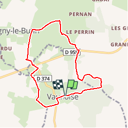
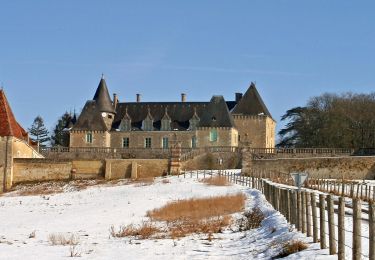
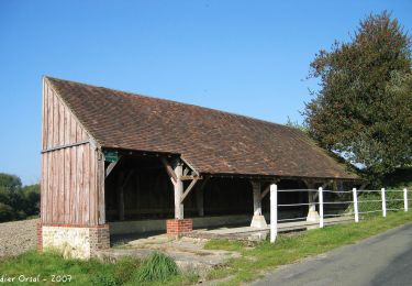
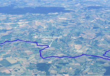
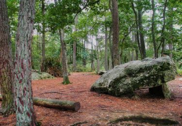
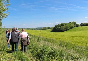
Randonnée Marche de 7,6 km à découvrir à Normandie, Orne, Vaunoise. Cette randonnée est proposée par ODDAD78.

Description

D'après le circuit N°13
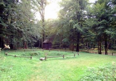
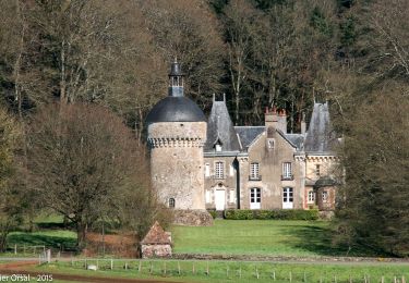
Peut-on passer par "le pavillon" ?

Profil altimétrique

Localisation

Pays :
France
Région :
Normandie
Département/Province :
Orne
Commune :
Vaunoise
Localité :
Unknown
Départ:(Dec)
Départ:(UTM)
313751 ; 5358977 (31U) N.

Randonnées à proximité

Randonnée Marche Belforêt-en-Perche - Chêne séculaire - Bellême - Photo
Marche
tracegps

Marche

Moyen
(2)
Belforêt-en-Perche, Normandie, Orne, France
9,3 km | 11,8 km-effort
3h 30min
Oui
Randonnée Marche Belforêt-en-Perche - La Perrière, forêt et village - Photo
Marche
jeannine grandjean

Marche

Difficile
Belforêt-en-Perche, Normandie, Orne, France
11,1 km | 13,8 km-effort
3h 8min
Oui
Randonnée Marche Belforêt-en-Perche - le chêne de l'école - Photo
Marche
fournieralain

Marche

Très facile
Belforêt-en-Perche, Normandie, Orne, France
15,7 km | 19,7 km-effort
6h 47min
Oui
Randonnée Marche Igé - Igé - Prieuré de Sainte-Gauburge  via Appenai-sous-Bellême 20 km - Photo
Marche

Marche

Moyen
Igé, Normandie, Orne, France
20 km | 24 km-effort
5h 18min
Non
Randonnée Marche Igé - Igé - Saint-Cyr-la-Rosière  via Appenai-sous-Bellême 20 km - Photo
Marche

Marche

Facile
Igé, Normandie, Orne, France
20 km | 24 km-effort
5h 29min
Non
Randonnée Marche Igé - Igé - Prieuré de Sainte-Gauburge 18 km - Photo
Marche

Marche

Facile
Igé, Normandie, Orne, France
18,4 km | 23 km-effort
7h 2min
Non
Randonnée Marche Igé - Igé - Saint-Cyr-la-Rosière 18 km - Photo
Marche

Marche

Facile
Igé, Normandie, Orne, France
18,4 km | 23 km-effort
7h 2min
Non
Randonnée Marche Belforêt-en-Perche -  La Perrière - Saint-Germain-de-la-Coudre via Bellême (TCP) 28 km - Photo
Marche

Marche

Moyen
Belforêt-en-Perche, Normandie, Orne, France
28 km | 35 km-effort
7h 16min
Non
Randonnée Marche Belforêt-en-Perche - La Perrière - Saint-Germain-de-la-Coudre via Igé (TCP) 27 km - Photo
Marche

Marche

Facile
Belforêt-en-Perche, Normandie, Orne, France
27 km | 33 km-effort
7h 2min
Non


Fermer
Mes abonnements