8,3 km | 9,5 km-effort
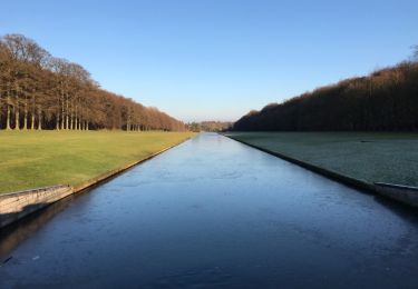
Tervueren 20201020
leon40
Utilisateur
Longueur
12,1 km
Altitude max
118 m
Dénivelé positif
152 m
Km-Effort
14,2 km
Altitude min
59 m
Dénivelé négatif
152 m
Boucle
Oui
Date de création :
2020-10-20 07:40:36.993
Dernière modification :
2020-10-20 12:35:15.715
2h03
Difficulté : Très facile
Application GPS de randonnée GRATUITE
À propos
Randonnée Course à pied de 12,1 km à découvrir à Flandre, Brabant flamand, Tervueren. Cette randonnée est proposée par leon40.
Localisation
Pays :
Belgique
Région :
Flandre
Département/Province :
Brabant flamand
Commune :
Tervueren
Localité :
Tervuren
Départ:(Dec)
Départ:(UTM)
606669 ; 5631770 (31U) N.
Commentaires
Randonnées à proximité
#221017 - Duisburg, Wolfkensberg, Raffelberg*****
Marche
Moyen
(1)
Tervueren,
Flandre,
Brabant flamand,
Belgique
2h 10min
Oui
Tervuren Leefdaal 22 km
Marche
Facile
(1)
Tervueren,
Flandre,
Brabant flamand,
Belgique
23 km | 27 km-effort
5h 24min
Oui
Arboretum - Kapucijnenbos
Marche
Difficile
(1)
Tervueren,
Flandre,
Brabant flamand,
Belgique
13,7 km | 16,3 km-effort
3h 41min
Oui
arboretum
Marche
Très facile
(1)
Tervueren,
Flandre,
Brabant flamand,
Belgique
8 km | 9,2 km-effort
2h 51min
Oui
ox2
Vélo
Facile
(1)
Wezembeek-Ophem,
Flandre,
Brabant flamand,
Belgique
13,7 km | 15,2 km-effort
48min
Oui
Meester Crapswandeling
A pied
Facile
Zaventem,
Flandre,
Brabant flamand,
Belgique
8,5 km | 9,4 km-effort
2h 7min
Oui
Vossekouterwandeling
A pied
Facile
Huldenberg,
Flandre,
Brabant flamand,
Belgique
7,1 km | 8,7 km-effort
1h 58min
Oui
Warandewandeling
A pied
Facile
Tervueren,
Flandre,
Brabant flamand,
Belgique
4,9 km | 6 km-effort
1h 21min
Non
Kap(ucijnen)bos van Duisburgwandeling
A pied
Facile
Tervueren,
Flandre,
Brabant flamand,
Belgique
6,2 km | 7,6 km-effort
1h 43min
Non