Randonnée Marche Faverolles-sur-Cher - Faverolles-sur-Cher l'Audronnière - les Raimbaudières le Port le Cher - 6.4km 50m 1h35 - 2020 10 04 - Photo

Faverolles-sur-Cher l'Audronnière - les Raimbaudières le Port le Cher - 6.4km 50m 1h35 - 2020 10 04

 Orcal37
Orcal37

Utilisateur GUIDE

© OpenStreetMap contributors
Longueur
Longueur
6,4 km
Altitude max
Altitude max
84 m
Dénivelé positif
Dénivelé positif
52 m
Km-Effort
Km-Effort  
7,1 km
Altitude min
Altitude min
55 m
Dénivelé négatif
Dénivelé négatif
55 m
Boucle
Boucle
Oui
Date de création :
2020-10-04 14:38:32.809
Dernière modification :
2024-09-09 16:42:56.732

(0 Avis)

Marche
Marche
1h35
Difficulté : Facile

Scannez ce code QR pour ouvrir la randonnée dans l'application SityTrail

Application GPS de randonnée GRATUITE

Logo SityTrail SityTrail

IGN / Instituts géographiques

Télécharger SityTrail sur l'App Store Télécharger SityTrail sur Google Play

Logo SityTrail SityTrail World

Le monde est à vous

Télécharger SityTrail sur l'App Store Télécharger SityTrail sur Google Play Télécharger SityTrail sur Huawei AppGallery

À propos

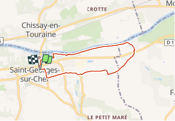
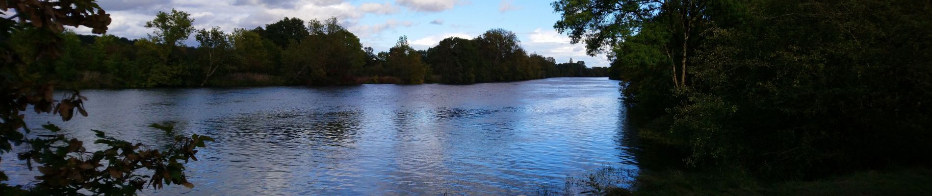
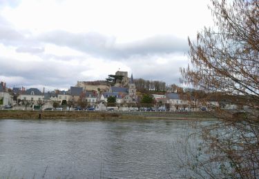
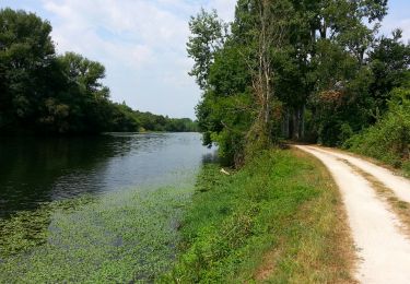
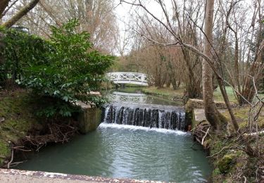
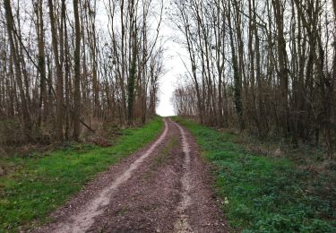
Randonnée Marche de 6,4 km à découvrir à Centre-Val de Loire, Loir-et-Cher, Faverolles-sur-Cher. Cette randonnée est proposée par Orcal37.

Description

Faverolles-sur-Cher l'Audronnière - les Raimbaudières (Saint-Georges-sur-Cher) le Port - le Cher - 6.4km 50m 1h35 - 2020 10 04

Profil altimétrique

Photos

Localisation

Pays :
France
Région :
Centre-Val de Loire
Département/Province :
Loir-et-Cher
Commune :
Faverolles-sur-Cher
Localité :
Unknown
Départ:(UTM)
361435 ; 5243672 (31T) N.

Randonnées à proximité

Randonnée Marche Chissay-en-Touraine - Chissay-en-Touraine - Zig zag Beaune les Durdents - 18.2km 330m 3h50 - 2024 08 14 - Photo
Marche
GUIDE
Orcal37

Marche

Moyen
Chissay-en-Touraine, Centre-Val de Loire, Loir-et-Cher, France
17,8 km | 22 km-effort
3h 50min
Oui
Randonnée Marche Saint-Georges-sur-Cher - Saint-Georges-sur-Cher - GRP Forêt Montrichard - 17.6km 165m 3h40 - 2023 12 27 - Photo
Marche
GUIDE
Orcal37

Marche

Facile
Saint-Georges-sur-Cher, Centre-Val de Loire, Loir-et-Cher, France
17,7 km | 19,8 km-effort
3h 40min
Oui
Randonnée Marche Faverolles-sur-Cher - Montrichard - GR41 Forêt GRP - 13.9km 220m 3h30 - 2022 03 03 - Photo
Marche
GUIDE
Orcal37

Marche

Facile
Faverolles-sur-Cher, Centre-Val de Loire, Loir-et-Cher, France
13,9 km | 16,9 km-effort
3h 30min
Oui
Randonnée Marche Saint-Georges-sur-Cher - Saint-Georges-sur-Cher - Vrigny la Rabotière - 5.8km 50m 1h25 - 2021 12 26 - Photo
Marche
GUIDE
Orcal37

Marche

Facile
Saint-Georges-sur-Cher, Centre-Val de Loire, Loir-et-Cher, France
5,8 km | 6,5 km-effort
1h 25min
Oui
Randonnée Marche Saint-Georges-sur-Cher - Saint-Georges-sur-Cher - les Magasins Montfourgon le Moulin du Porteau - 10km 110m 2h25 - 2021 01 02 - Photo
Marche
GUIDE
Orcal37

Marche

Facile
Saint-Georges-sur-Cher, Centre-Val de Loire, Loir-et-Cher, France
10,1 km | 11,6 km-effort
2h 25min
Oui
Randonnée Marche Saint-Georges-sur-Cher - Saint-Georges-sur-Cher - barrage de castors de Chézelles - 9.9km 130m 2h10 - 2020 12 26 - Photo
Marche
GUIDE
Orcal37

Marche

Très facile
Saint-Georges-sur-Cher, Centre-Val de Loire, Loir-et-Cher, France
9,9 km | 11,7 km-effort
2h 10min
Oui
Randonnée Marche Montrichard Val de Cher - Bourré - boucle GR41 - 7.3km 125m 2h00 - 2015 07 05 - Photo
Marche
GUIDE
Orcal37

Marche

Facile
Montrichard Val de Cher, Centre-Val de Loire, Loir-et-Cher, France
7,3 km | 9 km-effort
2h 0min
Oui
Randonnée Marche Saint-Georges-sur-Cher - Saint-Georges-sur-Cher - Salle des Fêtes la Vallée Pitrou la Larderie la Poterie - 12.3km 130m 2h30 - 2014 03 16 - Photo
Marche
GUIDE
Orcal37

Marche

Facile
Saint-Georges-sur-Cher, Centre-Val de Loire, Loir-et-Cher, France
12,4 km | 14,1 km-effort
2h 30min
Oui
Randonnée Marche Saint-Georges-sur-Cher - Saint-Georges-sur-Cher - Vallée Pitrou et Moulins - 6.9km 65m 1h35 - 2023 12 27 - Photo
Marche
GUIDE
Orcal37

Marche

Facile
Saint-Georges-sur-Cher, Centre-Val de Loire, Loir-et-Cher, France
6,9 km | 7,8 km-effort
1h 35min
Oui


Fermer
Mes abonnements