![](/images/other/stat-length.png)
![Randonnée Marche Roosdaal - OLVrouw Lombeek (Roosdaal) - Windmolen - Photo](https://media.geolcdn.com/t/1900/400/ext.pjpeg?maxdim=2&url=https%3A%2F%2Fstatic1.geolcdn.com%2Fsiteimages%2Fupload%2Ffiles%2F1553511878bg_sport_marche.png)
OLVrouw Lombeek (Roosdaal) - Windmolen
pitteke1
Utilisateur
![Longueur](/images/other/stat-length.png)
Longueur
9,4 km
![Altitude max](https://static1.geolcdn.com/siteimages/upload/files/1508320355ic_sort_altitude_max_24dp.png)
Altitude max
90 m
![Dénivelé positif](https://static1.geolcdn.com/siteimages/upload/files/1508320355ic_sort_den_pos_24dp.png)
Dénivelé positif
94 m
![Km-Effort](/images/other/stat-length.png)
Km-Effort
10,6 km
![Altitude min](https://static1.geolcdn.com/siteimages/upload/files/1508320355ic_sort_altitude_min_24dp.png)
Altitude min
42 m
![Dénivelé négatif](https://static1.geolcdn.com/siteimages/upload/files/1508320355ic_sort_den_neg_24dp.png)
Dénivelé négatif
92 m
![Boucle](https://static1.geolcdn.com/siteimages/upload/files/16400158638029165_repeat_loop_refresh_sync_direction_icon.png)
Boucle
Oui
Date de création :
2020-09-29 09:44:41.615
Dernière modification :
2020-09-29 17:30:12.226
![Marche](https://static1.geolcdn.com/sitytour/trail-icons/101.png)
2h45
Difficulté : Facile
![Scannez ce code QR pour ouvrir la randonnée dans l'application SityTrail](https://capi.geolives.com/qq0zvz2zws4bq2lad0pu/sitytour/trails/2564824/qr.png?size=200)
Application GPS de randonnée GRATUITE
À propos
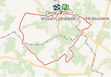
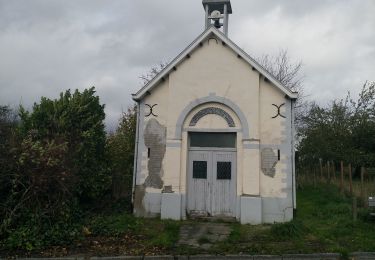
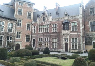
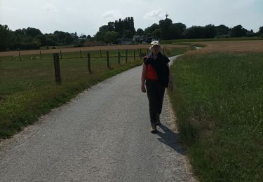
Randonnée Marche de 9,4 km à découvrir à Flandre, Brabant flamand, Roosdaal. Cette randonnée est proposée par pitteke1.
Description
Rando extraite du livret "24 randos en Brabant flamand".
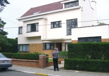
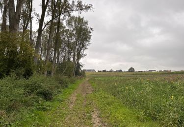
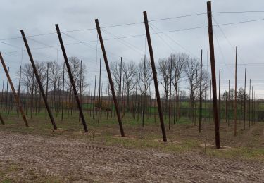
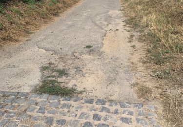
Paysages vallonnés avec de jolies vues. Petites routes très peu fréquentées, chemins de terre et sentiers.
Le moulin à vent est splendide.
Boulangerie artisanale devant l'église. Grand choix de pâtisseries !
Localisation
Pays :
Belgique
Région :
Flandre
Département/Province :
Brabant flamand
Commune :
Roosdaal
Localité :
Onze-Lieve-Vrouw-Lombeek
Départ:(Dec)
Départ:(UTM)
578450 ; 5630679 (31U) N.
Commentaires
Randonnées à proximité
![Randonnée A pied Liedekerke - Tweedorpenwandeling - Photo](https://media.geolcdn.com/t/375/260/318adc88-016f-4533-ab78-8de83420931e.jpeg&format=jpg&maxdim=2)
![A pied A pied](https://static1.geolcdn.com/sitytour/trail-icons/100.png)
Tweedorpenwandeling
A pied
Facile
Liedekerke,
Flandre,
Brabant flamand,
Belgique
![](/images/other/stat-length.png)
9,5 km | 10,6 km-effort
2h 24min
![](https://static1.geolcdn.com/siteimages/upload/files/16400158638029165_repeat_loop_refresh_sync_direction_icon.png)
Oui
![Randonnée Marche Ninove - Neigem Neigembos Pajottenland Ninove - 10 km RT - Photo](https://media.geolcdn.com/t/375/260/ext.jpg?maxdim=2&url=https%3A%2F%2Fstatic1.geolcdn.com%2Fsiteimages%2Fupload%2Ffiles%2F1553511878bg_sport_marche.png)
![Marche Marche](https://static1.geolcdn.com/sitytour/trail-icons/101.png)
Neigem Neigembos Pajottenland Ninove - 10 km RT
Marche
Très facile
(1)
Ninove,
Flandre,
Flandre orientale,
Belgique
![](/images/other/stat-length.png)
10,2 km | 12,3 km-effort
Inconnu
![](https://static1.geolcdn.com/siteimages/upload/files/16400158638029165_repeat_loop_refresh_sync_direction_icon.png)
Oui
![Randonnée Marche Lennik - Sint Martens Lennik 7,9 km - Photo](https://media.geolcdn.com/t/375/260/1ff1b843-1bd4-4c35-9997-d2a88eb92555.jpg&format=jpg&maxdim=2)
![Marche Marche](https://static1.geolcdn.com/sitytour/trail-icons/101.png)
Sint Martens Lennik 7,9 km
Marche
Facile
Lennik,
Flandre,
Brabant flamand,
Belgique
![](/images/other/stat-length.png)
7,9 km | 8,8 km-effort
1h 59min
![](https://static1.geolcdn.com/siteimages/upload/files/16400158638029165_repeat_loop_refresh_sync_direction_icon.png)
Oui
![Randonnée Marche Lennik - Bree Eik - Photo](https://media.geolcdn.com/t/375/260/e2bb16a3-c9e6-42c8-99e7-2951aec30e3d.jpg&format=jpg&maxdim=2)
![Marche Marche](https://static1.geolcdn.com/sitytour/trail-icons/101.png)
Bree Eik
Marche
Très facile
Lennik,
Flandre,
Brabant flamand,
Belgique
![](/images/other/stat-length.png)
5 km | 5,8 km-effort
1h 4min
![](https://static1.geolcdn.com/siteimages/upload/files/16400158638029165_repeat_loop_refresh_sync_direction_icon.png)
Oui
![Randonnée Marche Lennik - schaekens Ternat kapel - Photo](https://media.geolcdn.com/t/375/260/789b059d-25db-44ac-87e2-3aa7417a3c24.jpg&format=jpg&maxdim=2)
![Marche Marche](https://static1.geolcdn.com/sitytour/trail-icons/101.png)
schaekens Ternat kapel
Marche
Très facile
Lennik,
Flandre,
Brabant flamand,
Belgique
![](/images/other/stat-length.png)
12 km | 13,3 km-effort
2h 50min
![](https://static1.geolcdn.com/siteimages/upload/files/16400158638029165_repeat_loop_refresh_sync_direction_icon.png)
Non
![Randonnée Marche Lennik - pajottenland - Photo](https://media.geolcdn.com/t/375/260/ext.jpg?maxdim=2&url=https%3A%2F%2Fservices.sitytrail.com%2FGeolivesWS%2FDownloadMedia.ashx%3FTrailID%3D114668%26Media%3Db6f7e476-ff90-4efb-99f7-c536144e18f3.jpg)
![Marche Marche](https://static1.geolcdn.com/sitytour/trail-icons/101.png)
pajottenland
Marche
Facile
Lennik,
Flandre,
Brabant flamand,
Belgique
![](/images/other/stat-length.png)
11,6 km | 13,5 km-effort
2h 29min
![](https://static1.geolcdn.com/siteimages/upload/files/16400158638029165_repeat_loop_refresh_sync_direction_icon.png)
Oui
![Randonnée Marche Gooik - paddenbroek-kesterheide - Photo](https://media.geolcdn.com/t/375/260/6fb3724c-60e4-43d0-82f9-16aa9c98ace2.jpg&format=jpg&maxdim=2)
![Marche Marche](https://static1.geolcdn.com/sitytour/trail-icons/101.png)
paddenbroek-kesterheide
Marche
Moyen
Gooik,
Flandre,
Brabant flamand,
Belgique
![](/images/other/stat-length.png)
6,2 km | 7,9 km-effort
2h 4min
![](https://static1.geolcdn.com/siteimages/upload/files/16400158638029165_repeat_loop_refresh_sync_direction_icon.png)
Oui
![Randonnée Marche Lennik - 20220814 Lennik WSV Windheren 10 km - Photo](https://media.geolcdn.com/t/375/260/bbb2b2c3-7f7c-41d8-94be-f0075e116f6c.jpg&format=jpg&maxdim=2)
![Marche Marche](https://static1.geolcdn.com/sitytour/trail-icons/101.png)
20220814 Lennik WSV Windheren 10 km
Marche
Moyen
Lennik,
Flandre,
Brabant flamand,
Belgique
![](/images/other/stat-length.png)
9,4 km | 10,3 km-effort
5h 41min
![](https://static1.geolcdn.com/siteimages/upload/files/16400158638029165_repeat_loop_refresh_sync_direction_icon.png)
Oui
![Randonnée Marche Roosdaal - 2022 03 26 Tocht maart - Photo](https://media.geolcdn.com/t/375/260/0fae5cd3-6fe9-4715-8f25-2bbf0633d9da.jpg&format=jpg&maxdim=2)
![Marche Marche](https://static1.geolcdn.com/sitytour/trail-icons/101.png)
2022 03 26 Tocht maart
Marche
Moyen
Roosdaal,
Flandre,
Brabant flamand,
Belgique
![](/images/other/stat-length.png)
8,2 km | 9,5 km-effort
1h 43min
![](https://static1.geolcdn.com/siteimages/upload/files/16400158638029165_repeat_loop_refresh_sync_direction_icon.png)
Oui