![](/images/other/stat-length.png)
![Randonnée Marche Saint-Rémy-lès-Chevreuse - Virade de St Remy Parcours jaune - Photo](https://media.geolcdn.com/t/1900/400/126e6a2d-965b-4bd4-a9ad-b6559f93723e.jpg&format=pjpeg&maxdim=2)
Virade de St Remy Parcours jaune
mallovon
Utilisateur
![Longueur](/images/other/stat-length.png)
Longueur
12,9 km
![Altitude max](https://static1.geolcdn.com/siteimages/upload/files/1508320355ic_sort_altitude_max_24dp.png)
Altitude max
176 m
![Dénivelé positif](https://static1.geolcdn.com/siteimages/upload/files/1508320355ic_sort_den_pos_24dp.png)
Dénivelé positif
276 m
![Km-Effort](/images/other/stat-length.png)
Km-Effort
16,6 km
![Altitude min](https://static1.geolcdn.com/siteimages/upload/files/1508320355ic_sort_altitude_min_24dp.png)
Altitude min
76 m
![Dénivelé négatif](https://static1.geolcdn.com/siteimages/upload/files/1508320355ic_sort_den_neg_24dp.png)
Dénivelé négatif
276 m
![Boucle](https://static1.geolcdn.com/siteimages/upload/files/16400158638029165_repeat_loop_refresh_sync_direction_icon.png)
Boucle
Oui
Date de création :
2020-09-26 12:02:39.425
Dernière modification :
2020-09-26 15:56:40.842
![Marche](https://static1.geolcdn.com/sitytour/trail-icons/101.png)
3h51
Difficulté : Moyen
![Scannez ce code QR pour ouvrir la randonnée dans l'application SityTrail](https://capi.geolives.com/qq0zvz2zws4bq2lad0pu/sitytour/trails/2562180/qr.png?size=200)
Application GPS de randonnée GRATUITE
À propos
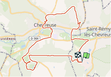
Randonnée Marche de 12,9 km à découvrir à Île-de-France, Yvelines, Saint-Rémy-lès-Chevreuse. Cette randonnée est proposée par mallovon.
Description
Avec le raccourci vert après le château de la Madeleine.
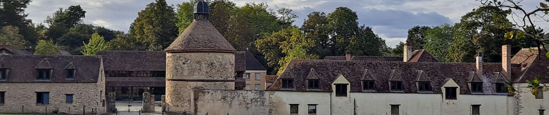
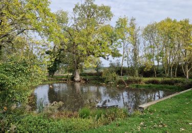
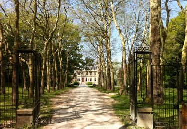
Localisation
Pays :
France
Région :
Île-de-France
Département/Province :
Yvelines
Commune :
Saint-Rémy-lès-Chevreuse
Localité :
Unknown
Départ:(Dec)
Départ:(UTM)
430938 ; 5393881 (31U) N.
Commentaires
Randonnées à proximité
![Randonnée Marche Saint-Rémy-lès-Chevreuse - _Entre vallées et châteaux - Photo](https://media.geolcdn.com/t/375/260/ext.jpg?maxdim=2&url=https%3A%2F%2Fservices.sitytrail.com%2FGeolivesWS%2FDownloadMedia.ashx%3FTrailID%3D775643%26Media%3Dde7a4f97-3e1e-4613-9986-4282e306d83b.JPG)
![Marche Marche](https://static1.geolcdn.com/sitytour/trail-icons/101.png)
_Entre vallées et châteaux
Marche
Moyen
(13)
Saint-Rémy-lès-Chevreuse,
Île-de-France,
Yvelines,
France
![](/images/other/stat-length.png)
7,8 km | 9,6 km-effort
2h 0min
![](https://static1.geolcdn.com/siteimages/upload/files/16400158638029165_repeat_loop_refresh_sync_direction_icon.png)
Oui
![Randonnée Marche Chevreuse - _La balade de tous les plaisirs - Photo](https://media.geolcdn.com/t/375/260/ext.jpg?maxdim=2&url=https%3A%2F%2Fservices.sitytrail.com%2FGeolivesWS%2FDownloadMedia.ashx%3FTrailID%3D754966%26Media%3D761e5f27-0704-4761-a8b3-7fd3e291dd40.jpg)
![Marche Marche](https://static1.geolcdn.com/sitytour/trail-icons/101.png)
_La balade de tous les plaisirs
Marche
Facile
(8)
Chevreuse,
Île-de-France,
Yvelines,
France
![](/images/other/stat-length.png)
5,5 km | 7 km-effort
1h 30min
![](https://static1.geolcdn.com/siteimages/upload/files/16400158638029165_repeat_loop_refresh_sync_direction_icon.png)
Oui
![Randonnée Marche Chevreuse - _Sur les pas de Racine (première partie) - Photo](https://media.geolcdn.com/t/375/260/ext.jpg?maxdim=2&url=https%3A%2F%2Fservices.sitytrail.com%2FGeolivesWS%2FDownloadMedia.ashx%3FTrailID%3D745166%26Media%3Dd5380f95-aa62-43a2-a37c-8510f53d593d.JPG)
![Marche Marche](https://static1.geolcdn.com/sitytour/trail-icons/101.png)
_Sur les pas de Racine (première partie)
Marche
Facile
(7)
Chevreuse,
Île-de-France,
Yvelines,
France
![](/images/other/stat-length.png)
10,7 km | 14,5 km-effort
2h 30min
![](https://static1.geolcdn.com/siteimages/upload/files/16400158638029165_repeat_loop_refresh_sync_direction_icon.png)
Oui
![Randonnée Marche Choisel - _Si Choisel m'était conté - Photo](https://media.geolcdn.com/t/375/260/ext.jpg?maxdim=2&url=https%3A%2F%2Fservices.sitytrail.com%2FGeolivesWS%2FDownloadMedia.ashx%3FTrailID%3D172083%26Media%3De60082f0-edf4-45f4-997a-35e9c7c799de.jpg)
![Marche Marche](https://static1.geolcdn.com/sitytour/trail-icons/101.png)
_Si Choisel m'était conté
Marche
Facile
(8)
Choisel,
Île-de-France,
Yvelines,
France
![](/images/other/stat-length.png)
5,6 km | 6,6 km-effort
1h 27min
![](https://static1.geolcdn.com/siteimages/upload/files/16400158638029165_repeat_loop_refresh_sync_direction_icon.png)
Oui
![Randonnée Marche Limours - Essonne_Tour_des_Fermes_de_la_Prédecelle - Photo](https://media.geolcdn.com/t/375/260/2a39169f-a228-484c-b261-d2ccff03535e.jpg&format=jpg&maxdim=2)
![Marche Marche](https://static1.geolcdn.com/sitytour/trail-icons/101.png)
Essonne_Tour_des_Fermes_de_la_Prédecelle
Marche
Très facile
(1)
Limours,
Île-de-France,
Essonne,
France
![](/images/other/stat-length.png)
12,9 km | 14,3 km-effort
3h 43min
![](https://static1.geolcdn.com/siteimages/upload/files/16400158638029165_repeat_loop_refresh_sync_direction_icon.png)
Oui
![Randonnée Marche Saint-Lambert - _Sur les pas de Racine (deuxième partie) - Photo](https://media.geolcdn.com/t/375/260/ext.jpg?maxdim=2&url=https%3A%2F%2Fservices.sitytrail.com%2FGeolivesWS%2FDownloadMedia.ashx%3FTrailID%3D745749%26Media%3Db1edb432-b6c8-43f7-9f4b-66b807e05156.jpg)
![Marche Marche](https://static1.geolcdn.com/sitytour/trail-icons/101.png)
_Sur les pas de Racine (deuxième partie)
Marche
Facile
(2)
Saint-Lambert,
Île-de-France,
Yvelines,
France
![](/images/other/stat-length.png)
10,5 km | 12,5 km-effort
2h 30min
![](https://static1.geolcdn.com/siteimages/upload/files/16400158638029165_repeat_loop_refresh_sync_direction_icon.png)
Oui
![Randonnée Marche Châteaufort - gitane à Chateaufort - Photo](https://media.geolcdn.com/t/375/260/ddb88f28-eed1-407a-8537-509b49789196.jpg&format=jpg&maxdim=2)
![Marche Marche](https://static1.geolcdn.com/sitytour/trail-icons/101.png)
gitane à Chateaufort
Marche
Facile
(1)
Châteaufort,
Île-de-France,
Yvelines,
France
![](/images/other/stat-length.png)
6,4 km | 7,7 km-effort
2h 3min
![](https://static1.geolcdn.com/siteimages/upload/files/16400158638029165_repeat_loop_refresh_sync_direction_icon.png)
Oui
![Randonnée Marche Milon-la-Chapelle - Yvelines_Milon-La-Chapelle=>Chemins_Beauregard&Jean-Racine=>Chevreuse - Photo](https://media.geolcdn.com/t/375/260/b9995b45-7638-4793-a22c-e5ba9a678abe.jpg&format=jpg&maxdim=2)
![Marche Marche](https://static1.geolcdn.com/sitytour/trail-icons/101.png)
Yvelines_Milon-La-Chapelle=>Chemins_Beauregard&Jean-Racine=>Chevreuse
Marche
Facile
(1)
Milon-la-Chapelle,
Île-de-France,
Yvelines,
France
![](/images/other/stat-length.png)
9,3 km | 12,7 km-effort
1h 56min
![](https://static1.geolcdn.com/siteimages/upload/files/16400158638029165_repeat_loop_refresh_sync_direction_icon.png)
Oui
![Randonnée V.T.T. Saint-Rémy-lès-Chevreuse - Saint Rémy les Chevreuse - Virades de l'Espoir 25 km - Photo](https://media.geolcdn.com/t/375/260/ext.jpg?maxdim=2&url=https%3A%2F%2Fservices.sitytrail.com%2FGeolivesWS%2FDownloadMedia.ashx%3FTrailID%3D107246%26Media%3D12122_2.jpg)
![V.T.T. V.T.T.](https://static1.geolcdn.com/sitytour/trail-icons/202.png)
Saint Rémy les Chevreuse - Virades de l'Espoir 25 km
V.T.T.
Moyen
(1)
Saint-Rémy-lès-Chevreuse,
Île-de-France,
Yvelines,
France
![](/images/other/stat-length.png)
23 km | 27 km-effort
2h 0min
![](https://static1.geolcdn.com/siteimages/upload/files/16400158638029165_repeat_loop_refresh_sync_direction_icon.png)
Non