![](/images/other/stat-length.png)
![Randonnée Marche Aurel - Le Plateau de Solaure par Aurel - Photo](https://media.geolcdn.com/t/1900/400/f9469c55-e221-43bf-9e27-eaf4200de7b7.jpg&format=pjpeg&maxdim=2)
Le Plateau de Solaure par Aurel
Philindy26
Utilisateur
![Longueur](/images/other/stat-length.png)
![Altitude max](https://static1.geolcdn.com/siteimages/upload/files/1508320355ic_sort_altitude_max_24dp.png)
![Dénivelé positif](https://static1.geolcdn.com/siteimages/upload/files/1508320355ic_sort_den_pos_24dp.png)
![Km-Effort](/images/other/stat-length.png)
![Altitude min](https://static1.geolcdn.com/siteimages/upload/files/1508320355ic_sort_altitude_min_24dp.png)
![Dénivelé négatif](https://static1.geolcdn.com/siteimages/upload/files/1508320355ic_sort_den_neg_24dp.png)
![Boucle](https://static1.geolcdn.com/siteimages/upload/files/16400158638029165_repeat_loop_refresh_sync_direction_icon.png)
![Marche](https://static1.geolcdn.com/sitytour/trail-icons/101.png)
5h00
Difficulté : Difficile
![Scannez ce code QR pour ouvrir la randonnée dans l'application SityTrail](https://capi.geolives.com/qq0zvz2zws4bq2lad0pu/sitytour/trails/2558049/qr.png?size=200)
Application GPS de randonnée GRATUITE
À propos
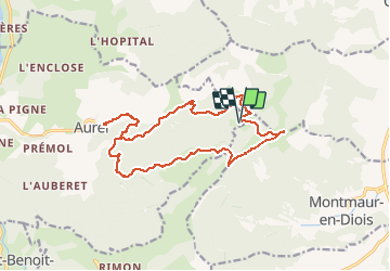
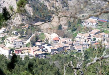
Randonnée Marche de 17,6 km à découvrir à Auvergne-Rhône-Alpes, Drôme, Aurel. Cette randonnée est proposée par Philindy26.
Description
Départ du village de Aurel, à partir du camping...
Géolocalisation (Google Maps) : https://goo.gl/maps/ghuzU5GmboEXroVY6 (44°41'43.9"N / 5°18'12.0"E ou 44.695514, 5.303327).
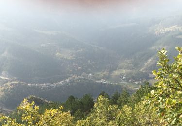
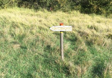
Prendre la direction du hameau de La Roche et montée par la Peyreire (608 m), le Chambon, Fond Frède, la Combe Tortel et Fondcouverte (1145 m).
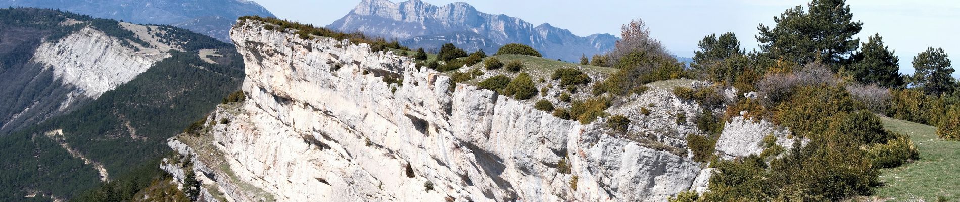
Puis arrivée sur le point culminant du plateau (1262 m).
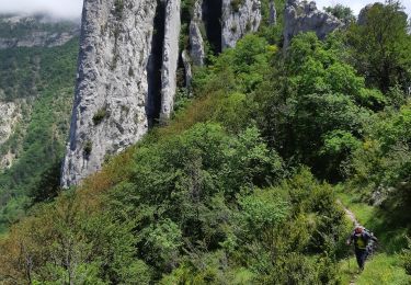
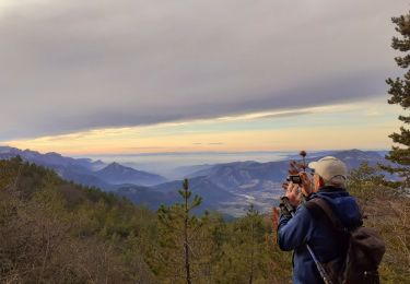
Retour en suivant les crêtes et descente sur le col du Royer (1140 m) par un sentier aérien où se trouve la grotte du Fournet.
Au col prendre la piste qui passe au Clos, la ferme du Poux (ruine à 964 m) et descente par le bois Diaumenge pour retrouver la piste de montée à la Peyreire.
Localisation
Commentaires
Randonnées à proximité
![Randonnée Marche Aurel - 26 aurel col de la grave rimon - Photo](https://media.geolcdn.com/t/375/260/3b53d616-3161-41d6-9a3c-e7c5766755ef.jpg&format=jpg&maxdim=2)
![Marche Marche](https://static1.geolcdn.com/sitytour/trail-icons/101.png)
Marche
![](/images/other/stat-length.png)
![](https://static1.geolcdn.com/siteimages/upload/files/16400158638029165_repeat_loop_refresh_sync_direction_icon.png)
![Randonnée Marche Rimon-et-Savel - 26 lames de pennes savel jp - Photo](https://media.geolcdn.com/t/375/260/f2bea45a-9c65-4d39-b93d-6507c3374444.jpg&format=jpg&maxdim=2)
![Marche Marche](https://static1.geolcdn.com/sitytour/trail-icons/101.png)
Marche
![](/images/other/stat-length.png)
![](https://static1.geolcdn.com/siteimages/upload/files/16400158638029165_repeat_loop_refresh_sync_direction_icon.png)
![Randonnée Marche Rimon-et-Savel - balcons de la Roanne - Photo](https://media.geolcdn.com/t/375/260/6f529a2b-52ed-4864-b6b1-e2b0e3236399.jpg&format=jpg&maxdim=2)
![Marche Marche](https://static1.geolcdn.com/sitytour/trail-icons/101.png)
Marche
![](/images/other/stat-length.png)
![](https://static1.geolcdn.com/siteimages/upload/files/16400158638029165_repeat_loop_refresh_sync_direction_icon.png)
![Randonnée sport Die - Croix de Justin , Ausson - Photo](https://media.geolcdn.com/t/375/260/c8090ee5-5a94-4ee1-b2d3-2c37d8bd6d5e.jpg&format=jpg&maxdim=2)
sport
![](/images/other/stat-length.png)
![](https://static1.geolcdn.com/siteimages/upload/files/16400158638029165_repeat_loop_refresh_sync_direction_icon.png)
![Randonnée Marche Aurel - Butte de l'Aigle - Photo](https://media.geolcdn.com/t/375/260/93f8cc31-cdb7-4c51-ac3c-2c9d3f413282.jpg&format=jpg&maxdim=2)
![Marche Marche](https://static1.geolcdn.com/sitytour/trail-icons/101.png)
Marche
![](/images/other/stat-length.png)
![](https://static1.geolcdn.com/siteimages/upload/files/16400158638029165_repeat_loop_refresh_sync_direction_icon.png)
![Randonnée Marche Rimon-et-Savel - rimon 2/1/2022 - Photo](https://media.geolcdn.com/t/375/260/d71302a3-bf5b-468d-ad27-fcad37c90032.jpg&format=jpg&maxdim=2)
![Marche Marche](https://static1.geolcdn.com/sitytour/trail-icons/101.png)
Marche
![](/images/other/stat-length.png)
![](https://static1.geolcdn.com/siteimages/upload/files/16400158638029165_repeat_loop_refresh_sync_direction_icon.png)
![Randonnée Marche Aurel - Aurel 15/10/2020 - Photo](https://media.geolcdn.com/t/375/260/4042d0a3-24f1-40dc-9aa7-4bee70a8d897.jpg&format=jpg&maxdim=2)
![Marche Marche](https://static1.geolcdn.com/sitytour/trail-icons/101.png)
Marche
![](/images/other/stat-length.png)
![](https://static1.geolcdn.com/siteimages/upload/files/16400158638029165_repeat_loop_refresh_sync_direction_icon.png)
![Randonnée Marche Aurel - Le Plateau de Solaure par Aurel - Photo](https://media.geolcdn.com/t/375/260/d6a67fe1-b272-48fd-a657-a0a29568d153.jpg&format=jpg&maxdim=2)
![Marche Marche](https://static1.geolcdn.com/sitytour/trail-icons/101.png)
Marche
![](/images/other/stat-length.png)
![](https://static1.geolcdn.com/siteimages/upload/files/16400158638029165_repeat_loop_refresh_sync_direction_icon.png)
![Randonnée Marche Aurel - aurel - Photo](https://media.geolcdn.com/t/375/260/ext.jpg?maxdim=2&url=https%3A%2F%2Fstatic1.geolcdn.com%2Fsiteimages%2Fupload%2Ffiles%2F1553511878bg_sport_marche.png)
![Marche Marche](https://static1.geolcdn.com/sitytour/trail-icons/101.png)
Marche
![](/images/other/stat-length.png)
![](https://static1.geolcdn.com/siteimages/upload/files/16400158638029165_repeat_loop_refresh_sync_direction_icon.png)