![](/images/other/stat-length.png)
![Randonnée Trail Merelbeke - 2020-09-20_12h32m16_routeyou-asselkouter - Photo](https://media.geolcdn.com/t/1900/400/ext.pjpeg?maxdim=2&url=https%3A%2F%2Fstatic1.geolcdn.com%2Fsiteimages%2Fupload%2Ffiles%2F1524743154running.jpg)
2020-09-20_12h32m16_routeyou-asselkouter
Jan Pieters
Utilisateur
![Longueur](/images/other/stat-length.png)
Longueur
12,5 km
![Altitude max](https://static1.geolcdn.com/siteimages/upload/files/1508320355ic_sort_altitude_max_24dp.png)
Altitude max
52 m
![Dénivelé positif](https://static1.geolcdn.com/siteimages/upload/files/1508320355ic_sort_den_pos_24dp.png)
Dénivelé positif
96 m
![Km-Effort](/images/other/stat-length.png)
Km-Effort
13,8 km
![Altitude min](https://static1.geolcdn.com/siteimages/upload/files/1508320355ic_sort_altitude_min_24dp.png)
Altitude min
18 m
![Dénivelé négatif](https://static1.geolcdn.com/siteimages/upload/files/1508320355ic_sort_den_neg_24dp.png)
Dénivelé négatif
95 m
![Boucle](https://static1.geolcdn.com/siteimages/upload/files/16400158638029165_repeat_loop_refresh_sync_direction_icon.png)
Boucle
Oui
Date de création :
2020-09-20 10:32:16.053
Dernière modification :
2020-09-21 18:34:17.567
![Trail](https://static1.geolcdn.com/sitytour/trail-icons/104.png)
3h00
Difficulté : Facile
![Scannez ce code QR pour ouvrir la randonnée dans l'application SityTrail](https://capi.geolives.com/qq0zvz2zws4bq2lad0pu/sitytour/trails/2556631/qr.png?size=200)
Application GPS de randonnée GRATUITE
À propos
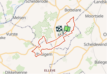
Randonnée Trail de 12,5 km à découvrir à Flandre, Flandre orientale, Merelbeke. Cette randonnée est proposée par Jan Pieters.
Description
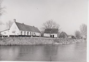
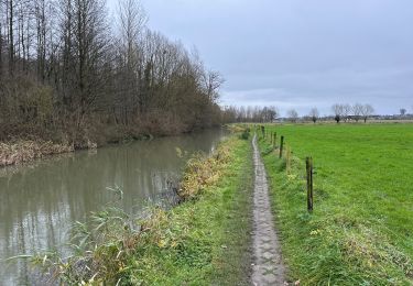
Nice trail in a very nice environment.
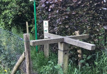
Pity of to much concrete roads.
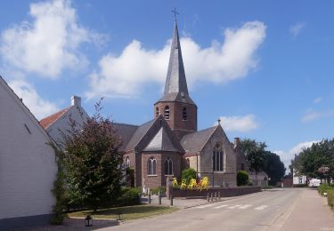
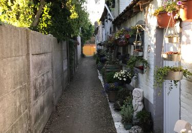
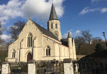
Starting point 'Munte' is a pretty and cosy village.
Localisation
Pays :
Belgique
Région :
Flandre
Département/Province :
Flandre orientale
Commune :
Merelbeke
Localité :
Munte
Départ:(Dec)
Départ:(UTM)
552281 ; 5643965 (31U) N.
Commentaires
Randonnées à proximité
![Randonnée A pied De Pinte - Natuurbeleefpad Magische Meersen - Photo](https://media.geolcdn.com/t/375/260/e12c85a9-8b45-443b-b7ca-d708034adbc9.jpeg&format=jpg&maxdim=2)
![A pied A pied](https://static1.geolcdn.com/sitytour/trail-icons/100.png)
Natuurbeleefpad Magische Meersen
A pied
Facile
De Pinte,
Flandre,
Flandre orientale,
Belgique
![](/images/other/stat-length.png)
4,3 km | 4,7 km-effort
1h 3min
![](https://static1.geolcdn.com/siteimages/upload/files/16400158638029165_repeat_loop_refresh_sync_direction_icon.png)
Oui
![Randonnée A pied De Pinte - Doornhammekeroute - Photo](https://media.geolcdn.com/t/375/260/e12c85a9-8b45-443b-b7ca-d708034adbc9.jpeg&format=jpg&maxdim=2)
![A pied A pied](https://static1.geolcdn.com/sitytour/trail-icons/100.png)
Doornhammekeroute
A pied
Facile
De Pinte,
Flandre,
Flandre orientale,
Belgique
![](/images/other/stat-length.png)
9,8 km | 10,6 km-effort
2h 25min
![](https://static1.geolcdn.com/siteimages/upload/files/16400158638029165_repeat_loop_refresh_sync_direction_icon.png)
Non
![Randonnée A pied De Pinte - Doornhammekeroute (verlenging) - Photo](https://media.geolcdn.com/t/375/260/e12c85a9-8b45-443b-b7ca-d708034adbc9.jpeg&format=jpg&maxdim=2)
![A pied A pied](https://static1.geolcdn.com/sitytour/trail-icons/100.png)
Doornhammekeroute (verlenging)
A pied
Facile
De Pinte,
Flandre,
Flandre orientale,
Belgique
![](/images/other/stat-length.png)
4,4 km | 4,8 km-effort
1h 4min
![](https://static1.geolcdn.com/siteimages/upload/files/16400158638029165_repeat_loop_refresh_sync_direction_icon.png)
Non
![Randonnée A pied Gavere - Asselkouterroute - Photo](https://media.geolcdn.com/t/375/260/e3b1e24b-6c8e-421e-80ee-132a8e2ab4f4.jpeg&format=jpg&maxdim=2)
![A pied A pied](https://static1.geolcdn.com/sitytour/trail-icons/100.png)
Asselkouterroute
A pied
Facile
Gavere,
Flandre,
Flandre orientale,
Belgique
![](/images/other/stat-length.png)
12,5 km | 13,7 km-effort
3h 7min
![](https://static1.geolcdn.com/siteimages/upload/files/16400158638029165_repeat_loop_refresh_sync_direction_icon.png)
Oui
![Randonnée Marche Oosterzele - Oosterzele Bunker - 12 km RT - Photo](https://media.geolcdn.com/t/375/260/ext.jpg?maxdim=2&url=https%3A%2F%2Fstatic1.geolcdn.com%2Fsiteimages%2Fupload%2Ffiles%2F1553511878bg_sport_marche.png)
![Marche Marche](https://static1.geolcdn.com/sitytour/trail-icons/101.png)
Oosterzele Bunker - 12 km RT
Marche
Très facile
(2)
Oosterzele,
Flandre,
Flandre orientale,
Belgique
![](/images/other/stat-length.png)
12,1 km | 13,4 km-effort
Inconnu
![](https://static1.geolcdn.com/siteimages/upload/files/16400158638029165_repeat_loop_refresh_sync_direction_icon.png)
Oui
![Randonnée Marche Melle - Gontrode Munkzwalm 25 km - Photo](https://media.geolcdn.com/t/375/260/467e94e0-3b43-4cca-be16-d6b647696c57.jpg&format=jpg&maxdim=2)
![Marche Marche](https://static1.geolcdn.com/sitytour/trail-icons/101.png)
Gontrode Munkzwalm 25 km
Marche
Moyen
Melle,
Flandre,
Flandre orientale,
Belgique
![](/images/other/stat-length.png)
25 km | 28 km-effort
7h 21min
![](https://static1.geolcdn.com/siteimages/upload/files/16400158638029165_repeat_loop_refresh_sync_direction_icon.png)
Non
![Randonnée Marche Merelbeke - Bottelare Munte Baaigem en terug - Photo](https://media.geolcdn.com/t/375/260/ext.jpg?maxdim=2&url=https%3A%2F%2Fservices.sitytrail.com%2FGeolivesWS%2FDownloadMedia.ashx%3FTrailID%3D850360%26Media%3D20170521201903.jpg)
![Marche Marche](https://static1.geolcdn.com/sitytour/trail-icons/101.png)
Bottelare Munte Baaigem en terug
Marche
Facile
Merelbeke,
Flandre,
Flandre orientale,
Belgique
![](/images/other/stat-length.png)
21 km | 23 km-effort
4h 2min
![](https://static1.geolcdn.com/siteimages/upload/files/16400158638029165_repeat_loop_refresh_sync_direction_icon.png)
Non
![Randonnée Marche Merelbeke - Bottelare Munte Baaigem en terug - Photo](https://media.geolcdn.com/t/375/260/ext.jpg?maxdim=2&url=https%3A%2F%2Fservices.sitytrail.com%2FGeolivesWS%2FDownloadMedia.ashx%3FTrailID%3D757392%26Media%3D20170521182340.jpg)
![Marche Marche](https://static1.geolcdn.com/sitytour/trail-icons/101.png)
Bottelare Munte Baaigem en terug
Marche
Facile
Merelbeke,
Flandre,
Flandre orientale,
Belgique
![](/images/other/stat-length.png)
15,6 km | 17,3 km-effort
3h 49min
![](https://static1.geolcdn.com/siteimages/upload/files/16400158638029165_repeat_loop_refresh_sync_direction_icon.png)
Oui
![Randonnée Marche Merelbeke - Melsen - Vurste - Melsen - Photo](https://media.geolcdn.com/t/375/260/ext.jpg?maxdim=2&url=https%3A%2F%2Fservices.sitytrail.com%2FGeolivesWS%2FDownloadMedia.ashx%3FTrailID%3D527579%26Media%3D20160219145053.jpg)
![Marche Marche](https://static1.geolcdn.com/sitytour/trail-icons/101.png)
Melsen - Vurste - Melsen
Marche
Moyen
Merelbeke,
Flandre,
Flandre orientale,
Belgique
![](/images/other/stat-length.png)
11,6 km | 12,8 km-effort
2h 6min
![](https://static1.geolcdn.com/siteimages/upload/files/16400158638029165_repeat_loop_refresh_sync_direction_icon.png)
Oui