


12,8 km | 15 km-effort


Utilisateur


Application GPS de randonnée GRATUITE
 SityTrail
IGN / Instituts géographiques
SityTrail World
Le monde est à vous
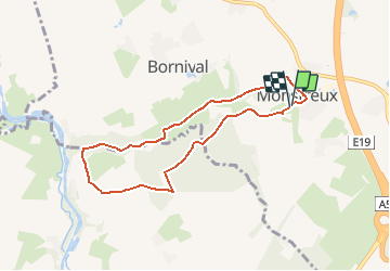
Randonnée A pied de 6,5 km à découvrir à Wallonie, Brabant wallon, Nivelles. Cette randonnée est proposée par calofrancis.
version MDJ avec arrêts didactiques
Monstreux thines et moulin
Maison facade en cimorné
Chapelle du curé Smars
Le Castia
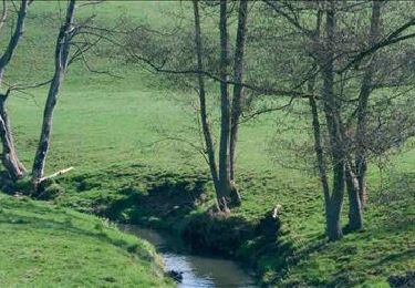
Vallée de la Thines
Bois de l'hopitai/Planti
Ferme de l'Abbaye

Marche

Marche

Marche

Marche

Marche
Marche

Marche

Marche
Marche