![](/images/other/stat-length.png)
![Randonnée A pied Arbus - ARBUS Circuit N° 47 Le Cap D’Arrandes - Photo](https://media.geolcdn.com/t/1900/400/ext.pjpeg?maxdim=2&url=https%3A%2F%2Fstatic1.geolcdn.com%2Fsiteimages%2Fupload%2Ffiles%2F1545311037marcheuse_200dpi.jpg)
ARBUS Circuit N° 47 Le Cap D’Arrandes
marmotte65
Utilisateur GUIDE
![Longueur](/images/other/stat-length.png)
![Altitude max](https://static1.geolcdn.com/siteimages/upload/files/1508320355ic_sort_altitude_max_24dp.png)
![Dénivelé positif](https://static1.geolcdn.com/siteimages/upload/files/1508320355ic_sort_den_pos_24dp.png)
![Km-Effort](/images/other/stat-length.png)
![Altitude min](https://static1.geolcdn.com/siteimages/upload/files/1508320355ic_sort_altitude_min_24dp.png)
![Dénivelé négatif](https://static1.geolcdn.com/siteimages/upload/files/1508320355ic_sort_den_neg_24dp.png)
![Boucle](https://static1.geolcdn.com/siteimages/upload/files/16400158638029165_repeat_loop_refresh_sync_direction_icon.png)
![A pied](https://static1.geolcdn.com/sitytour/trail-icons/100.png)
--
Difficulté : Facile
![Scannez ce code QR pour ouvrir la randonnée dans l'application SityTrail](https://capi.geolives.com/qq0zvz2zws4bq2lad0pu/sitytour/trails/2543081/qr.png?size=200)
Application GPS de randonnée GRATUITE
À propos
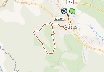
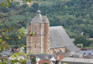
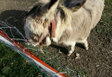
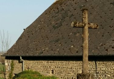
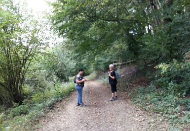
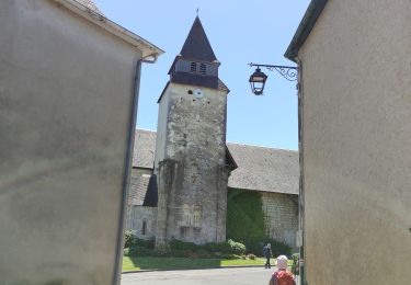
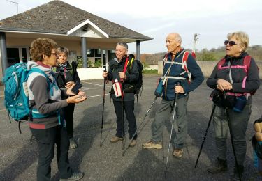
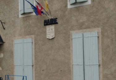
Randonnée A pied de 3,8 km à découvrir à Nouvelle-Aquitaine, Pyrénées-Atlantiques, Arbus. Cette randonnée est proposée par marmotte65.
Description
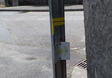
Cette randonnée nature vous offrira une vue sur les Pyrénées à couper le souffle. Mais comme toute bonne chose se mérite, il vous faudra monter au sommet de la colline pour pouvoir en profiter. Départ : Parking de la Mairie - 4 Rue du Général Pommies - Arbus Balisage Jaune Pédestre (n°19)
Localisation
Commentaires
Randonnées à proximité
![Randonnée V.T.T. Abos - Abos - Monein - Abos - Photo](https://media.geolcdn.com/t/375/260/ext.jpg?maxdim=2&url=https%3A%2F%2Fservices.sitytrail.com%2FGeolivesWS%2FDownloadMedia.ashx%3FTrailID%3D106040%26Media%3D10173_1.jpg)
![V.T.T. V.T.T.](https://static1.geolcdn.com/sitytour/trail-icons/202.png)
V.T.T.
![](/images/other/stat-length.png)
![](https://static1.geolcdn.com/siteimages/upload/files/16400158638029165_repeat_loop_refresh_sync_direction_icon.png)
![Randonnée Marche Siros - SIROS Le sentier du gave M2 3143980 - Photo](https://media.geolcdn.com/t/375/260/2adf7da9-eb05-4d5c-bb78-ec6153367b08.jpg&format=jpg&maxdim=2)
![Marche Marche](https://static1.geolcdn.com/sitytour/trail-icons/101.png)
Marche
![](/images/other/stat-length.png)
![](https://static1.geolcdn.com/siteimages/upload/files/16400158638029165_repeat_loop_refresh_sync_direction_icon.png)
![Randonnée Marche Arbus - ARBUS boucle du bois de bas M2 reco - Photo](https://media.geolcdn.com/t/375/260/0be87ab0-cd88-4f67-aff2-a0f6800a6e9e.jpg&format=jpg&maxdim=2)
![Marche Marche](https://static1.geolcdn.com/sitytour/trail-icons/101.png)
Marche
![](/images/other/stat-length.png)
![](https://static1.geolcdn.com/siteimages/upload/files/16400158638029165_repeat_loop_refresh_sync_direction_icon.png)
![Randonnée Marche Arbus - ARBUS Le cap d Arrandes N° 47 balisage et signaletique verticale fait le 15/09/2020 - Photo](https://media.geolcdn.com/t/375/260/a2e3dbf3-d618-45af-b80f-84d7f5133529.jpg&format=jpg&maxdim=2)
![Marche Marche](https://static1.geolcdn.com/sitytour/trail-icons/101.png)
Marche
![](/images/other/stat-length.png)
![](https://static1.geolcdn.com/siteimages/upload/files/16400158638029165_repeat_loop_refresh_sync_direction_icon.png)
![Randonnée V.T.T. Aussevielle - siros labastide aussevielle - Photo](https://media.geolcdn.com/t/375/260/ext.jpg?maxdim=2&url=https%3A%2F%2Fstatic1.geolcdn.com%2Fsiteimages%2Fupload%2Ffiles%2F1524743154velo.jpg)
![V.T.T. V.T.T.](https://static1.geolcdn.com/sitytour/trail-icons/202.png)
V.T.T.
![](/images/other/stat-length.png)
![](https://static1.geolcdn.com/siteimages/upload/files/16400158638029165_repeat_loop_refresh_sync_direction_icon.png)
![Randonnée Marche Artiguelouve - ARTIGUELOUVE LA COMMANDE GR653 G4 - Photo](https://media.geolcdn.com/t/375/260/0eb1058d-00a5-4625-be32-6d5c177b89e3.jpg&format=jpg&maxdim=2)
![Marche Marche](https://static1.geolcdn.com/sitytour/trail-icons/101.png)
Marche
![](/images/other/stat-length.png)
![](https://static1.geolcdn.com/siteimages/upload/files/16400158638029165_repeat_loop_refresh_sync_direction_icon.png)
![Randonnée Marche Beyrie-en-Béarn - BEYRIE en BEARN promenade autour de Beyrie 3180282 - Photo](https://media.geolcdn.com/t/375/260/b77c8a6d-0428-4a7c-aa8b-4febe27ba7e3.jpg&format=jpg&maxdim=2)
![Marche Marche](https://static1.geolcdn.com/sitytour/trail-icons/101.png)
Marche
![](/images/other/stat-length.png)
![](https://static1.geolcdn.com/siteimages/upload/files/16400158638029165_repeat_loop_refresh_sync_direction_icon.png)
![Randonnée Marche Artiguelouve - ARTIGUELOUVE (PPT) balisage N24 les coteaux de la Juscle - Photo](https://media.geolcdn.com/t/375/260/d1007c67-24ef-496a-b525-978ae81d4689.jpg&format=jpg&maxdim=2)
![Marche Marche](https://static1.geolcdn.com/sitytour/trail-icons/101.png)
Marche
![](/images/other/stat-length.png)
![](https://static1.geolcdn.com/siteimages/upload/files/16400158638029165_repeat_loop_refresh_sync_direction_icon.png)
![Randonnée Marche Siros - siros n17 nettoyé - Photo](https://media.geolcdn.com/t/375/260/26003ef3-6efd-4473-a02b-5727f30c2cdd.jpg&format=jpg&maxdim=2)
![Marche Marche](https://static1.geolcdn.com/sitytour/trail-icons/101.png)
Marche
![](/images/other/stat-length.png)
![](https://static1.geolcdn.com/siteimages/upload/files/16400158638029165_repeat_loop_refresh_sync_direction_icon.png)