![](/images/other/stat-length.png)
![Randonnée V.T.T. Tonnoy - Tonnoy - Bois de Richardménil - Photo](https://media.geolcdn.com/t/1900/400/1fed1a17-e159-44d0-be88-c19fb27f6e04.jpg&format=pjpeg&maxdim=2)
Tonnoy - Bois de Richardménil
regish54
Utilisateur
![Longueur](/images/other/stat-length.png)
Longueur
21 km
![Altitude max](https://static1.geolcdn.com/siteimages/upload/files/1508320355ic_sort_altitude_max_24dp.png)
Altitude max
339 m
![Dénivelé positif](https://static1.geolcdn.com/siteimages/upload/files/1508320355ic_sort_den_pos_24dp.png)
Dénivelé positif
364 m
![Km-Effort](/images/other/stat-length.png)
Km-Effort
26 km
![Altitude min](https://static1.geolcdn.com/siteimages/upload/files/1508320355ic_sort_altitude_min_24dp.png)
Altitude min
231 m
![Dénivelé négatif](https://static1.geolcdn.com/siteimages/upload/files/1508320355ic_sort_den_neg_24dp.png)
Dénivelé négatif
364 m
![Boucle](https://static1.geolcdn.com/siteimages/upload/files/16400158638029165_repeat_loop_refresh_sync_direction_icon.png)
Boucle
Oui
Date de création :
2020-09-03 14:13:29.174
Dernière modification :
2021-06-16 15:37:22.142
![V.T.T.](https://static1.geolcdn.com/sitytour/trail-icons/202.png)
1h47
Difficulté : Difficile
![Scannez ce code QR pour ouvrir la randonnée dans l'application SityTrail](https://capi.geolives.com/qq0zvz2zws4bq2lad0pu/sitytour/trails/2536898/qr.png?size=200)
Application GPS de randonnée GRATUITE
À propos
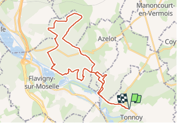
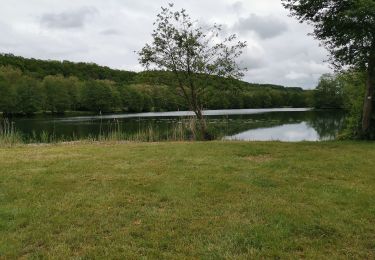
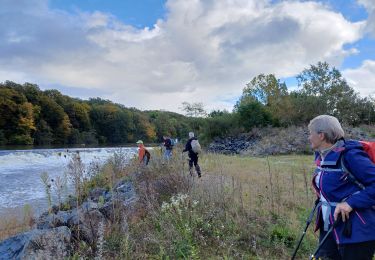
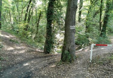
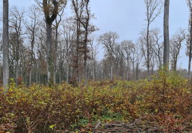
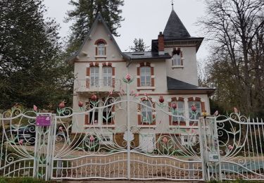
Randonnée V.T.T. de 21 km à découvrir à Grand Est, Meurthe-et-Moselle, Tonnoy. Cette randonnée est proposée par regish54.
Description
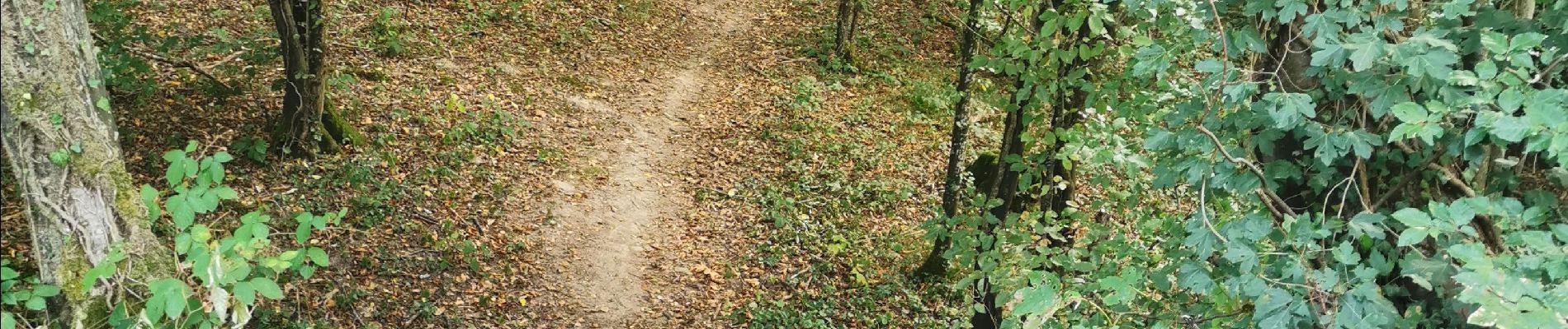
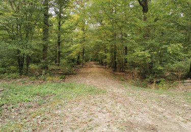
Sortie à travers les bois de Tonnoy, Burthecourt, Azelot jusqu'au dessus de Richardménil. Retour vers Flavigny puis vers Tonnoy empruntant une petite piste bien raide, mon VTT à assistance électrique m'a bien aidé à passer ce dénivelé.
Localisation
Pays :
France
Région :
Grand Est
Département/Province :
Meurthe-et-Moselle
Commune :
Tonnoy
Localité :
Unknown
Départ:(Dec)
Départ:(UTM)
296987 ; 5381664 (32U) N.
Commentaires
Randonnées à proximité
![Randonnée V.T.T. Crévéchamps - Crevechamp-Benney-Menil - Photo](https://media.geolcdn.com/t/375/260/540b83c1-451c-49ce-9526-f52cfedac254.jpg&format=jpg&maxdim=2)
![V.T.T. V.T.T.](https://static1.geolcdn.com/sitytour/trail-icons/202.png)
Crevechamp-Benney-Menil
V.T.T.
Facile
Crévéchamps,
Grand Est,
Meurthe-et-Moselle,
France
![](/images/other/stat-length.png)
11,7 km | 14,9 km-effort
1h 10min
![](https://static1.geolcdn.com/siteimages/upload/files/16400158638029165_repeat_loop_refresh_sync_direction_icon.png)
Non
![Randonnée V.T.T. Tonnoy - Menil-Benney - Photo](https://media.geolcdn.com/t/375/260/ded3f7d6-8204-4ac6-bdbd-59d02aee33c2.jpg&format=jpg&maxdim=2)
![V.T.T. V.T.T.](https://static1.geolcdn.com/sitytour/trail-icons/202.png)
Menil-Benney
V.T.T.
Facile
Tonnoy,
Grand Est,
Meurthe-et-Moselle,
France
![](/images/other/stat-length.png)
13,1 km | 16,9 km-effort
1h 11min
![](https://static1.geolcdn.com/siteimages/upload/files/16400158638029165_repeat_loop_refresh_sync_direction_icon.png)
Non
![Randonnée Marche Flavigny-sur-Moselle - Flavigny sur moselle - Photo](https://media.geolcdn.com/t/375/260/865fe255-4e7c-4609-9d3b-ef2d91cda2a8.jpg&format=jpg&maxdim=2)
![Marche Marche](https://static1.geolcdn.com/sitytour/trail-icons/101.png)
Flavigny sur moselle
Marche
Très facile
Flavigny-sur-Moselle,
Grand Est,
Meurthe-et-Moselle,
France
![](/images/other/stat-length.png)
10,1 km | 11 km-effort
3h 1min
![](https://static1.geolcdn.com/siteimages/upload/files/16400158638029165_repeat_loop_refresh_sync_direction_icon.png)
Oui
![Randonnée Marche Flavigny-sur-Moselle - Flavigny 2 12 100m + 197m - Photo](https://media.geolcdn.com/t/375/260/ext.jpg?maxdim=2&url=https%3A%2F%2Fservices.sitytrail.com%2FGeolivesWS%2FDownloadMedia.ashx%3FTrailID%3D789985%26Media%3Dfix__20170715161919.jpg)
![Marche Marche](https://static1.geolcdn.com/sitytour/trail-icons/101.png)
Flavigny 2 12 100m + 197m
Marche
Très facile
Flavigny-sur-Moselle,
Grand Est,
Meurthe-et-Moselle,
France
![](/images/other/stat-length.png)
11,9 km | 14,1 km-effort
3h 13min
![](https://static1.geolcdn.com/siteimages/upload/files/16400158638029165_repeat_loop_refresh_sync_direction_icon.png)
Oui
![Randonnée V.T.T. Flavigny-sur-Moselle - FLAVIGNY 2015-10-12 - Photo](https://media.geolcdn.com/t/375/260/ext.jpg?maxdim=2&url=https%3A%2F%2Fstatic1.geolcdn.com%2Fsiteimages%2Fupload%2Ffiles%2F1524743154velo.jpg)
![V.T.T. V.T.T.](https://static1.geolcdn.com/sitytour/trail-icons/202.png)
FLAVIGNY 2015-10-12
V.T.T.
Moyen
(2)
Flavigny-sur-Moselle,
Grand Est,
Meurthe-et-Moselle,
France
![](/images/other/stat-length.png)
28 km | 34 km-effort
2h 37min
![](https://static1.geolcdn.com/siteimages/upload/files/16400158638029165_repeat_loop_refresh_sync_direction_icon.png)
Non
![Randonnée Marche Flavigny-sur-Moselle - flavigny tonnoy - Photo](https://media.geolcdn.com/t/375/260/0ca0cd44-7df3-4fef-bee9-e241184aa787.jpg&format=jpg&maxdim=2)
![Marche Marche](https://static1.geolcdn.com/sitytour/trail-icons/101.png)
flavigny tonnoy
Marche
Difficile
Flavigny-sur-Moselle,
Grand Est,
Meurthe-et-Moselle,
France
![](/images/other/stat-length.png)
14,3 km | 15,6 km-effort
3h 7min
![](https://static1.geolcdn.com/siteimages/upload/files/16400158638029165_repeat_loop_refresh_sync_direction_icon.png)
Oui
![Randonnée V.T.T. Flavigny-sur-Moselle - 16km-decouverte - Photo](https://media.geolcdn.com/t/375/260/30de833d-a230-4aec-b6f6-4526fb860e4c.jpg&format=jpg&maxdim=2)
![V.T.T. V.T.T.](https://static1.geolcdn.com/sitytour/trail-icons/202.png)
16km-decouverte
V.T.T.
Facile
Flavigny-sur-Moselle,
Grand Est,
Meurthe-et-Moselle,
France
![](/images/other/stat-length.png)
12,2 km | 16,2 km-effort
1h 17min
![](https://static1.geolcdn.com/siteimages/upload/files/16400158638029165_repeat_loop_refresh_sync_direction_icon.png)
Non
![Randonnée Marche Flavigny-sur-Moselle - Flavgny - la boucle verte - Photo](https://media.geolcdn.com/t/375/260/ef58e8c1-1330-4eab-9a60-92650ba4806a.jpg&format=jpg&maxdim=2)
![Marche Marche](https://static1.geolcdn.com/sitytour/trail-icons/101.png)
Flavgny - la boucle verte
Marche
Facile
Flavigny-sur-Moselle,
Grand Est,
Meurthe-et-Moselle,
France
![](/images/other/stat-length.png)
9,5 km | 11,5 km-effort
4h 51min
![](https://static1.geolcdn.com/siteimages/upload/files/16400158638029165_repeat_loop_refresh_sync_direction_icon.png)
Oui
![Randonnée Marche Flavigny-sur-Moselle - FLAVIGNY SUR MOSELLE - LA BOUCLE VERTE - Photo](https://media.geolcdn.com/t/375/260/4272141d-29e7-41da-95c3-766930e6e427.jpg&format=jpg&maxdim=2)
![Marche Marche](https://static1.geolcdn.com/sitytour/trail-icons/101.png)
FLAVIGNY SUR MOSELLE - LA BOUCLE VERTE
Marche
Facile
Flavigny-sur-Moselle,
Grand Est,
Meurthe-et-Moselle,
France
![](/images/other/stat-length.png)
9,6 km | 11,6 km-effort
4h 35min
![](https://static1.geolcdn.com/siteimages/upload/files/16400158638029165_repeat_loop_refresh_sync_direction_icon.png)
Oui