![](/images/other/stat-length.png)
![Randonnée Marche nordique Orlu - Orlu, col de l'Osque, Porteille d'Orgeix, Orgeix - Photo](https://media.geolcdn.com/t/1900/400/bb96309c-1ffe-4fdf-ba7a-51865c84fc15.jpg&format=pjpeg&maxdim=2)
Orlu, col de l'Osque, Porteille d'Orgeix, Orgeix
octo
Utilisateur
![Longueur](/images/other/stat-length.png)
Longueur
13,9 km
![Altitude max](https://static1.geolcdn.com/siteimages/upload/files/1508320355ic_sort_altitude_max_24dp.png)
Altitude max
1435 m
![Dénivelé positif](https://static1.geolcdn.com/siteimages/upload/files/1508320355ic_sort_den_pos_24dp.png)
Dénivelé positif
637 m
![Km-Effort](/images/other/stat-length.png)
Km-Effort
22 km
![Altitude min](https://static1.geolcdn.com/siteimages/upload/files/1508320355ic_sort_altitude_min_24dp.png)
Altitude min
821 m
![Dénivelé négatif](https://static1.geolcdn.com/siteimages/upload/files/1508320355ic_sort_den_neg_24dp.png)
Dénivelé négatif
637 m
![Boucle](https://static1.geolcdn.com/siteimages/upload/files/16400158638029165_repeat_loop_refresh_sync_direction_icon.png)
Boucle
Oui
Date de création :
2020-08-26 06:11:34.861
Dernière modification :
2020-08-26 14:54:38.227
![Marche nordique](https://static1.geolcdn.com/sitytour/trail-icons/102.png)
3h21
Difficulté : Très facile
![Scannez ce code QR pour ouvrir la randonnée dans l'application SityTrail](https://capi.geolives.com/qq0zvz2zws4bq2lad0pu/sitytour/trails/2528226/qr.png?size=200)
Application GPS de randonnée GRATUITE
À propos
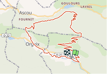
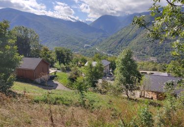
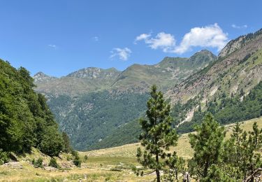
Randonnée Marche nordique de 13,9 km à découvrir à Occitanie, Ariège, Orlu. Cette randonnée est proposée par octo.
Description
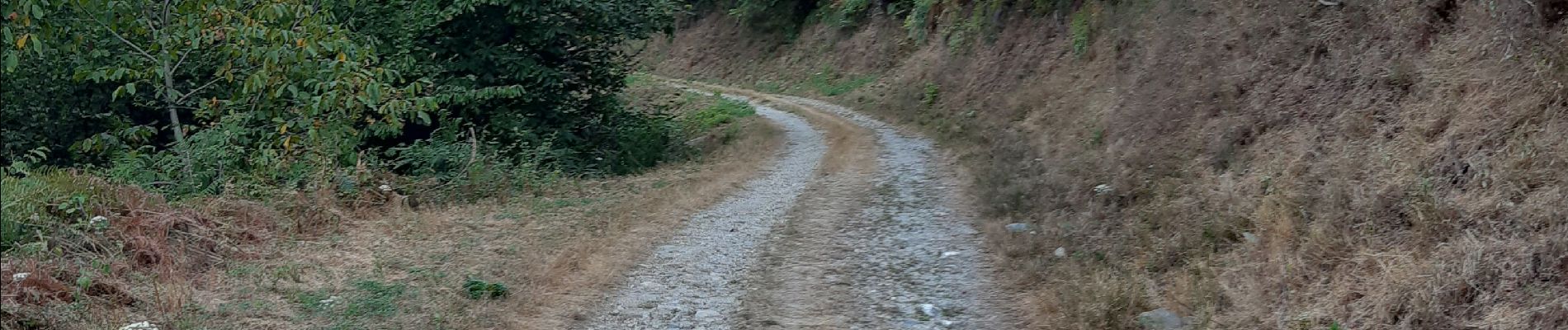
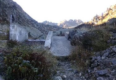
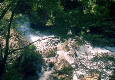
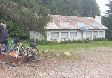
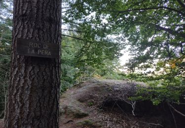
depuis le départ vous prenez un chemin routier forestier, pas de difficulté particulière, retour par le porteille d'Orgeix et puis suivre le ruisseau l'Oriege par sa rive gauche
Localisation
Pays :
France
Région :
Occitanie
Département/Province :
Ariège
Commune :
Orlu
Localité :
Unknown
Départ:(Dec)
Départ:(UTM)
409048 ; 4728222 (31T) N.
Commentaires
Randonnées à proximité
![Randonnée Marche Orgeix - aiguelongue - Photo](https://media.geolcdn.com/t/375/260/ext.jpg?maxdim=2&url=https%3A%2F%2Fservices.sitytrail.com%2FGeolivesWS%2FDownloadMedia.ashx%3FTrailID%3D643989%26Media%3Dfix__20161010104856.jpg)
![Marche Marche](https://static1.geolcdn.com/sitytour/trail-icons/101.png)
![Randonnée Marche Sorgeat - Chemin des Bonhommes - Sorgeat Merens - Photo](https://media.geolcdn.com/t/375/260/ext.jpg?maxdim=2&url=https%3A%2F%2Fservices.sitytrail.com%2FGeolivesWS%2FDownloadMedia.ashx%3FTrailID%3D108179%26Media%3D769_1.jpg)
![Marche Marche](https://static1.geolcdn.com/sitytour/trail-icons/101.png)
Chemin des Bonhommes - Sorgeat Merens
Marche
Très difficile
(1)
Sorgeat,
Occitanie,
Ariège,
France
![](/images/other/stat-length.png)
21 km | 36 km-effort
8h 0min
![](https://static1.geolcdn.com/siteimages/upload/files/16400158638029165_repeat_loop_refresh_sync_direction_icon.png)
Non
![Randonnée V.T.T. Orlu - Orlu Parking Aygue Longue - Photo](https://media.geolcdn.com/t/375/260/29d37a56-8c65-404d-a626-5d8cec80cb8d.jpg&format=jpg&maxdim=2)
![V.T.T. V.T.T.](https://static1.geolcdn.com/sitytour/trail-icons/202.png)
Orlu Parking Aygue Longue
V.T.T.
Moyen
Orlu,
Occitanie,
Ariège,
France
![](/images/other/stat-length.png)
16,1 km | 24 km-effort
2h 51min
![](https://static1.geolcdn.com/siteimages/upload/files/16400158638029165_repeat_loop_refresh_sync_direction_icon.png)
Oui
![Randonnée Marche Ax-les-Thermes - Lac de Campauleil - Orgeix - Photo](https://media.geolcdn.com/t/375/260/ext.jpg?maxdim=2&url=https%3A%2F%2Fstatic1.geolcdn.com%2Fsiteimages%2Fupload%2Ffiles%2F1553511878bg_sport_marche.png)
![Marche Marche](https://static1.geolcdn.com/sitytour/trail-icons/101.png)
Lac de Campauleil - Orgeix
Marche
Très facile
(1)
Ax-les-Thermes,
Occitanie,
Ariège,
France
![](/images/other/stat-length.png)
8,6 km | 11,2 km-effort
3h 3min
![](https://static1.geolcdn.com/siteimages/upload/files/16400158638029165_repeat_loop_refresh_sync_direction_icon.png)
Oui
![Randonnée Marche Orlu - Le Fanguil - Photo](https://media.geolcdn.com/t/375/260/c3accd76-1509-4827-a01c-0e33052ccaa5.jpg&format=jpg&maxdim=2)
![Marche Marche](https://static1.geolcdn.com/sitytour/trail-icons/101.png)
![Randonnée Marche Ax-les-Thermes - balade bleue au dessus d'Ax - Photo](https://media.geolcdn.com/t/375/260/1d43ecd2-3cc0-4fbb-b33b-15c49f564005.jpg&format=jpg&maxdim=2)
![Marche Marche](https://static1.geolcdn.com/sitytour/trail-icons/101.png)
balade bleue au dessus d'Ax
Marche
Facile
Ax-les-Thermes,
Occitanie,
Ariège,
France
![](/images/other/stat-length.png)
3,8 km | 6,1 km-effort
1h 22min
![](https://static1.geolcdn.com/siteimages/upload/files/16400158638029165_repeat_loop_refresh_sync_direction_icon.png)
Oui
![Randonnée Marche Ax-les-Thermes - Orgeix _ Ignaux - Photo](https://media.geolcdn.com/t/375/260/e43b3995-af8e-4435-939e-d3db1e3b3da2.jpg&format=jpg&maxdim=2)
![Marche Marche](https://static1.geolcdn.com/sitytour/trail-icons/101.png)
Orgeix _ Ignaux
Marche
Moyen
Ax-les-Thermes,
Occitanie,
Ariège,
France
![](/images/other/stat-length.png)
12,8 km | 19,1 km-effort
4h 12min
![](https://static1.geolcdn.com/siteimages/upload/files/16400158638029165_repeat_loop_refresh_sync_direction_icon.png)
Oui
![Randonnée Marche Orlu - Le roc de la péra - Photo](https://media.geolcdn.com/t/375/260/73155c20-8e48-42b7-9201-111106b56065.jpg&format=jpg&maxdim=2)
![Marche Marche](https://static1.geolcdn.com/sitytour/trail-icons/101.png)
Le roc de la péra
Marche
Moyen
(1)
Orlu,
Occitanie,
Ariège,
France
![](/images/other/stat-length.png)
9,3 km | 15 km-effort
2h 52min
![](https://static1.geolcdn.com/siteimages/upload/files/16400158638029165_repeat_loop_refresh_sync_direction_icon.png)
Oui
![Randonnée Marche Orlu - Orlu promenade des marmottes - Photo](https://media.geolcdn.com/t/375/260/5b2a5531-e3cc-44c5-8612-d73d9e8195ce.jpg&format=jpg&maxdim=2)
![Marche Marche](https://static1.geolcdn.com/sitytour/trail-icons/101.png)
Orlu promenade des marmottes
Marche
Très facile
Orlu,
Occitanie,
Ariège,
France
![](/images/other/stat-length.png)
10,9 km | 15,5 km-effort
4h 3min
![](https://static1.geolcdn.com/siteimages/upload/files/16400158638029165_repeat_loop_refresh_sync_direction_icon.png)
Oui