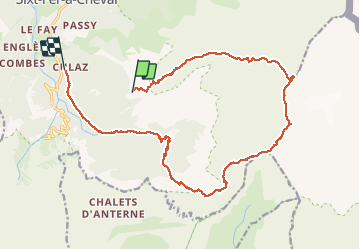
![](/images/other/stat-length.png)
![Randonnée Marche Sixt-Fer-à-Cheval - 2020-08-15 Marche Refuge Grenairon Le Mont Buet Les Fonts Salvagny - Photo](https://media.geolcdn.com/t/1900/400/e7db8eb5-0ce5-4100-b4bb-95b4993ccdfd.jpg&format=pjpeg&maxdim=2)
2020-08-15 Marche Refuge Grenairon Le Mont Buet Les Fonts Salvagny
holtzv
Utilisateur GUIDE
![Longueur](/images/other/stat-length.png)
![Altitude max](https://static1.geolcdn.com/siteimages/upload/files/1508320355ic_sort_altitude_max_24dp.png)
![Dénivelé positif](https://static1.geolcdn.com/siteimages/upload/files/1508320355ic_sort_den_pos_24dp.png)
![Km-Effort](/images/other/stat-length.png)
![Altitude min](https://static1.geolcdn.com/siteimages/upload/files/1508320355ic_sort_altitude_min_24dp.png)
![Dénivelé négatif](https://static1.geolcdn.com/siteimages/upload/files/1508320355ic_sort_den_neg_24dp.png)
![Boucle](https://static1.geolcdn.com/siteimages/upload/files/16400158638029165_repeat_loop_refresh_sync_direction_icon.png)
![Marche](https://static1.geolcdn.com/sitytour/trail-icons/101.png)
12h24
Difficulté : Très facile
![Scannez ce code QR pour ouvrir la randonnée dans l'application SityTrail](https://capi.geolives.com/qq0zvz2zws4bq2lad0pu/sitytour/trails/2515676/qr.png?size=200)
Application GPS de randonnée GRATUITE
À propos
Randonnée Marche de 20 km à découvrir à Auvergne-Rhône-Alpes, Haute-Savoie, Sixt-Fer-à-Cheval. Cette randonnée est proposée par holtzv.
Description
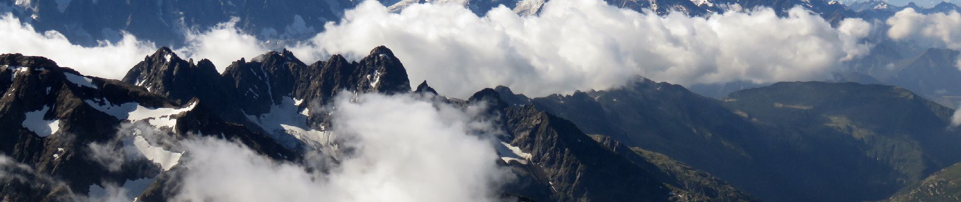
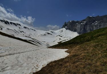
Départ à 5h du Refuge de Grenairon pour l'ascension du Mont Buet en passant par la Cathédrale, le lac du Plan du Buet, la crète de la montagne des Eves.
Arrivée au sommet du Mont Buet à 3100m à 10h.
Descente de 2260m de d- par le Grenier de Villy, les Beaux prés, le refuge des Fonts pour une petite mousse, et retour aux voitures à Salvagny.
Localisation
Commentaires
Randonnées à proximité
![Randonnée Marche Sixt-Fer-à-Cheval - Lac d'Anterne - Photo](https://media.geolcdn.com/t/375/260/ext.jpg?maxdim=2&url=https%3A%2F%2Fservices.sitytrail.com%2FGeolivesWS%2FDownloadMedia.ashx%3FTrailID%3D219373%26Media%3Dfix__20130905155735.jpg)
![Marche Marche](https://static1.geolcdn.com/sitytour/trail-icons/101.png)
Marche
![](/images/other/stat-length.png)
![](https://static1.geolcdn.com/siteimages/upload/files/16400158638029165_repeat_loop_refresh_sync_direction_icon.png)
![Randonnée Marche Sixt-Fer-à-Cheval - Gorges des Tines - Gers - Samoens - Photo](https://media.geolcdn.com/t/375/260/62d4f53d-e161-4e86-b37e-5afda26819a6.jpg&format=jpg&maxdim=2)
![Marche Marche](https://static1.geolcdn.com/sitytour/trail-icons/101.png)
Marche
![](/images/other/stat-length.png)
![](https://static1.geolcdn.com/siteimages/upload/files/16400158638029165_repeat_loop_refresh_sync_direction_icon.png)
![Randonnée Marche Sixt-Fer-à-Cheval - Le tour des Fiz : J3 - Photo](https://media.geolcdn.com/t/375/260/9c7228c0-b1d1-422d-97b7-6cc678ab62a3.jpg&format=jpg&maxdim=2)
![Marche Marche](https://static1.geolcdn.com/sitytour/trail-icons/101.png)
Marche
![](/images/other/stat-length.png)
![](https://static1.geolcdn.com/siteimages/upload/files/16400158638029165_repeat_loop_refresh_sync_direction_icon.png)
![Randonnée Marche Passy - Le tour des Fiz : J2 - Photo](https://media.geolcdn.com/t/375/260/939b6d9f-8ec5-49fa-ac5f-683b426f45bd.jpg&format=jpg&maxdim=2)
![Marche Marche](https://static1.geolcdn.com/sitytour/trail-icons/101.png)
Marche
![](/images/other/stat-length.png)
![](https://static1.geolcdn.com/siteimages/upload/files/16400158638029165_repeat_loop_refresh_sync_direction_icon.png)
![Randonnée Marche Sixt-Fer-à-Cheval - J9GR5Nord - Photo](https://media.geolcdn.com/t/375/260/425bb134-0523-4921-89e1-6ba98a367abc.jpg&format=jpg&maxdim=2)
![Marche Marche](https://static1.geolcdn.com/sitytour/trail-icons/101.png)
Marche
![](/images/other/stat-length.png)
![](https://static1.geolcdn.com/siteimages/upload/files/16400158638029165_repeat_loop_refresh_sync_direction_icon.png)
![Randonnée Marche Sixt-Fer-à-Cheval - SIXT PASSY RESERVE: CHALETS DE SALES 2 - Photo](https://media.geolcdn.com/t/375/260/8dd95f56-4f3c-4299-950f-2399bed8a605.jpg&format=jpg&maxdim=2)
![Marche Marche](https://static1.geolcdn.com/sitytour/trail-icons/101.png)
Marche
![](/images/other/stat-length.png)
![](https://static1.geolcdn.com/siteimages/upload/files/16400158638029165_repeat_loop_refresh_sync_direction_icon.png)
![Randonnée Marche Sixt-Fer-à-Cheval - SIXT PASSY RESERVE: LE BUET MONTEE VIA GRENAIRON - RETOUR PAR LES FONDS - Photo](https://media.geolcdn.com/t/375/260/37ee0cc7-a301-4565-b950-3c9eefd63255.jpg&format=jpg&maxdim=2)
![Marche Marche](https://static1.geolcdn.com/sitytour/trail-icons/101.png)
Marche
![](/images/other/stat-length.png)
![](https://static1.geolcdn.com/siteimages/upload/files/16400158638029165_repeat_loop_refresh_sync_direction_icon.png)
![Randonnée Marche Sixt-Fer-à-Cheval - cirsue du fer à cheval jusqu´au bout du monde . montée rive gauche, descente rive droite - Photo](https://media.geolcdn.com/t/375/260/0ee6e92c-6111-4147-a729-df2ba347cc42.jpg&format=jpg&maxdim=2)
![Marche Marche](https://static1.geolcdn.com/sitytour/trail-icons/101.png)
Marche
![](/images/other/stat-length.png)
![](https://static1.geolcdn.com/siteimages/upload/files/16400158638029165_repeat_loop_refresh_sync_direction_icon.png)
![Randonnée Marche Sixt-Fer-à-Cheval - Refuge et Lac d'Anterne - Photo](https://media.geolcdn.com/t/375/260/c3c25e1d-5a1f-48df-a97a-3c9cb28bf307.jpg&format=jpg&maxdim=2)
![Marche Marche](https://static1.geolcdn.com/sitytour/trail-icons/101.png)
Marche
![](/images/other/stat-length.png)
![](https://static1.geolcdn.com/siteimages/upload/files/16400158638029165_repeat_loop_refresh_sync_direction_icon.png)