![](/images/other/stat-length.png)
![Randonnée Marche Hostens - Hostens les lacs - Photo](https://media.geolcdn.com/t/1900/400/ext.pjpeg?maxdim=2&url=https%3A%2F%2Fstatic1.geolcdn.com%2Fsiteimages%2Fupload%2Ffiles%2F1553511878bg_sport_marche.png)
Hostens les lacs
BIBAR
Utilisateur
![Longueur](/images/other/stat-length.png)
Longueur
13,5 km
![Altitude max](https://static1.geolcdn.com/siteimages/upload/files/1508320355ic_sort_altitude_max_24dp.png)
Altitude max
85 m
![Dénivelé positif](https://static1.geolcdn.com/siteimages/upload/files/1508320355ic_sort_den_pos_24dp.png)
Dénivelé positif
100 m
![Km-Effort](/images/other/stat-length.png)
Km-Effort
14,9 km
![Altitude min](https://static1.geolcdn.com/siteimages/upload/files/1508320355ic_sort_altitude_min_24dp.png)
Altitude min
67 m
![Dénivelé négatif](https://static1.geolcdn.com/siteimages/upload/files/1508320355ic_sort_den_neg_24dp.png)
Dénivelé négatif
100 m
![Boucle](https://static1.geolcdn.com/siteimages/upload/files/16400158638029165_repeat_loop_refresh_sync_direction_icon.png)
Boucle
Oui
Date de création :
2020-08-14 07:35:41.787
Dernière modification :
2020-08-14 18:31:21.349
![Marche](https://static1.geolcdn.com/sitytour/trail-icons/101.png)
3h25
Difficulté : Facile
![Scannez ce code QR pour ouvrir la randonnée dans l'application SityTrail](https://capi.geolives.com/qq0zvz2zws4bq2lad0pu/sitytour/trails/2514095/qr.png?size=200)
Application GPS de randonnée GRATUITE
À propos
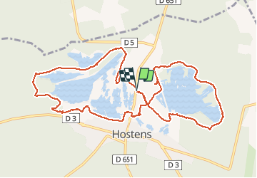
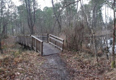
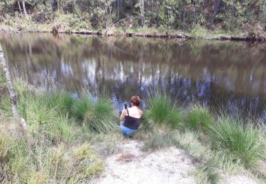
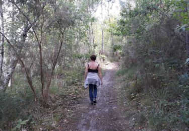
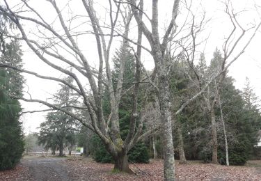
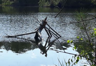
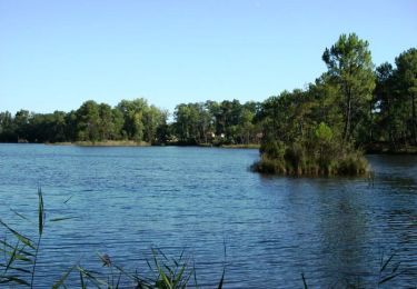
Randonnée Marche de 13,5 km à découvrir à Nouvelle-Aquitaine, Gironde, Hostens. Cette randonnée est proposée par BIBAR.
Description
Un grand 8 autour des lacs, dans une forêt de feuillus parcourue par un immense labyrinthe de pistes de VTT. Un peu embêtés par les moucherons. Et n' oubliez pas d'emmener à boire.
Localisation
Pays :
France
Région :
Nouvelle-Aquitaine
Département/Province :
Gironde
Commune :
Hostens
Localité :
Unknown
Départ:(Dec)
Départ:(UTM)
687861 ; 4930181 (30T) N.
Commentaires
Randonnées à proximité
![Randonnée Marche Hostens - les lacs d'Hostens - Photo](https://media.geolcdn.com/t/375/260/96a0644d-cf80-4d48-865c-4d9bfa2c432d.jpg&format=jpg&maxdim=2)
![Marche Marche](https://static1.geolcdn.com/sitytour/trail-icons/101.png)
les lacs d'Hostens
Marche
Facile
Hostens,
Nouvelle-Aquitaine,
Gironde,
France
![](/images/other/stat-length.png)
5,7 km | 6,3 km-effort
1h 26min
![](https://static1.geolcdn.com/siteimages/upload/files/16400158638029165_repeat_loop_refresh_sync_direction_icon.png)
Non
![Randonnée Marche Hostens - tour du lac du Bourg et de Lamothe - Photo](https://media.geolcdn.com/t/375/260/d3ce82f5-1826-4012-9762-25d3f1eb629a.jpg&format=jpg&maxdim=2)
![Marche Marche](https://static1.geolcdn.com/sitytour/trail-icons/101.png)
tour du lac du Bourg et de Lamothe
Marche
Facile
Hostens,
Nouvelle-Aquitaine,
Gironde,
France
![](/images/other/stat-length.png)
6,9 km | 7,6 km-effort
1h 57min
![](https://static1.geolcdn.com/siteimages/upload/files/16400158638029165_repeat_loop_refresh_sync_direction_icon.png)
Oui
![Randonnée Marche Hostens - Les lacs d'Hostens - Photo](https://media.geolcdn.com/t/375/260/c00d140f-2d7e-4947-a4e4-385fc77dce5f.jpg&format=jpg&maxdim=2)
![Marche Marche](https://static1.geolcdn.com/sitytour/trail-icons/101.png)
Les lacs d'Hostens
Marche
Facile
Hostens,
Nouvelle-Aquitaine,
Gironde,
France
![](/images/other/stat-length.png)
17,5 km | 19,3 km-effort
4h 35min
![](https://static1.geolcdn.com/siteimages/upload/files/16400158638029165_repeat_loop_refresh_sync_direction_icon.png)
Oui
![Randonnée Marche Hostens - lacs de Bernadas et Lamothe Hostens - Photo](https://media.geolcdn.com/t/375/260/3fa8d80e-296a-4d61-a1f1-9b3219248515.jpg&format=jpg&maxdim=2)
![Marche Marche](https://static1.geolcdn.com/sitytour/trail-icons/101.png)
lacs de Bernadas et Lamothe Hostens
Marche
Très facile
Hostens,
Nouvelle-Aquitaine,
Gironde,
France
![](/images/other/stat-length.png)
6,3 km | 7,2 km-effort
2h 3min
![](https://static1.geolcdn.com/siteimages/upload/files/16400158638029165_repeat_loop_refresh_sync_direction_icon.png)
Oui
![Randonnée Marche Hostens - boucle de Hostens - Photo](https://media.geolcdn.com/t/375/260/40f08afc-222d-4976-bd41-9fe63c38192c.jpg&format=jpg&maxdim=2)
![Marche Marche](https://static1.geolcdn.com/sitytour/trail-icons/101.png)
boucle de Hostens
Marche
Très facile
Hostens,
Nouvelle-Aquitaine,
Gironde,
France
![](/images/other/stat-length.png)
6,8 km | 7,6 km-effort
1h 59min
![](https://static1.geolcdn.com/siteimages/upload/files/16400158638029165_repeat_loop_refresh_sync_direction_icon.png)
Oui
![Randonnée Marche Hostens - tour du Lac du bourg et lamothe - Photo](https://media.geolcdn.com/t/375/260/159720e7-39a2-4c29-895f-f0935db5b8fa.jpg&format=jpg&maxdim=2)
![Marche Marche](https://static1.geolcdn.com/sitytour/trail-icons/101.png)
tour du Lac du bourg et lamothe
Marche
Très facile
Hostens,
Nouvelle-Aquitaine,
Gironde,
France
![](/images/other/stat-length.png)
6,3 km | 6,9 km-effort
1h 50min
![](https://static1.geolcdn.com/siteimages/upload/files/16400158638029165_repeat_loop_refresh_sync_direction_icon.png)
Non
![Randonnée Marche Hostens - variante des lacs de Bernadas - Photo](https://media.geolcdn.com/t/375/260/0adfbfde-eeb4-44e5-be1b-6b8d1a2caf61.jpg&format=jpg&maxdim=2)
![Marche Marche](https://static1.geolcdn.com/sitytour/trail-icons/101.png)
variante des lacs de Bernadas
Marche
Très facile
Hostens,
Nouvelle-Aquitaine,
Gironde,
France
![](/images/other/stat-length.png)
5,8 km | 6,5 km-effort
1h 51min
![](https://static1.geolcdn.com/siteimages/upload/files/16400158638029165_repeat_loop_refresh_sync_direction_icon.png)
Non
![Randonnée Marche Hostens - boucle d'Hostens - Photo](https://media.geolcdn.com/t/375/260/ae9e4bec-9c95-4027-90dc-ab1b3e8ec352.jpg&format=jpg&maxdim=2)
![Marche Marche](https://static1.geolcdn.com/sitytour/trail-icons/101.png)
boucle d'Hostens
Marche
Très facile
Hostens,
Nouvelle-Aquitaine,
Gironde,
France
![](/images/other/stat-length.png)
5,3 km | 6 km-effort
1h 37min
![](https://static1.geolcdn.com/siteimages/upload/files/16400158638029165_repeat_loop_refresh_sync_direction_icon.png)
Non
![Randonnée V.T.T. Hostens - Autour des lacs d'Hostens - Photo](https://media.geolcdn.com/t/375/260/ext.jpg?maxdim=2&url=https%3A%2F%2Fservices.sitytrail.com%2FGeolivesWS%2FDownloadMedia.ashx%3FTrailID%3D102777%26Media%3D3938_1.jpg)
![V.T.T. V.T.T.](https://static1.geolcdn.com/sitytour/trail-icons/202.png)
Autour des lacs d'Hostens
V.T.T.
Facile
Hostens,
Nouvelle-Aquitaine,
Gironde,
France
![](/images/other/stat-length.png)
14,4 km | 15,8 km-effort
1h 30min
![](https://static1.geolcdn.com/siteimages/upload/files/16400158638029165_repeat_loop_refresh_sync_direction_icon.png)
Oui