![](/images/other/stat-length.png)
![Randonnée Marche Alost - Aalst wandelroute - Photo](https://media.geolcdn.com/t/1900/400/ext.pjpeg?maxdim=2&url=https%3A%2F%2Fstatic1.geolcdn.com%2Fsiteimages%2Fupload%2Ffiles%2F1553511878bg_sport_marche.png)
Aalst wandelroute
zorro
Utilisateur
![Longueur](/images/other/stat-length.png)
![Altitude max](https://static1.geolcdn.com/siteimages/upload/files/1508320355ic_sort_altitude_max_24dp.png)
![Dénivelé positif](https://static1.geolcdn.com/siteimages/upload/files/1508320355ic_sort_den_pos_24dp.png)
![Km-Effort](/images/other/stat-length.png)
![Altitude min](https://static1.geolcdn.com/siteimages/upload/files/1508320355ic_sort_altitude_min_24dp.png)
![Dénivelé négatif](https://static1.geolcdn.com/siteimages/upload/files/1508320355ic_sort_den_neg_24dp.png)
![Boucle](https://static1.geolcdn.com/siteimages/upload/files/16400158638029165_repeat_loop_refresh_sync_direction_icon.png)
![Marche](https://static1.geolcdn.com/sitytour/trail-icons/101.png)
57m
Difficulté : Moyen
![Scannez ce code QR pour ouvrir la randonnée dans l'application SityTrail](https://capi.geolives.com/qq0zvz2zws4bq2lad0pu/sitytour/trails/250832/qr.png?size=200)
Application GPS de randonnée GRATUITE
À propos
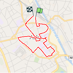
Randonnée Marche de 4 km à découvrir à Flandre, Flandre orientale, Alost. Cette randonnée est proposée par zorro.
Description
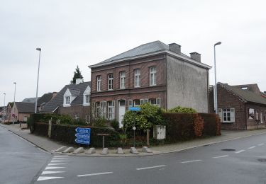
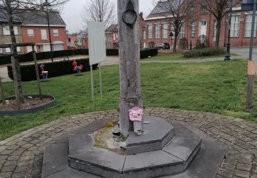
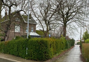
Vier bekende figuren, heel wat mooie gebouwen, onverwachte plekjes, een leuk museum en een gezellige winkelstad. Dat is in grote lijnen wat je te zien krijgt tijdens deze vier kilometer lange wandeling door Aalst. Het is een stad met een rijke geschiedenis en dat zal je met deze wandelroute op een leuke manier ontdekken. Opnieuw brengen we heel wat afwisseling in de wandelroute opdat zowel de culturele of culinaire toerist als de levensgenieter aan zijn trekken komt. De shopper geniet van een unieke autovrije winkelstratenstructuur: vijf winkelstraten die uitgeven op de Grote Markt vormen het shoppinghart van de stad. De route kan je zowel starten aan het station, vanop de autoparking of camperplaats.
Localisation
Commentaires
Randonnées à proximité
![Randonnée A pied Lede - Honegem Natte Voetenpad - Photo](https://media.geolcdn.com/t/375/260/e471e2e6-6e18-40c0-b0e2-67167332cf88.jpeg&format=jpg&maxdim=2)
![A pied A pied](https://static1.geolcdn.com/sitytour/trail-icons/100.png)
A pied
![](/images/other/stat-length.png)
![](https://static1.geolcdn.com/siteimages/upload/files/16400158638029165_repeat_loop_refresh_sync_direction_icon.png)
![Randonnée A pied Alost - Welle- en Kapellemeersen - Photo](https://media.geolcdn.com/t/375/260/ba64ab78-4105-4e5b-9620-a073ddfe9810.jpeg&format=jpg&maxdim=2)
![A pied A pied](https://static1.geolcdn.com/sitytour/trail-icons/100.png)
A pied
![](/images/other/stat-length.png)
![](https://static1.geolcdn.com/siteimages/upload/files/16400158638029165_repeat_loop_refresh_sync_direction_icon.png)
![Randonnée Marche Lebbeke - Wieze Vossewegelroute - Photo](https://media.geolcdn.com/t/375/260/4cbd18b9-62c2-4f01-919a-e46986a49074.jpg&format=jpg&maxdim=2)
![Marche Marche](https://static1.geolcdn.com/sitytour/trail-icons/101.png)
Marche
![](/images/other/stat-length.png)
![](https://static1.geolcdn.com/siteimages/upload/files/16400158638029165_repeat_loop_refresh_sync_direction_icon.png)
![Randonnée A pied Lebbeke - 10.000-stappenroute Wieze - Photo](https://media.geolcdn.com/t/375/260/081c64ef-57ce-4c52-8248-859338abd2a5.jpeg&format=jpg&maxdim=2)
![A pied A pied](https://static1.geolcdn.com/sitytour/trail-icons/100.png)
A pied
![](/images/other/stat-length.png)
![](https://static1.geolcdn.com/siteimages/upload/files/16400158638029165_repeat_loop_refresh_sync_direction_icon.png)
![Randonnée A pied Lebbeke - Vliegenetersroute - Photo](https://media.geolcdn.com/t/375/260/081c64ef-57ce-4c52-8248-859338abd2a5.jpeg&format=jpg&maxdim=2)
![A pied A pied](https://static1.geolcdn.com/sitytour/trail-icons/100.png)
A pied
![](/images/other/stat-length.png)
![](https://static1.geolcdn.com/siteimages/upload/files/16400158638029165_repeat_loop_refresh_sync_direction_icon.png)
![Randonnée Marche Lebbeke - vliegeneters - Photo](https://media.geolcdn.com/t/375/260/ext.jpg?maxdim=2&url=https%3A%2F%2Fstatic1.geolcdn.com%2Fsiteimages%2Fupload%2Ffiles%2F1553511878bg_sport_marche.png)
![Marche Marche](https://static1.geolcdn.com/sitytour/trail-icons/101.png)
Marche
![](/images/other/stat-length.png)
![](https://static1.geolcdn.com/siteimages/upload/files/16400158638029165_repeat_loop_refresh_sync_direction_icon.png)
![Randonnée Marche Alost - Martinus Aalst - Wetteren - Photo](https://media.geolcdn.com/t/375/260/420186e8-f7f4-411a-82d3-cd0ca7b924d6.jpg&format=jpg&maxdim=2)
![Marche Marche](https://static1.geolcdn.com/sitytour/trail-icons/101.png)
Marche
![](/images/other/stat-length.png)
![](https://static1.geolcdn.com/siteimages/upload/files/16400158638029165_repeat_loop_refresh_sync_direction_icon.png)
![Randonnée Marche Lebbeke - 20220220 WSV Denderklokjes - Photo](https://media.geolcdn.com/t/375/260/f3fd42c1-e9e8-4d8b-bce5-21a6c867bfa5.jpg&format=jpg&maxdim=2)
![Marche Marche](https://static1.geolcdn.com/sitytour/trail-icons/101.png)
Marche
![](/images/other/stat-length.png)
![](https://static1.geolcdn.com/siteimages/upload/files/16400158638029165_repeat_loop_refresh_sync_direction_icon.png)
![Randonnée Marche Lede - de 2 molenbeeken - Photo](https://media.geolcdn.com/t/375/260/ext.jpg?maxdim=2&url=https%3A%2F%2Fservices.sitytrail.com%2FGeolivesWS%2FDownloadMedia.ashx%3FTrailID%3D462154%26Media%3Dfix__20150821190042.jpg)
![Marche Marche](https://static1.geolcdn.com/sitytour/trail-icons/101.png)
Marche
![](/images/other/stat-length.png)
![](https://static1.geolcdn.com/siteimages/upload/files/16400158638029165_repeat_loop_refresh_sync_direction_icon.png)