![](/images/other/stat-length.png)
![Randonnée Vélo Boutersem - Fietslus Boutersem - Photo](https://media.geolcdn.com/t/1900/400/ext.pjpeg?maxdim=2&url=https%3A%2F%2Fstatic1.geolcdn.com%2Fsiteimages%2Fupload%2Ffiles%2F1524743154velo.jpg)
Fietslus Boutersem
zorro
Utilisateur
![Longueur](/images/other/stat-length.png)
![Altitude max](https://static1.geolcdn.com/siteimages/upload/files/1508320355ic_sort_altitude_max_24dp.png)
![Dénivelé positif](https://static1.geolcdn.com/siteimages/upload/files/1508320355ic_sort_den_pos_24dp.png)
![Km-Effort](/images/other/stat-length.png)
![Altitude min](https://static1.geolcdn.com/siteimages/upload/files/1508320355ic_sort_altitude_min_24dp.png)
![Dénivelé négatif](https://static1.geolcdn.com/siteimages/upload/files/1508320355ic_sort_den_neg_24dp.png)
![Boucle](https://static1.geolcdn.com/siteimages/upload/files/16400158638029165_repeat_loop_refresh_sync_direction_icon.png)
![Vélo](https://static1.geolcdn.com/sitytour/trail-icons/200.png)
2h02
Difficulté : Moyen
![Scannez ce code QR pour ouvrir la randonnée dans l'application SityTrail](https://capi.geolives.com/qq0zvz2zws4bq2lad0pu/sitytour/trails/250799/qr.png?size=200)
Application GPS de randonnée GRATUITE
À propos
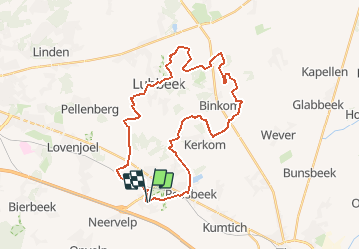
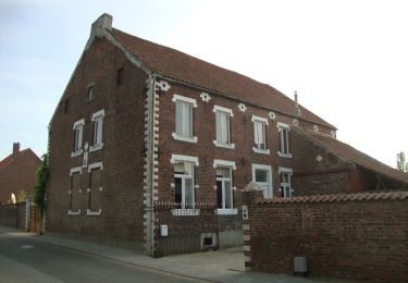
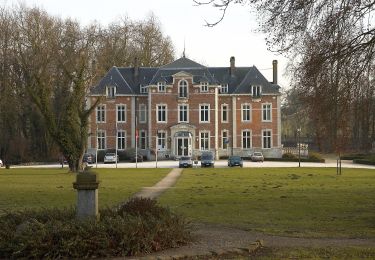
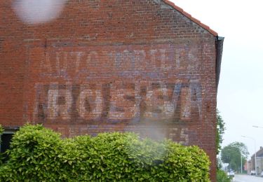
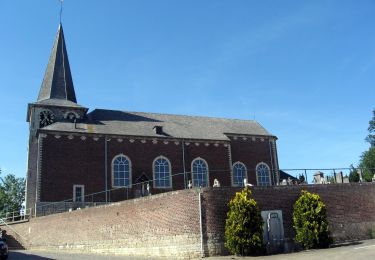
Randonnée Vélo de 31 km à découvrir à Flandre, Brabant flamand, Boutersem. Cette randonnée est proposée par zorro.
Description
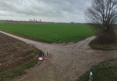
Fietsen in het Hageland dat is op twee wielen genieten van prachtige landschappen en vergezichten. Af en toe krijg je een helling voor de wielen, maar erg lang is ze nooit. Bovendien kun je tijdens de afdaling extra genieten van de omgevende landschappen. Akkers,weilanden en bossen kleuren de omgeving, maar af en toe duiken er ook percelen op waar het lekkere Hagelandse fruit geteeld wordt. Sommige wegen zijn afgeboord met hagen, een vage verwijzing naar het kreupelhout dat vroeger veelvuldig aanwezig was en deze streek haar naam bezorgde.
Localisation
Commentaires
Randonnées à proximité
![Randonnée Marche Hougaerde - Meldert - Photo](https://media.geolcdn.com/t/375/260/31b1a0a0-1852-490a-917d-83e16fb1a5a8.jpg&format=jpg&maxdim=2)
![Marche Marche](https://static1.geolcdn.com/sitytour/trail-icons/101.png)
Marche
![](/images/other/stat-length.png)
![](https://static1.geolcdn.com/siteimages/upload/files/16400158638029165_repeat_loop_refresh_sync_direction_icon.png)
![Randonnée A pied Tirlemont - Orbeccawandeling Kort - Photo](https://media.geolcdn.com/t/375/260/e812d299-df6e-4ffd-bbb0-c17a49cbfa6d.jpeg&format=jpg&maxdim=2)
![A pied A pied](https://static1.geolcdn.com/sitytour/trail-icons/100.png)
A pied
![](/images/other/stat-length.png)
![](https://static1.geolcdn.com/siteimages/upload/files/16400158638029165_repeat_loop_refresh_sync_direction_icon.png)
![Randonnée A pied Hougaerde - Mene- en Jordaanwandeling - Photo](https://media.geolcdn.com/t/375/260/758c5d97-4085-4265-85c9-f07729efccc1.jpeg&format=jpg&maxdim=2)
![A pied A pied](https://static1.geolcdn.com/sitytour/trail-icons/100.png)
A pied
![](/images/other/stat-length.png)
![](https://static1.geolcdn.com/siteimages/upload/files/16400158638029165_repeat_loop_refresh_sync_direction_icon.png)
![Randonnée A pied Bierbeek - Hollewegenwandelpad - Photo](https://media.geolcdn.com/t/375/260/58a21a26-c364-46a8-866b-beae515c5750.jpeg&format=jpg&maxdim=2)
![A pied A pied](https://static1.geolcdn.com/sitytour/trail-icons/100.png)
A pied
![](/images/other/stat-length.png)
![](https://static1.geolcdn.com/siteimages/upload/files/16400158638029165_repeat_loop_refresh_sync_direction_icon.png)
![Randonnée A pied Boutersem - Kleine Kringwandelpad - Photo](https://media.geolcdn.com/t/375/260/921c562e-84e1-448b-b0e1-9555ca637c1e.jpeg&format=jpg&maxdim=2)
![A pied A pied](https://static1.geolcdn.com/sitytour/trail-icons/100.png)
A pied
![](/images/other/stat-length.png)
![](https://static1.geolcdn.com/siteimages/upload/files/16400158638029165_repeat_loop_refresh_sync_direction_icon.png)
![Randonnée A pied Boutersem - Velpehoevewandelpad - Photo](https://media.geolcdn.com/t/375/260/32694a94-9124-4a9f-8730-155bd3fc653c.jpeg&format=jpg&maxdim=2)
![A pied A pied](https://static1.geolcdn.com/sitytour/trail-icons/100.png)
A pied
![](/images/other/stat-length.png)
![](https://static1.geolcdn.com/siteimages/upload/files/16400158638029165_repeat_loop_refresh_sync_direction_icon.png)
![Randonnée A pied Boutersem - Heulingenwandelpad - Photo](https://media.geolcdn.com/t/375/260/4b61fc62-7afe-4e8d-b814-42fb11394875.jpeg&format=jpg&maxdim=2)
![A pied A pied](https://static1.geolcdn.com/sitytour/trail-icons/100.png)
A pied
![](/images/other/stat-length.png)
![](https://static1.geolcdn.com/siteimages/upload/files/16400158638029165_repeat_loop_refresh_sync_direction_icon.png)
![Randonnée A pied Boutersem - Klein Zwitserlandwandelpad - Photo](https://media.geolcdn.com/t/375/260/7f0b01f3-cab3-4dab-a75a-24500e4a0e89.jpeg&format=jpg&maxdim=2)
![A pied A pied](https://static1.geolcdn.com/sitytour/trail-icons/100.png)
A pied
![](/images/other/stat-length.png)
![](https://static1.geolcdn.com/siteimages/upload/files/16400158638029165_repeat_loop_refresh_sync_direction_icon.png)
![Randonnée A pied Lubbeek - Koebos Rode driehoek - Photo](https://media.geolcdn.com/t/375/260/5c20d123-ec17-4589-930d-f0e497ca53fb.jpeg&format=jpg&maxdim=2)
![A pied A pied](https://static1.geolcdn.com/sitytour/trail-icons/100.png)
A pied
![](/images/other/stat-length.png)
![](https://static1.geolcdn.com/siteimages/upload/files/16400158638029165_repeat_loop_refresh_sync_direction_icon.png)