


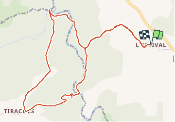

18,6 km | 24 km-effort

Utilisateur


Application GPS de randonnée GRATUITE
 SityTrail
IGN / Instituts géographiques
SityTrail World
Le monde est à vous
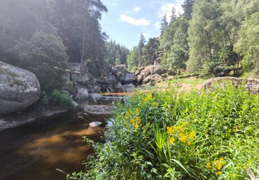
Randonnée Marche de 6,8 km à découvrir à Occitanie, Lozère, Fontans. Cette randonnée est proposée par walrou63.
belle petite randonnée au départ de L'ESTIVAL pour découvrir le Baou de l'Estival. Beau passage le long de la Truyère.


Marche
Voiture
Marche
V.T.T.

Randonnée équestre
Randonnée équestre
Randonnée équestre

Marche