![](/images/other/stat-length.png)
![Randonnée Marche Villars-Colmars - Bergerie de Juan - Photo](https://media.geolcdn.com/t/1900/400/b2cf2bd3-21bb-436f-b68c-27cdb38c2d26.jpg&format=pjpeg&maxdim=2)
Bergerie de Juan
soca
Utilisateur
![Longueur](/images/other/stat-length.png)
![Altitude max](https://static1.geolcdn.com/siteimages/upload/files/1508320355ic_sort_altitude_max_24dp.png)
![Dénivelé positif](https://static1.geolcdn.com/siteimages/upload/files/1508320355ic_sort_den_pos_24dp.png)
![Km-Effort](/images/other/stat-length.png)
![Altitude min](https://static1.geolcdn.com/siteimages/upload/files/1508320355ic_sort_altitude_min_24dp.png)
![Dénivelé négatif](https://static1.geolcdn.com/siteimages/upload/files/1508320355ic_sort_den_neg_24dp.png)
![Boucle](https://static1.geolcdn.com/siteimages/upload/files/16400158638029165_repeat_loop_refresh_sync_direction_icon.png)
![Marche](https://static1.geolcdn.com/sitytour/trail-icons/101.png)
3h41
Difficulté : Facile
![Scannez ce code QR pour ouvrir la randonnée dans l'application SityTrail](https://capi.geolives.com/qq0zvz2zws4bq2lad0pu/sitytour/trails/2504377/qr.png?size=200)
Application GPS de randonnée GRATUITE
À propos
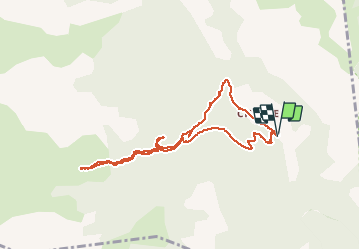
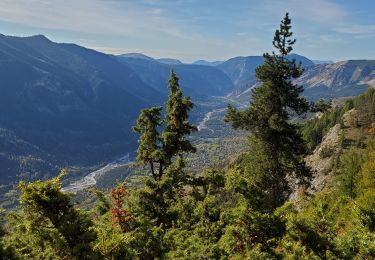
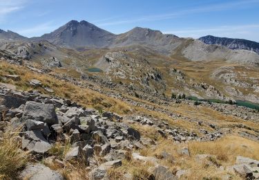
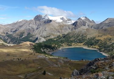
Randonnée Marche de 9,2 km à découvrir à Provence-Alpes-Côte d'Azur, Alpes-de-Haute-Provence, Villars-Colmars. Cette randonnée est proposée par soca.
Description
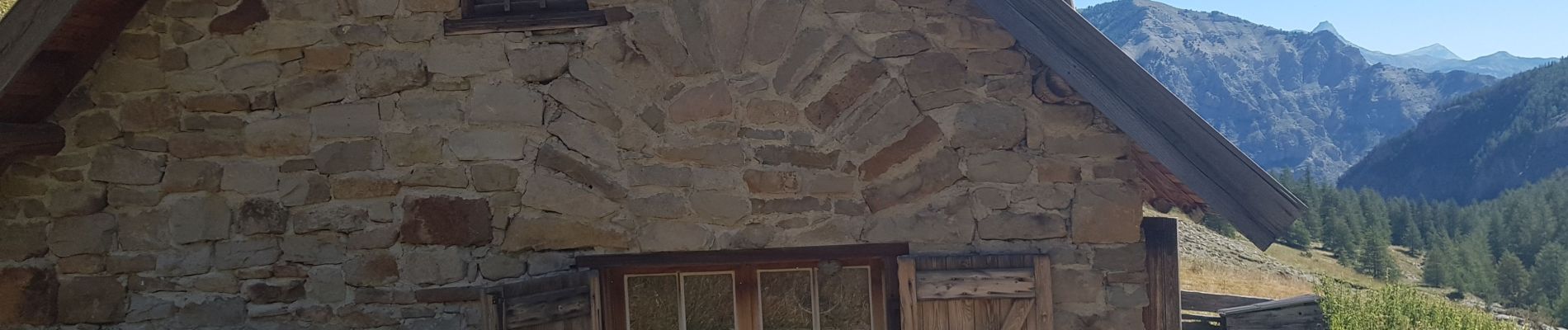
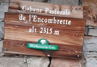
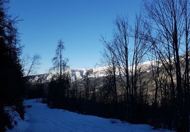
Départ après le pont de Chasse. Courte montée un peu raide à travers les sapins, puis chemin en pente douce jusqu'à la bergerie.
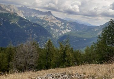
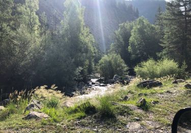
Le retour vers le puy agréable jusqu'à la rencontre avec la piste qui a été refaite au bull : épouvantable.
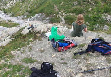
Mieux vaut revenir sur ses pas vers le pont de chasse.
Localisation
Commentaires
Randonnées à proximité
![Randonnée Marche Colmars - Colmars autapie 19.5k ms 1200m - Photo](https://media.geolcdn.com/t/375/260/9d112094-8159-4db6-8f08-1f5a21c98a9f.jpg&format=jpg&maxdim=2)
![Marche Marche](https://static1.geolcdn.com/sitytour/trail-icons/101.png)
Marche
![](/images/other/stat-length.png)
![](https://static1.geolcdn.com/siteimages/upload/files/16400158638029165_repeat_loop_refresh_sync_direction_icon.png)
![Randonnée Marche Colmars - clignon encombrette - Photo](https://media.geolcdn.com/t/375/260/be8c3d38-73f7-4208-88b1-25cf6491a9c9.jpg&format=jpg&maxdim=2)
![Marche Marche](https://static1.geolcdn.com/sitytour/trail-icons/101.png)
Marche
![](/images/other/stat-length.png)
![](https://static1.geolcdn.com/siteimages/upload/files/16400158638029165_repeat_loop_refresh_sync_direction_icon.png)
![Randonnée Marche Colmars - Col de l](https://media.geolcdn.com/t/375/260/09a91b7d-2e2d-4897-a96c-c33d12bc529d.jpg&format=jpg&maxdim=2)
![Marche Marche](https://static1.geolcdn.com/sitytour/trail-icons/101.png)
Marche
![](/images/other/stat-length.png)
![](https://static1.geolcdn.com/siteimages/upload/files/16400158638029165_repeat_loop_refresh_sync_direction_icon.png)
![Randonnée Marche Colmars - col de l'encombrette pas de L'Echellette - Photo](https://media.geolcdn.com/t/375/260/e4efe46f-86ba-4576-b21d-bdc6efd2fc20.jpg&format=jpg&maxdim=2)
![Marche Marche](https://static1.geolcdn.com/sitytour/trail-icons/101.png)
Marche
![](/images/other/stat-length.png)
![](https://static1.geolcdn.com/siteimages/upload/files/16400158638029165_repeat_loop_refresh_sync_direction_icon.png)
![Randonnée Marche Colmars - l autupie Colmars les Alpes belvédères des gardettes - Photo](https://media.geolcdn.com/t/375/260/0b579c14-8af1-444e-a2de-998771f711c5.jpg&format=jpg&maxdim=2)
![Marche Marche](https://static1.geolcdn.com/sitytour/trail-icons/101.png)
Marche
![](/images/other/stat-length.png)
![](https://static1.geolcdn.com/siteimages/upload/files/16400158638029165_repeat_loop_refresh_sync_direction_icon.png)
![Randonnée Marche Villars-Colmars - Chasse - Photo](https://media.geolcdn.com/t/375/260/adce822d-d4d0-4bf2-b2fe-e681e367f77a.jpg&format=jpg&maxdim=2)
![Marche Marche](https://static1.geolcdn.com/sitytour/trail-icons/101.png)
Marche
![](/images/other/stat-length.png)
![](https://static1.geolcdn.com/siteimages/upload/files/16400158638029165_repeat_loop_refresh_sync_direction_icon.png)
![Randonnée Marche Villars-Colmars - Chalet - Les Espiniers - l'Adroit- Colmars - Photo](https://media.geolcdn.com/t/375/260/ext.jpg?maxdim=2&url=https%3A%2F%2Fstatic1.geolcdn.com%2Fsiteimages%2Fupload%2Ffiles%2F1553511878bg_sport_marche.png)
![Marche Marche](https://static1.geolcdn.com/sitytour/trail-icons/101.png)
Marche
![](/images/other/stat-length.png)
![](https://static1.geolcdn.com/siteimages/upload/files/16400158638029165_repeat_loop_refresh_sync_direction_icon.png)
![Randonnée Raquettes à neige Colmars - LAUPON 23.02.19 - Photo](https://media.geolcdn.com/t/375/260/21a0c733-859d-49e3-919f-68701cc1a2d5.jpg&format=jpg&maxdim=2)
![Raquettes à neige Raquettes à neige](https://static1.geolcdn.com/sitytour/trail-icons/504.png)
Raquettes à neige
![](/images/other/stat-length.png)
![](https://static1.geolcdn.com/siteimages/upload/files/16400158638029165_repeat_loop_refresh_sync_direction_icon.png)
![Randonnée 4x4 Villars-Colmars - Piste de chasse - Photo](https://media.geolcdn.com/t/375/260/ext.jpg?maxdim=2&url=https%3A%2F%2Fservices.sitytrail.com%2FGeolivesWS%2FDownloadMedia.ashx%3FTrailID%3D1018803%26Media%3D20180809093118.jpg)
![4x4 4x4](https://static1.geolcdn.com/sitytour/trail-icons/403.png)
4x4
![](/images/other/stat-length.png)
![](https://static1.geolcdn.com/siteimages/upload/files/16400158638029165_repeat_loop_refresh_sync_direction_icon.png)