![](/images/other/stat-length.png)
![Randonnée Vélo de route Draguignan - 20200806 vélo route - Photo](https://media.geolcdn.com/t/1900/400/ext.pjpeg?maxdim=2&url=https%3A%2F%2Fstatic1.geolcdn.com%2Fsiteimages%2Fupload%2Ffiles%2F1524743154velo.jpg)
20200806 vélo route
Sugg
Utilisateur
![Longueur](/images/other/stat-length.png)
Longueur
59 km
![Altitude max](https://static1.geolcdn.com/siteimages/upload/files/1508320355ic_sort_altitude_max_24dp.png)
Altitude max
481 m
![Dénivelé positif](https://static1.geolcdn.com/siteimages/upload/files/1508320355ic_sort_den_pos_24dp.png)
Dénivelé positif
989 m
![Km-Effort](/images/other/stat-length.png)
Km-Effort
72 km
![Altitude min](https://static1.geolcdn.com/siteimages/upload/files/1508320355ic_sort_altitude_min_24dp.png)
Altitude min
45 m
![Dénivelé négatif](https://static1.geolcdn.com/siteimages/upload/files/1508320355ic_sort_den_neg_24dp.png)
Dénivelé négatif
990 m
![Boucle](https://static1.geolcdn.com/siteimages/upload/files/16400158638029165_repeat_loop_refresh_sync_direction_icon.png)
Boucle
Oui
Date de création :
2020-08-06 05:17:10.052
Dernière modification :
2020-08-06 09:53:17.584
![Vélo de route](https://static1.geolcdn.com/sitytour/trail-icons/201.png)
3h53
Difficulté : Moyen
![Scannez ce code QR pour ouvrir la randonnée dans l'application SityTrail](https://capi.geolives.com/qq0zvz2zws4bq2lad0pu/sitytour/trails/2504216/qr.png?size=200)
Application GPS de randonnée GRATUITE
À propos
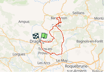
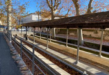
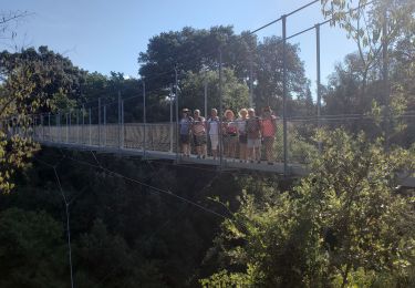
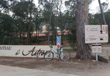
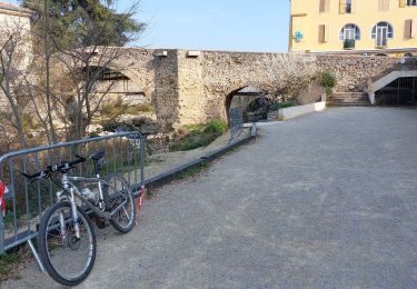
Randonnée Vélo de route de 59 km à découvrir à Provence-Alpes-Côte d'Azur, Var, Draguignan. Cette randonnée est proposée par Sugg.
Description
sortie clubs 17 cyclistes c'est nul j'ai failli tomber suite écart. je rentre seul à Bargemon Claviers café et Pennafort 58 kms 20.5 kmh archi nul pas de jus
Localisation
Pays :
France
Région :
Provence-Alpes-Côte d'Azur
Département/Province :
Var
Commune :
Draguignan
Localité :
Unknown
Départ:(Dec)
Départ:(UTM)
294945 ; 4823313 (32T) N.
Commentaires
Randonnées à proximité
![Randonnée Marche Draguignan - Draguignan Malmont 10 km - Photo](https://media.geolcdn.com/t/375/260/d1a2a54e-903f-461c-ac9a-777d73202ad8.jpg&format=jpg&maxdim=2)
![Marche Marche](https://static1.geolcdn.com/sitytour/trail-icons/101.png)
Draguignan Malmont 10 km
Marche
Moyen
Draguignan,
Provence-Alpes-Côte d'Azur,
Var,
France
![](/images/other/stat-length.png)
10 km | 14,7 km-effort
2h 56min
![](https://static1.geolcdn.com/siteimages/upload/files/16400158638029165_repeat_loop_refresh_sync_direction_icon.png)
Oui
![Randonnée Marche Draguignan - Draguignan Roche aux Fées Malmont 17 km - Photo](https://media.geolcdn.com/t/375/260/f159f27b-5b1e-45be-88d4-c4333d86164c.jpg&format=jpg&maxdim=2)
![Marche Marche](https://static1.geolcdn.com/sitytour/trail-icons/101.png)
Draguignan Roche aux Fées Malmont 17 km
Marche
Moyen
Draguignan,
Provence-Alpes-Côte d'Azur,
Var,
France
![](/images/other/stat-length.png)
17,2 km | 23 km-effort
5h 52min
![](https://static1.geolcdn.com/siteimages/upload/files/16400158638029165_repeat_loop_refresh_sync_direction_icon.png)
Oui
![Randonnée Marche Figanières - Figanières 01 - Photo](https://media.geolcdn.com/t/375/260/ext.jpg?maxdim=2&url=https%3A%2F%2Fstatic1.geolcdn.com%2Fsiteimages%2Fupload%2Ffiles%2F1553511878bg_sport_marche.png)
![Marche Marche](https://static1.geolcdn.com/sitytour/trail-icons/101.png)
Figanières 01
Marche
Très facile
(1)
Figanières,
Provence-Alpes-Côte d'Azur,
Var,
France
![](/images/other/stat-length.png)
8,4 km | 11,8 km-effort
2h 30min
![](https://static1.geolcdn.com/siteimages/upload/files/16400158638029165_repeat_loop_refresh_sync_direction_icon.png)
Oui
![Randonnée Marche Draguignan - Musée de l’artillerie et cimetière américain 7 km - Photo](https://media.geolcdn.com/t/375/260/778163a7-819c-4bb6-a61f-19371b647e3b.jpg&format=jpg&maxdim=2)
![Marche Marche](https://static1.geolcdn.com/sitytour/trail-icons/101.png)
Musée de l’artillerie et cimetière américain 7 km
Marche
Très facile
Draguignan,
Provence-Alpes-Côte d'Azur,
Var,
France
![](/images/other/stat-length.png)
7,3 km | 8,1 km-effort
2h 49min
![](https://static1.geolcdn.com/siteimages/upload/files/16400158638029165_repeat_loop_refresh_sync_direction_icon.png)
Oui
![Randonnée Marche Draguignan - Rebouillon le long de la Nartuby - Photo](https://media.geolcdn.com/t/375/260/5546167f-335f-4958-9f3e-7305fd054196.jpg&format=jpg&maxdim=2)
![Marche Marche](https://static1.geolcdn.com/sitytour/trail-icons/101.png)
Rebouillon le long de la Nartuby
Marche
Facile
Draguignan,
Provence-Alpes-Côte d'Azur,
Var,
France
![](/images/other/stat-length.png)
4,8 km | 5,9 km-effort
1h 33min
![](https://static1.geolcdn.com/siteimages/upload/files/16400158638029165_repeat_loop_refresh_sync_direction_icon.png)
Oui
![Randonnée Marche Draguignan - Malmont 10 km - Photo](https://media.geolcdn.com/t/375/260/da456918-fb68-4e05-ab32-80af50d67781.jpg&format=jpg&maxdim=2)
![Marche Marche](https://static1.geolcdn.com/sitytour/trail-icons/101.png)
Malmont 10 km
Marche
Moyen
Draguignan,
Provence-Alpes-Côte d'Azur,
Var,
France
![](/images/other/stat-length.png)
10,1 km | 15,2 km-effort
4h 32min
![](https://static1.geolcdn.com/siteimages/upload/files/16400158638029165_repeat_loop_refresh_sync_direction_icon.png)
Oui
![Randonnée Marche Trans-en-Provence - TRANS-Le puits aérien et la passerelle hymalayenne -MBO - Photo](https://media.geolcdn.com/t/375/260/52faf0f7-6a43-44b3-98ad-47b606885080.jpg&format=jpg&maxdim=2)
![Marche Marche](https://static1.geolcdn.com/sitytour/trail-icons/101.png)
TRANS-Le puits aérien et la passerelle hymalayenne -MBO
Marche
Facile
(2)
Trans-en-Provence,
Provence-Alpes-Côte d'Azur,
Var,
France
![](/images/other/stat-length.png)
8,1 km | 10,6 km-effort
2h 41min
![](https://static1.geolcdn.com/siteimages/upload/files/16400158638029165_repeat_loop_refresh_sync_direction_icon.png)
Oui
![Randonnée V.T.T. Draguignan - 20220308 vtt route - Photo](https://media.geolcdn.com/t/375/260/f158cf40-388a-495c-9de7-d89e468d92c8.jpg&format=jpg&maxdim=2)
![V.T.T. V.T.T.](https://static1.geolcdn.com/sitytour/trail-icons/202.png)
20220308 vtt route
V.T.T.
Très difficile
Draguignan,
Provence-Alpes-Côte d'Azur,
Var,
France
![](/images/other/stat-length.png)
53 km | 61 km-effort
3h 35min
![](https://static1.geolcdn.com/siteimages/upload/files/16400158638029165_repeat_loop_refresh_sync_direction_icon.png)
Oui
![Randonnée V.T.T. Draguignan - 20220301 vtt route - Photo](https://media.geolcdn.com/t/375/260/d0f2d217-7e6a-4760-8c6c-914bc0336dc2.jpg&format=jpg&maxdim=2)
![V.T.T. V.T.T.](https://static1.geolcdn.com/sitytour/trail-icons/202.png)
20220301 vtt route
V.T.T.
Facile
Draguignan,
Provence-Alpes-Côte d'Azur,
Var,
France
![](/images/other/stat-length.png)
30 km | 35 km-effort
2h 37min
![](https://static1.geolcdn.com/siteimages/upload/files/16400158638029165_repeat_loop_refresh_sync_direction_icon.png)
Oui