![](/images/other/stat-length.png)
![Randonnée Marche Octeville-sur-Mer - Octeville sur Mer / la ferme aquatique / Octeville sur Mer - Photo](https://media.geolcdn.com/t/1900/400/ed85ff22-e57a-49a3-856e-cd8f1bc12579.jpg&format=pjpeg&maxdim=2)
Octeville sur Mer / la ferme aquatique / Octeville sur Mer
MarcherEnsemble
Utilisateur
![Longueur](/images/other/stat-length.png)
Longueur
10,4 km
![Altitude max](https://static1.geolcdn.com/siteimages/upload/files/1508320355ic_sort_altitude_max_24dp.png)
Altitude max
102 m
![Dénivelé positif](https://static1.geolcdn.com/siteimages/upload/files/1508320355ic_sort_den_pos_24dp.png)
Dénivelé positif
78 m
![Km-Effort](/images/other/stat-length.png)
Km-Effort
11,5 km
![Altitude min](https://static1.geolcdn.com/siteimages/upload/files/1508320355ic_sort_altitude_min_24dp.png)
Altitude min
71 m
![Dénivelé négatif](https://static1.geolcdn.com/siteimages/upload/files/1508320355ic_sort_den_neg_24dp.png)
Dénivelé négatif
77 m
![Boucle](https://static1.geolcdn.com/siteimages/upload/files/16400158638029165_repeat_loop_refresh_sync_direction_icon.png)
Boucle
Oui
Date de création :
2020-08-03 07:23:13.588
Dernière modification :
2020-08-03 14:17:49.416
![Marche](https://static1.geolcdn.com/sitytour/trail-icons/101.png)
2h31
Difficulté : Très facile
![Scannez ce code QR pour ouvrir la randonnée dans l'application SityTrail](https://capi.geolives.com/qq0zvz2zws4bq2lad0pu/sitytour/trails/2500359/qr.png?size=200)
Application GPS de randonnée GRATUITE
À propos
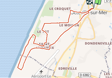
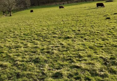
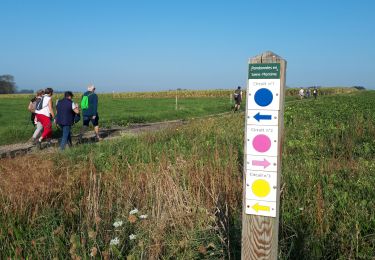
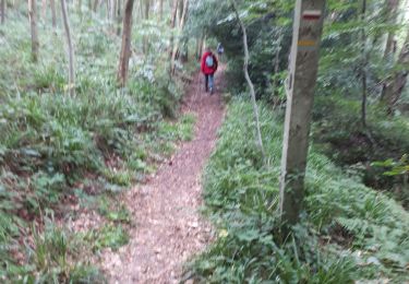
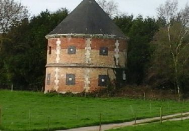
Randonnée Marche de 10,4 km à découvrir à Normandie, Seine-Maritime, Octeville-sur-Mer. Cette randonnée est proposée par MarcherEnsemble.
Description
Départ du parking de la salle de sport d'Octeville Michel Adam.
Les plus courageux pourront descendre au bord de l'eau et remonter par le chemin de chèvres.
Attention un ou deux passages très près du bord de la falaise 😰
Localisation
Pays :
France
Région :
Normandie
Département/Province :
Seine-Maritime
Commune :
Octeville-sur-Mer
Localité :
Unknown
Départ:(Dec)
Départ:(UTM)
291636 ; 5493334 (31U) N.
Commentaires
Randonnées à proximité
![Randonnée A pied Fontaine-la-Mallet - Les Bassins des Vallées - Photo](https://media.geolcdn.com/t/375/260/ce57ffe6-f4ea-486c-bc79-47861158f9a7.jpeg&format=jpg&maxdim=2)
![A pied A pied](https://static1.geolcdn.com/sitytour/trail-icons/100.png)
Les Bassins des Vallées
A pied
Facile
Fontaine-la-Mallet,
Normandie,
Seine-Maritime,
France
![](/images/other/stat-length.png)
5,1 km | 6 km-effort
1h 21min
![](https://static1.geolcdn.com/siteimages/upload/files/16400158638029165_repeat_loop_refresh_sync_direction_icon.png)
Non
![Randonnée A pied Le Havre - Parc de Rouelles - GR - 16-09-2024 - Photo](https://media.geolcdn.com/t/375/260/ext.jpg?maxdim=2&url=https%3A%2F%2Fstatic1.geolcdn.com%2Fsiteimages%2Fupload%2Ffiles%2F1545311037marcheuse_200dpi.jpg)
![A pied A pied](https://static1.geolcdn.com/sitytour/trail-icons/100.png)
Parc de Rouelles - GR - 16-09-2024
A pied
Facile
(1)
Le Havre,
Normandie,
Seine-Maritime,
France
![](/images/other/stat-length.png)
9,4 km | 11,6 km-effort
2h 37min
![](https://static1.geolcdn.com/siteimages/upload/files/16400158638029165_repeat_loop_refresh_sync_direction_icon.png)
Oui
![Randonnée Marche Fontenay - Le Fontenay - 10-07-23 - Circuit court - Photo](https://media.geolcdn.com/t/375/260/ext.jpg?maxdim=2&url=https%3A%2F%2Fstatic1.geolcdn.com%2Fsiteimages%2Fupload%2Ffiles%2F1553511878bg_sport_marche.png)
![Marche Marche](https://static1.geolcdn.com/sitytour/trail-icons/101.png)
Le Fontenay - 10-07-23 - Circuit court
Marche
Moyen
(1)
Fontenay,
Normandie,
Seine-Maritime,
France
![](/images/other/stat-length.png)
7,1 km | 8,3 km-effort
1h 53min
![](https://static1.geolcdn.com/siteimages/upload/files/16400158638029165_repeat_loop_refresh_sync_direction_icon.png)
Oui
![Randonnée Marche Fontenay - Le Fontenay - 10-07-23 - Photo](https://media.geolcdn.com/t/375/260/ext.jpg?maxdim=2&url=https%3A%2F%2Fstatic1.geolcdn.com%2Fsiteimages%2Fupload%2Ffiles%2F1553511878bg_sport_marche.png)
![Marche Marche](https://static1.geolcdn.com/sitytour/trail-icons/101.png)
Le Fontenay - 10-07-23
Marche
Moyen
(1)
Fontenay,
Normandie,
Seine-Maritime,
France
![](/images/other/stat-length.png)
9,7 km | 11,1 km-effort
2h 31min
![](https://static1.geolcdn.com/siteimages/upload/files/16400158638029165_repeat_loop_refresh_sync_direction_icon.png)
Oui
![Randonnée Marche Le Havre - parc rouelles mini pas - Photo](https://media.geolcdn.com/t/375/260/4828ec3b-0ba5-48a6-a7b6-2d96d2df242a.jpg&format=jpg&maxdim=2)
![Marche Marche](https://static1.geolcdn.com/sitytour/trail-icons/101.png)
parc rouelles mini pas
Marche
Facile
Le Havre,
Normandie,
Seine-Maritime,
France
![](/images/other/stat-length.png)
3,1 km | 3,6 km-effort
49min
![](https://static1.geolcdn.com/siteimages/upload/files/16400158638029165_repeat_loop_refresh_sync_direction_icon.png)
Oui
![Randonnée Marche Le Havre - rouelles jarfleur - Photo](https://media.geolcdn.com/t/375/260/5ae05f62-481a-4ec4-9ff2-2462690d422c.jpg&format=jpg&maxdim=2)
![Marche Marche](https://static1.geolcdn.com/sitytour/trail-icons/101.png)
rouelles jarfleur
Marche
Facile
Le Havre,
Normandie,
Seine-Maritime,
France
![](/images/other/stat-length.png)
11,8 km | 13,5 km-effort
2h 21min
![](https://static1.geolcdn.com/siteimages/upload/files/16400158638029165_repeat_loop_refresh_sync_direction_icon.png)
Oui
![Randonnée Marche Mannevillette - Manevillette - Photo](https://media.geolcdn.com/t/375/260/ac876953-8dc4-43c6-b79b-f344f5908c23.jpg&format=jpg&maxdim=2)
![Marche Marche](https://static1.geolcdn.com/sitytour/trail-icons/101.png)
Manevillette
Marche
Très facile
Mannevillette,
Normandie,
Seine-Maritime,
France
![](/images/other/stat-length.png)
9,9 km | 10,7 km-effort
2h 28min
![](https://static1.geolcdn.com/siteimages/upload/files/16400158638029165_repeat_loop_refresh_sync_direction_icon.png)
Oui
![Randonnée Marche Fontaine-la-Mallet - Le Havre: Forêt de Montgeon variante N°4 - Photo](https://media.geolcdn.com/t/375/260/8b15d953-6666-4ab2-ae83-cbcb0c4950af.jpg&format=jpg&maxdim=2)
![Marche Marche](https://static1.geolcdn.com/sitytour/trail-icons/101.png)
Le Havre: Forêt de Montgeon variante N°4
Marche
Très facile
(1)
Fontaine-la-Mallet,
Normandie,
Seine-Maritime,
France
![](/images/other/stat-length.png)
8,5 km | 10,7 km-effort
2h 29min
![](https://static1.geolcdn.com/siteimages/upload/files/16400158638029165_repeat_loop_refresh_sync_direction_icon.png)
Oui
![Randonnée Marche Montivilliers - Montivilliers / Eprémesnil / Parc La Bouteillerie / Montivilliers - Photo](https://media.geolcdn.com/t/375/260/ext.jpg?maxdim=2&url=https%3A%2F%2Fservices.sitytrail.com%2FGeolivesWS%2FDownloadMedia.ashx%3FTrailID%3D717248%26Media%3Dfix__20170320112756.jpg)
![Marche Marche](https://static1.geolcdn.com/sitytour/trail-icons/101.png)
Montivilliers / Eprémesnil / Parc La Bouteillerie / Montivilliers
Marche
Facile
Montivilliers,
Normandie,
Seine-Maritime,
France
![](/images/other/stat-length.png)
10 km | 11,8 km-effort
2h 33min
![](https://static1.geolcdn.com/siteimages/upload/files/16400158638029165_repeat_loop_refresh_sync_direction_icon.png)
Oui