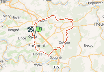

24 km | 34 km-effort


Utilisateur


Application GPS de randonnée GRATUITE
 SityTrail
IGN / Instituts géographiques
SityTrail World
Le monde est à vous
Randonnée Vélo de 27 km à découvrir à Wallonie, Liège, Sprimont. Cette randonnée est proposée par verpoorten.
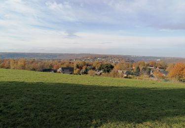
La région sprimontoise est prisée, depuis des siècles, par de nombreux bâtisseurs pour la qualité de sa pierre et le savoir-faire de ses artisans. Le Centre d’Interprétation de la Pierre à Sprimont, haut lieu de mémoire de l’histoire industrielle de la région, témoigne de l’ambition à s’inscrire parmi les grands équipements culturels et historiques de Wallonie. C’est autour de cette thématique que cet itinéraire vous emmène à la découverte du patrimoine architectural entre chemins de campagnes, panoramas et petits villages. Sans oublier le passage à Banneux, haut lieu de pèlerinage qui accueille chaque année des centaines de milliers de personnes.
Points-nœuds à suivre : 46-4-5-6-7-44-38-37-36-35-48-47-46

Marche

Marche

Marche

Marche

Marche
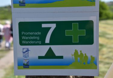
Marche

Marche

Marche