![](/images/other/stat-length.png)
Aups - Pic de l'aigle - Les Cugulons.
Sugg
Utilisateur
![Longueur](/images/other/stat-length.png)
![Altitude max](https://static1.geolcdn.com/siteimages/upload/files/1508320355ic_sort_altitude_max_24dp.png)
![Dénivelé positif](https://static1.geolcdn.com/siteimages/upload/files/1508320355ic_sort_den_pos_24dp.png)
![Km-Effort](/images/other/stat-length.png)
![Altitude min](https://static1.geolcdn.com/siteimages/upload/files/1508320355ic_sort_altitude_min_24dp.png)
![Dénivelé négatif](https://static1.geolcdn.com/siteimages/upload/files/1508320355ic_sort_den_neg_24dp.png)
![Boucle](https://static1.geolcdn.com/siteimages/upload/files/16400158638029165_repeat_loop_refresh_sync_direction_icon.png)
![Marche](https://static1.geolcdn.com/sitytour/trail-icons/101.png)
5h08
Difficulté : Moyen
![Scannez ce code QR pour ouvrir la randonnée dans l'application SityTrail](https://capi.geolives.com/qq0zvz2zws4bq2lad0pu/sitytour/trails/249690/qr.png?size=200)
Application GPS de randonnée GRATUITE
À propos
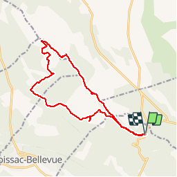
Randonnée Marche de 17,3 km à découvrir à Provence-Alpes-Côte d'Azur, Var, Aups. Cette randonnée est proposée par Sugg.
Description
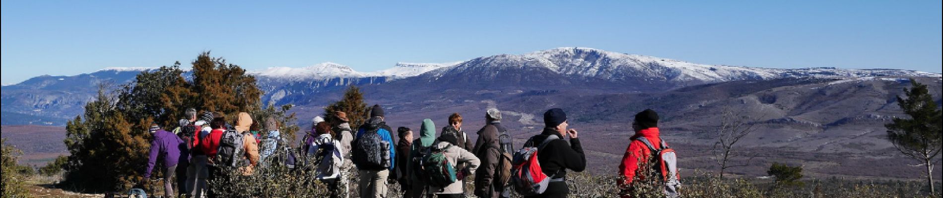
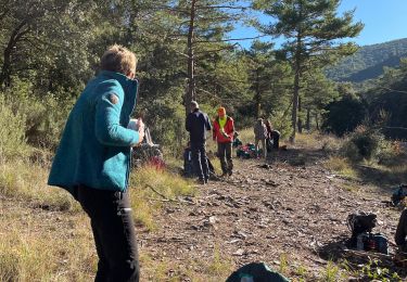
Rando avec Restons en Forme du 12 février 2014.Guide : Pierre
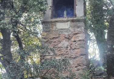
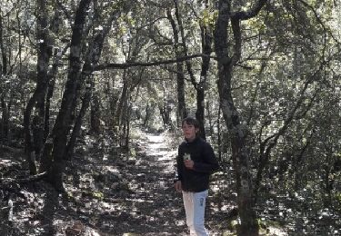
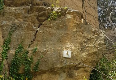
Très beau parcours jusqu'à la citerne en 767, en passant par le pylône de l'Aigle en 982.
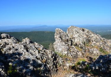
Pas mal de grimpettes sur le retour, beau point de vue en 810.
PS : comme d'hab,la durée comprend les arrêts et le pique nique .
Localisation
Commentaires
Randonnées à proximité
![Randonnée Marche Aups - Tour de la montagne des Espiguières - Photo](https://media.geolcdn.com/t/375/260/431b4009-bb72-41ce-bf82-1eb70c111177.jpg&format=jpg&maxdim=2)
![Marche Marche](https://static1.geolcdn.com/sitytour/trail-icons/101.png)
Marche
![](/images/other/stat-length.png)
![](https://static1.geolcdn.com/siteimages/upload/files/16400158638029165_repeat_loop_refresh_sync_direction_icon.png)
![Randonnée Marche Vérignon - 2024-01-30 Vérignon - Chapelle Saint Priest - Photo](https://media.geolcdn.com/t/375/260/bc33279d-e419-4c1d-b671-4cabd4fbe480.jpg&format=jpg&maxdim=2)
![Marche Marche](https://static1.geolcdn.com/sitytour/trail-icons/101.png)
Marche
![](/images/other/stat-length.png)
![](https://static1.geolcdn.com/siteimages/upload/files/16400158638029165_repeat_loop_refresh_sync_direction_icon.png)
![Randonnée Marche Aups - 2023-01-31 Col de la Bigue - Les Eyssariades - Photo](https://media.geolcdn.com/t/375/260/039bb7ef-09c0-4f59-a7b3-09433c82c531.jpg&format=jpg&maxdim=2)
![Marche Marche](https://static1.geolcdn.com/sitytour/trail-icons/101.png)
Marche
![](/images/other/stat-length.png)
![](https://static1.geolcdn.com/siteimages/upload/files/16400158638029165_repeat_loop_refresh_sync_direction_icon.png)
![Randonnée Marche Aups - 30-10-2022 Aups Sentier des Crêtes - Photo](https://media.geolcdn.com/t/375/260/032d8805-e093-4b3d-aca0-89dc5544919a.jpg&format=jpg&maxdim=2)
![Marche Marche](https://static1.geolcdn.com/sitytour/trail-icons/101.png)
Marche
![](/images/other/stat-length.png)
![](https://static1.geolcdn.com/siteimages/upload/files/16400158638029165_repeat_loop_refresh_sync_direction_icon.png)
![Randonnée Course à pied Moissac-Bellevue - TRAIL DE MOISSAC 2016 10KM +330 - Photo](https://media.geolcdn.com/t/375/260/ext.jpg?maxdim=2&url=https%3A%2F%2Fservices.sitytrail.com%2FGeolivesWS%2FDownloadMedia.ashx%3FTrailID%3D540393%26Media%3Dfix__20160319134649.jpg)
![Course à pied Course à pied](https://static1.geolcdn.com/sitytour/trail-icons/103.png)
Course à pied
![](/images/other/stat-length.png)
![](https://static1.geolcdn.com/siteimages/upload/files/16400158638029165_repeat_loop_refresh_sync_direction_icon.png)
![Randonnée Marche Aups - 2025-01-21 Montagne des Espiguières - Photo](https://media.geolcdn.com/t/375/260/1e29026a-5d46-486c-967e-572a0d99d84f.jpg&format=jpg&maxdim=2)
![Marche Marche](https://static1.geolcdn.com/sitytour/trail-icons/101.png)
Marche
![](/images/other/stat-length.png)
![](https://static1.geolcdn.com/siteimages/upload/files/16400158638029165_repeat_loop_refresh_sync_direction_icon.png)
![Randonnée Marche Vérignon - Verignon Notre Dame de Liesse Chapelle Saint Priest trace réelle - Photo](https://media.geolcdn.com/t/375/260/06e1804b-1eee-444e-ab93-f67bc999bfbe.jpg&format=jpg&maxdim=2)
![Marche Marche](https://static1.geolcdn.com/sitytour/trail-icons/101.png)
Marche
![](/images/other/stat-length.png)
![](https://static1.geolcdn.com/siteimages/upload/files/16400158638029165_repeat_loop_refresh_sync_direction_icon.png)
![Randonnée Marche Aups - Aups - Photo](https://media.geolcdn.com/t/375/260/fd86a7ef-4f3e-4db0-8d1f-50f58d38a091.jpg&format=jpg&maxdim=2)
![Marche Marche](https://static1.geolcdn.com/sitytour/trail-icons/101.png)
Marche
![](/images/other/stat-length.png)
![](https://static1.geolcdn.com/siteimages/upload/files/16400158638029165_repeat_loop_refresh_sync_direction_icon.png)
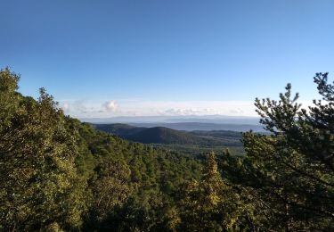
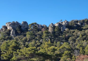
Tres belle randonnée, à faire quand il ne fait pas trop chaud
magnifique