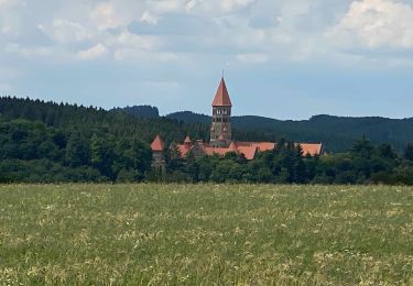
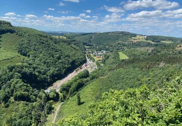
Randonnée Marche Kiischpelt - Escapardenne Eislek Trail - Etape 1 - Kautenbach - Clervaux - Photo

Escapardenne Eislek Trail - Etape 1 - Kautenbach - Clervaux

 kodak
kodak

Utilisateur

© OpenStreetMap contributors
Longueur
Longueur
24 km
Altitude max
Altitude max
478 m
Dénivelé positif
Dénivelé positif
939 m
Km-Effort
Km-Effort  
36 km
Altitude min
Altitude min
253 m
Dénivelé négatif
Dénivelé négatif
797 m
Boucle
Boucle
Non
Date de création :
2020-07-24 11:58:08.289
Dernière modification :
2020-07-24 11:58:40.429

(0 Avis)

Marche
Marche
7h31
Difficulté : Très difficile

Scannez ce code QR pour ouvrir la randonnée dans l'application SityTrail

Application GPS de randonnée GRATUITE

Logo SityTrail SityTrail

IGN / Instituts géographiques

Télécharger SityTrail sur l'App Store Télécharger SityTrail sur Google Play

Logo SityTrail SityTrail World

Le monde est à vous

Télécharger SityTrail sur l'App Store Télécharger SityTrail sur Google Play Télécharger SityTrail sur Huawei AppGallery

À propos

Randonnée Marche de 24 km à découvrir à Inconnu, Canton Wiltz, Kiischpelt. Cette randonnée est proposée par kodak.

Description

A Kautenbach et plus précisément au Park&Ride de la gare se trouve le point de départ de l’Escapardenne Eislek Trail. La randonnée débute avec une pente raide par l’ancien chemin destiné au bétail pour ensuite tourner sur les hauteurs en direction d’Alscheid. Après une descente vers le camping, la randonnée passe par le chemin des écrevisses afin de rejoindre la Schibberich avant de retomber dans la vallée. L’itinéraire continue en direction de Lellingen et débouche notamment sur un point de vu où vous pourrez admirer le Kischpelt.  En ralliant le fond vallée, une escale dans l’authentique village de Lellingen est possible. Ensuite, la randonnée emprunte le chemin asphalté du côté gauche de la voie ferrée, passe par le rocher « Geeslay » pour rallier les villages de Wilwerwiltz et d’Enscherange.  Après une montée sur le plateau près d’Enscherange, de magnifiques vues sur le Kiischpelt se présentent. En passant par les taillis près de la butte du « Walber », vous poursuivez votre chemin en direction de la vallée de l’Irbach. Enfin, la randonnée passe par le pont « Nol », où il est possible de rejoindre le village de Munshausen, pour finalement rejoindre la gare de Clervaux, arrivée de la première étape.

Profil altimétrique

Points d'intérêt

Point d'intérêt Kiischpelt - Kautenbach - Photo
kodak
KIISCHPELT 
Point d'intérêt Kiischpelt - Kautenbach Camping - Photo
kodak
KIISCHPELT 
Point d'intérêt Kiischpelt -  - Photo
kodak
KIISCHPELT 
Point d'intérêt Kiischpelt - Geeselay - Lellingen - Photo
kodak
Point d'intérêt Kiischpelt - Abissage en Ardennes - Photo
kodak
Point d'intérêt Kiischpelt - Wilwerwiltz - Photo
kodak
KIISCHPELT 
Point d'intérêt Kiischpelt - Enscherange - Photo
kodak
KIISCHPELT 
Point d'intérêt Kiischpelt - confluence - Photo
kodak
KIISCHPELT 
Point d'intérêt Clervaux - Drauffelt - Photo
kodak
CLERVAUX 
Point d'intérêt Clervaux - Poler / Walber - Photo
kodak
CLERVAUX 
Point d'intérêt Clervaux - Irbach - Photo
kodak
CLERVAUX 
Point d'intérêt Clervaux - Clervaux - Photo
kodak
CLERVAUX 

Localisation

Pays :
Luxembourg
Région :
Inconnu
Département/Province :
Canton Wiltz
Commune :
Kiischpelt
Localité :
Unknown
Départ:(Dec)
Départ:(UTM)
286129 ; 5537521 (32U) N.

Randonnées à proximité

Randonnée Marche Goesdorf - Autopedestres : Dahl - Photo
Marche
GUIDE+

Marche

Très facile
(1)
Goesdorf, Inconnu, Canton Wiltz, Luxembourg
8,7 km | 12,6 km-effort
Inconnu
Oui
Randonnée Marche Bourscheid - Autopedestres : Bourscheid - Photo
Marche
GUIDE+

Marche

Très facile
(2)
Bourscheid, Inconnu, Canton Diekirch, Luxembourg
10,5 km | 15,3 km-effort
Inconnu
Oui
Randonnée Marche Kiischpelt - eislek trail de Kautenbach à Troisvierges  - Photo
Marche
dragonchef

Marche

Difficile
Kiischpelt, Inconnu, Canton Wiltz, Luxembourg
42 km | 61 km-effort
12h 30min
Non
Randonnée Marche Kiischpelt - Eislek-pad Lellingen - Photo
Marche
GUIDE
mumu.larandonneuse

Marche

Moyen
Kiischpelt, Inconnu, Canton Wiltz, Luxembourg
11,1 km | 15,9 km-effort
3h 37min
Oui
Randonnée Marche Kiischpelt - Enscherange 8,2 km - Photo
Marche
GUIDE
rvapeldo

Marche

Facile
Kiischpelt, Inconnu, Canton Wiltz, Luxembourg
8,3 km | 10,8 km-effort
2h 5min
Oui
Randonnée Marche Kiischpelt - Éislek pad Kautenbach (1) - Photo
Marche
GUIDE
mumu.larandonneuse

Marche

Moyen
Kiischpelt, Inconnu, Canton Wiltz, Luxembourg
14,4 km | 22 km-effort
4h 58min
Oui
Randonnée Marche Bourscheid - Éislek pad Bourscheid - Photo
Marche
GUIDE
mumu.larandonneuse

Marche

Moyen
Bourscheid, Inconnu, Canton Diekirch, Luxembourg
14,8 km | 23 km-effort
5h 10min
Oui
Randonnée Marche Kiischpelt - Escapardenne Eisleck Trail: Kautenbach - Clervaux - Photo
Marche
dauzata

Marche

Difficile
Kiischpelt, Inconnu, Canton Wiltz, Luxembourg
25 km | 38 km-effort
6h 21min
Non
Randonnée Marche Parc Hosingen - Escapardenne Lee Trail: Hoscheid - Kautenbach - Photo
Marche
dauzata

Marche

Moyen
Parc Hosingen, Inconnu, Canton Clervaux, Luxembourg
15,5 km | 23 km-effort
4h 25min
Non


Fermer
Mes abonnements