![](/images/other/stat-length.png)
![Randonnée Marche Colmars - lignin - Photo](https://media.geolcdn.com/t/1900/400/96d7b7df-7227-4e8c-821e-2b82e5f0c685.jpg&format=pjpeg&maxdim=2)
lignin
PhilB24
Utilisateur
![Longueur](/images/other/stat-length.png)
![Altitude max](https://static1.geolcdn.com/siteimages/upload/files/1508320355ic_sort_altitude_max_24dp.png)
![Dénivelé positif](https://static1.geolcdn.com/siteimages/upload/files/1508320355ic_sort_den_pos_24dp.png)
![Km-Effort](/images/other/stat-length.png)
![Altitude min](https://static1.geolcdn.com/siteimages/upload/files/1508320355ic_sort_altitude_min_24dp.png)
![Dénivelé négatif](https://static1.geolcdn.com/siteimages/upload/files/1508320355ic_sort_den_neg_24dp.png)
![Boucle](https://static1.geolcdn.com/siteimages/upload/files/16400158638029165_repeat_loop_refresh_sync_direction_icon.png)
![Marche](https://static1.geolcdn.com/sitytour/trail-icons/101.png)
4h42
Difficulté : Moyen
![Scannez ce code QR pour ouvrir la randonnée dans l'application SityTrail](https://capi.geolives.com/qq0zvz2zws4bq2lad0pu/sitytour/trails/2487359/qr.png?size=200)
Application GPS de randonnée GRATUITE
À propos
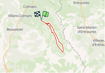
Randonnée Marche de 18 km à découvrir à Provence-Alpes-Côte d'Azur, Alpes-de-Haute-Provence, Colmars. Cette randonnée est proposée par PhilB24.
Description
Montée par la piste forestière, environ 30mn en premiere avec voiture normale, jusqu'au parking du pont de la Serre.
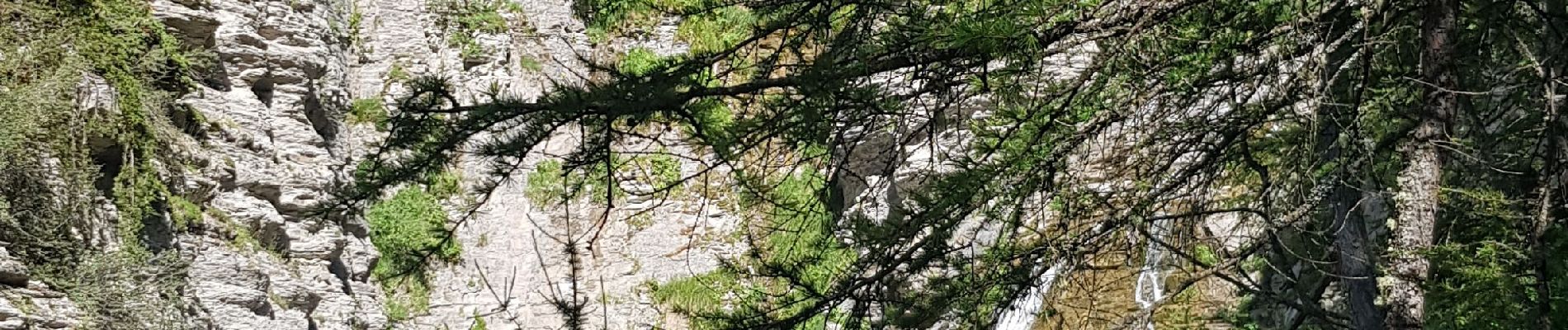
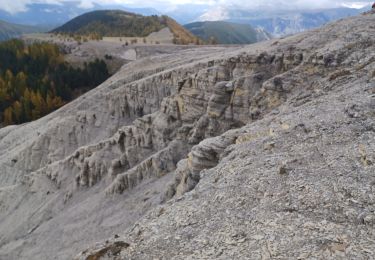
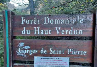
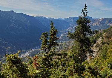
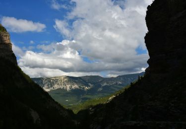
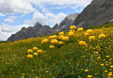
Magnifique randonnée en boucle, au départ du Pont de la Serre , avec des paysages très variés ,cascades , vasques , forêt de mélèzes, alpages , "steppe" , tourbières et vasque de la Lance.
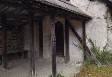
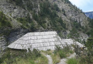
Aller par cabane de Bressange, montée reguliere et retour par cabane de Mouries descente plus raide.
Localisation
Commentaires
Randonnées à proximité
![Randonnée Marche Thorame-Haute - VILLARS HEYSIER .CABAN DE CONGERMAN - Photo](https://media.geolcdn.com/t/375/260/b251cad8-70ae-4895-901b-fe937d4b0df0.jpg&format=jpg&maxdim=2)
![Marche Marche](https://static1.geolcdn.com/sitytour/trail-icons/101.png)
Marche
![](/images/other/stat-length.png)
![](https://static1.geolcdn.com/siteimages/upload/files/16400158638029165_repeat_loop_refresh_sync_direction_icon.png)
![Randonnée Marche Beauvezer - 04.gorges st pierre 03.08.23 - Photo](https://media.geolcdn.com/t/375/260/ee41afb8-8bbb-46c3-8271-84bbc995eeab.jpg&format=jpg&maxdim=2)
![Marche Marche](https://static1.geolcdn.com/sitytour/trail-icons/101.png)
Marche
![](/images/other/stat-length.png)
![](https://static1.geolcdn.com/siteimages/upload/files/16400158638029165_repeat_loop_refresh_sync_direction_icon.png)
![Randonnée Marche Colmars - Les lacs Lignin - Photo](https://media.geolcdn.com/t/375/260/fbca6767-bae4-46df-a02f-745bbf118b44.jpg&format=jpg&maxdim=2)
![Marche Marche](https://static1.geolcdn.com/sitytour/trail-icons/101.png)
Marche
![](/images/other/stat-length.png)
![](https://static1.geolcdn.com/siteimages/upload/files/16400158638029165_repeat_loop_refresh_sync_direction_icon.png)
![Randonnée Marche Beauvezer - les gorges de St-Pierre - Photo](https://media.geolcdn.com/t/375/260/ext.jpg?maxdim=2&url=https%3A%2F%2Fservices.sitytrail.com%2FGeolivesWS%2FDownloadMedia.ashx%3FTrailID%3D793443%26Media%3Dfix__20170721123335.jpg)
![Marche Marche](https://static1.geolcdn.com/sitytour/trail-icons/101.png)
Marche
![](/images/other/stat-length.png)
![](https://static1.geolcdn.com/siteimages/upload/files/16400158638029165_repeat_loop_refresh_sync_direction_icon.png)
![Randonnée Marche Beauvezer - VILLARS HEYSSIER . GORGES DE SAINT PIERRE O - Photo](https://media.geolcdn.com/t/375/260/1711233c-dcfe-4507-8abf-7d44d68d7751.jpg&format=jpg&maxdim=2)
![Marche Marche](https://static1.geolcdn.com/sitytour/trail-icons/101.png)
Marche
![](/images/other/stat-length.png)
![](https://static1.geolcdn.com/siteimages/upload/files/16400158638029165_repeat_loop_refresh_sync_direction_icon.png)
![Randonnée Marche Colmars - Colmars petit coyer 993m 14kms - Photo](https://media.geolcdn.com/t/375/260/34cedc48-3841-4962-bcc9-facfdb32c9cc.jpg&format=jpg&maxdim=2)
![Marche Marche](https://static1.geolcdn.com/sitytour/trail-icons/101.png)
Marche
![](/images/other/stat-length.png)
![](https://static1.geolcdn.com/siteimages/upload/files/16400158638029165_repeat_loop_refresh_sync_direction_icon.png)
![Randonnée Marche Colmars - Colmars autapie 19.5k ms 1200m - Photo](https://media.geolcdn.com/t/375/260/9d112094-8159-4db6-8f08-1f5a21c98a9f.jpg&format=jpg&maxdim=2)
![Marche Marche](https://static1.geolcdn.com/sitytour/trail-icons/101.png)
Marche
![](/images/other/stat-length.png)
![](https://static1.geolcdn.com/siteimages/upload/files/16400158638029165_repeat_loop_refresh_sync_direction_icon.png)
![Marche Marche](https://static1.geolcdn.com/sitytour/trail-icons/101.png)
Marche
![](/images/other/stat-length.png)
![](https://static1.geolcdn.com/siteimages/upload/files/16400158638029165_repeat_loop_refresh_sync_direction_icon.png)
![Marche Marche](https://static1.geolcdn.com/sitytour/trail-icons/101.png)
Marche
![](/images/other/stat-length.png)
![](https://static1.geolcdn.com/siteimages/upload/files/16400158638029165_repeat_loop_refresh_sync_direction_icon.png)