


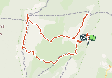

14,4 km | 27 km-effort

Utilisateur GUIDE


Application GPS de randonnée GRATUITE
 SityTrail
IGN / Instituts géographiques
SityTrail World
Le monde est à vous
Randonnée Marche de 15,2 km à découvrir à Auvergne-Rhône-Alpes, Isère, Sainte-Marie-du-Mont. Cette randonnée est proposée par nadd73.
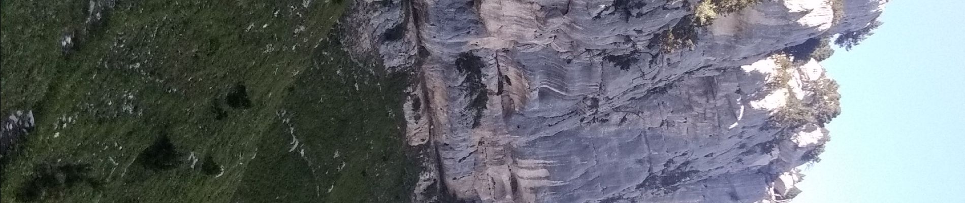
Passages aériens avoir le pied sûr.
Très belle vue sur le M'ont blanc, la chartreuse, les Bauges.


Marche

Marche

Marche

Marche

Raquettes à neige

Marche
Marche

Marche

Marche