


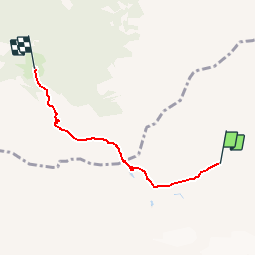

3,6 km | 4,8 km-effort


Utilisateur


Application GPS de randonnée GRATUITE
 SityTrail
IGN / Instituts géographiques
SityTrail World
Le monde est à vous
Randonnée Marche de 3,8 km à découvrir à Valais, Saint-Maurice, Evionnaz. Cette randonnée est proposée par chablaisinfo.
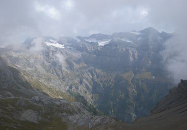
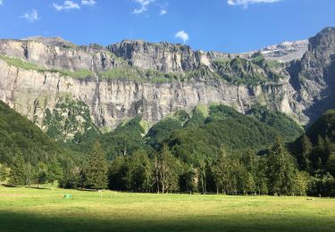
Ausgangspunkt ist der Cirque de Susanfe, der im Süden vom Mont Ruan und seinem Hängegletscher sowie von der Tour Sallière (3.218 m) begrenzt wird. Von hier aus geht es zu den steilen Schluchten des « Pas d''Encel ». Achtung: gute Sicherung erforderlich. Weiter bis zum Refuge de Bonavau.

A pied

Marche
A pied
Marche
Marche