![](/images/other/stat-length.png)
![Randonnée Marche Mareuil-Caubert - Au travers des étangs - Photo](https://media.geolcdn.com/t/1900/400/3d0ba1a8-2447-466c-a227-2f133fd97408.jpg&format=pjpeg&maxdim=2)
Au travers des étangs
Luc Gengoux
Utilisateur
![Longueur](/images/other/stat-length.png)
Longueur
3,7 km
![Altitude max](https://static1.geolcdn.com/siteimages/upload/files/1508320355ic_sort_altitude_max_24dp.png)
Altitude max
11 m
![Dénivelé positif](https://static1.geolcdn.com/siteimages/upload/files/1508320355ic_sort_den_pos_24dp.png)
Dénivelé positif
14 m
![Km-Effort](/images/other/stat-length.png)
Km-Effort
3,9 km
![Altitude min](https://static1.geolcdn.com/siteimages/upload/files/1508320355ic_sort_altitude_min_24dp.png)
Altitude min
2 m
![Dénivelé négatif](https://static1.geolcdn.com/siteimages/upload/files/1508320355ic_sort_den_neg_24dp.png)
Dénivelé négatif
17 m
![Boucle](https://static1.geolcdn.com/siteimages/upload/files/16400158638029165_repeat_loop_refresh_sync_direction_icon.png)
Boucle
Oui
Date de création :
2020-07-18 07:46:47.29
Dernière modification :
2020-07-18 10:35:40.444
![Marche](https://static1.geolcdn.com/sitytour/trail-icons/101.png)
1h16
Difficulté : Très facile
![Scannez ce code QR pour ouvrir la randonnée dans l'application SityTrail](https://capi.geolives.com/qq0zvz2zws4bq2lad0pu/sitytour/trails/2479987/qr.png?size=200)
Application GPS de randonnée GRATUITE
À propos
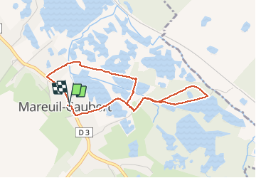
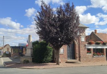
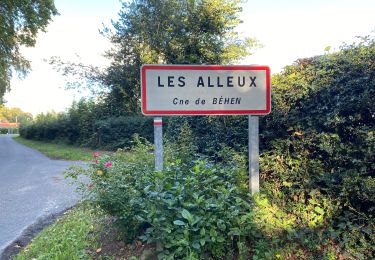
Randonnée Marche de 3,7 km à découvrir à Hauts-de-France, Somme, Mareuil-Caubert. Cette randonnée est proposée par Luc Gengoux.
Description
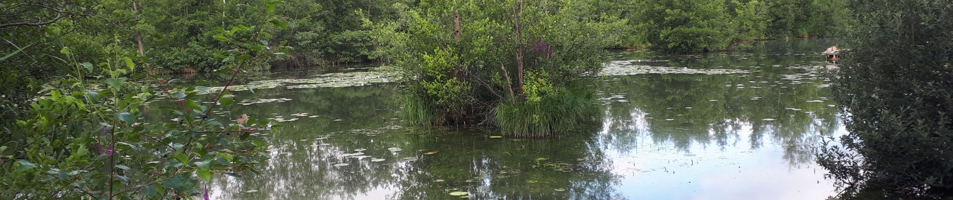
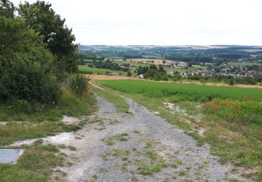
Une balade plutôt qu'une randonnée. Elle nous fait découvrir les chemins entourant les étangs et la faunes qui en découle.
Localisation
Pays :
France
Région :
Hauts-de-France
Département/Province :
Somme
Commune :
Mareuil-Caubert
Localité :
Unknown
Départ:(Dec)
Départ:(UTM)
416273 ; 5546909 (31U) N.
Commentaires
Randonnées à proximité
![Randonnée Marche Yonval - Les 3 Fétus - Yonval - Photo](https://media.geolcdn.com/t/375/260/ext.jpg?maxdim=2&url=https%3A%2F%2Fservices.sitytrail.com%2FGeolivesWS%2FDownloadMedia.ashx%3FTrailID%3D108581%26Media%3D1489_1.jpg)
![Marche Marche](https://static1.geolcdn.com/sitytour/trail-icons/101.png)
Les 3 Fétus - Yonval
Marche
Difficile
(2)
Yonval,
Hauts-de-France,
Somme,
France
![](/images/other/stat-length.png)
7,5 km | 9,4 km-effort
2h 30min
![](https://static1.geolcdn.com/siteimages/upload/files/16400158638029165_repeat_loop_refresh_sync_direction_icon.png)
Oui
![Randonnée A pied Eaucourt-sur-Somme - Le Moulin d'Eaucourt - Photo](https://media.geolcdn.com/t/375/260/9b9489ba-5456-4746-a4ec-6f9e1c594e14.jpeg&format=jpg&maxdim=2)
![A pied A pied](https://static1.geolcdn.com/sitytour/trail-icons/100.png)
Le Moulin d'Eaucourt
A pied
Facile
Eaucourt-sur-Somme,
Hauts-de-France,
Somme,
France
![](/images/other/stat-length.png)
5,8 km | 7,3 km-effort
1h 39min
![](https://static1.geolcdn.com/siteimages/upload/files/16400158638029165_repeat_loop_refresh_sync_direction_icon.png)
Oui
![Randonnée Vélo de route Béhen - Béhen Huppy Boëncourt - Photo](https://media.geolcdn.com/t/375/260/63d1e102-e234-4f81-9781-7a4437ef0dd2.jpg&format=jpg&maxdim=2)
![Vélo de route Vélo de route](https://static1.geolcdn.com/sitytour/trail-icons/201.png)
Béhen Huppy Boëncourt
Vélo de route
Facile
Béhen,
Hauts-de-France,
Somme,
France
![](/images/other/stat-length.png)
11,9 km | 12,8 km-effort
59min
![](https://static1.geolcdn.com/siteimages/upload/files/16400158638029165_repeat_loop_refresh_sync_direction_icon.png)
Oui
![Randonnée Course à pied Béhen - Les Alleux - Photo](https://media.geolcdn.com/t/375/260/0b72ba47-eb3e-48ef-8977-db903cf4990c.jpg&format=jpg&maxdim=2)
![Course à pied Course à pied](https://static1.geolcdn.com/sitytour/trail-icons/103.png)
![Randonnée Marche Eaucourt-sur-Somme - le moulin d'Eaucourt - Photo](https://media.geolcdn.com/t/375/260/4264d59a-a879-4d1d-a4fc-208df5e572be.jpg&format=jpg&maxdim=2)
![Marche Marche](https://static1.geolcdn.com/sitytour/trail-icons/101.png)
le moulin d'Eaucourt
Marche
Facile
Eaucourt-sur-Somme,
Hauts-de-France,
Somme,
France
![](/images/other/stat-length.png)
7,4 km | 9,1 km-effort
2h 23min
![](https://static1.geolcdn.com/siteimages/upload/files/16400158638029165_repeat_loop_refresh_sync_direction_icon.png)
Oui
![Randonnée Vélo Abbeville - la baie de Somme à vélo - Photo](https://media.geolcdn.com/t/375/260/ext.jpg?maxdim=2&url=https%3A%2F%2Fservices.sitytrail.com%2FGeolivesWS%2FDownloadMedia.ashx%3FTrailID%3D1132041%26Media%3D20190407095358.jpg)
![Vélo Vélo](https://static1.geolcdn.com/sitytour/trail-icons/200.png)
la baie de Somme à vélo
Vélo
Très facile
Abbeville,
Hauts-de-France,
Somme,
France
![](/images/other/stat-length.png)
118 km | 124 km-effort
8h 12min
![](https://static1.geolcdn.com/siteimages/upload/files/16400158638029165_repeat_loop_refresh_sync_direction_icon.png)
Non
![Randonnée Marche Abbeville - Abbeville chemin du Pâtis - Photo](https://media.geolcdn.com/t/375/260/ba947a24-30d5-4d85-9868-f6de26ac7666.jpg&format=jpg&maxdim=2)
![Marche Marche](https://static1.geolcdn.com/sitytour/trail-icons/101.png)
Abbeville chemin du Pâtis
Marche
Facile
Abbeville,
Hauts-de-France,
Somme,
France
![](/images/other/stat-length.png)
14 km | 15 km-effort
4h 6min
![](https://static1.geolcdn.com/siteimages/upload/files/16400158638029165_repeat_loop_refresh_sync_direction_icon.png)
Non
![Randonnée Marche Eaucourt-sur-Somme - lp80_eaucourt - Photo](https://media.geolcdn.com/t/375/260/9ce553b3-b2ee-49ec-b994-ab1db0443503.jpg&format=jpg&maxdim=2)
![Marche Marche](https://static1.geolcdn.com/sitytour/trail-icons/101.png)
lp80_eaucourt
Marche
Moyen
Eaucourt-sur-Somme,
Hauts-de-France,
Somme,
France
![](/images/other/stat-length.png)
7,2 km | 8,9 km-effort
2h 1min
![](https://static1.geolcdn.com/siteimages/upload/files/16400158638029165_repeat_loop_refresh_sync_direction_icon.png)
Oui
![Randonnée Marche Abbeville - Abbeville Grands Lavier - Photo](https://media.geolcdn.com/t/375/260/978d0648-091c-45aa-876f-de0aec8e1ab5.jpg&format=jpg&maxdim=2)
![Marche Marche](https://static1.geolcdn.com/sitytour/trail-icons/101.png)
Abbeville Grands Lavier
Marche
Très facile
Abbeville,
Hauts-de-France,
Somme,
France
![](/images/other/stat-length.png)
17,7 km | 18,6 km-effort
4h 40min
![](https://static1.geolcdn.com/siteimages/upload/files/16400158638029165_repeat_loop_refresh_sync_direction_icon.png)
Non