![](/images/other/stat-length.png)
![Randonnée Marche Pont-Remy - chemin de hallage et crête. - Photo](https://media.geolcdn.com/t/1900/400/5e164144-4371-41fa-81a6-060274847334.jpg&format=pjpeg&maxdim=2)
chemin de hallage et crête.
Luc Gengoux
Utilisateur
![Longueur](/images/other/stat-length.png)
Longueur
9,8 km
![Altitude max](https://static1.geolcdn.com/siteimages/upload/files/1508320355ic_sort_altitude_max_24dp.png)
Altitude max
104 m
![Dénivelé positif](https://static1.geolcdn.com/siteimages/upload/files/1508320355ic_sort_den_pos_24dp.png)
Dénivelé positif
137 m
![Km-Effort](/images/other/stat-length.png)
Km-Effort
11,6 km
![Altitude min](https://static1.geolcdn.com/siteimages/upload/files/1508320355ic_sort_altitude_min_24dp.png)
Altitude min
5 m
![Dénivelé négatif](https://static1.geolcdn.com/siteimages/upload/files/1508320355ic_sort_den_neg_24dp.png)
Dénivelé négatif
138 m
![Boucle](https://static1.geolcdn.com/siteimages/upload/files/16400158638029165_repeat_loop_refresh_sync_direction_icon.png)
Boucle
Oui
Date de création :
2020-07-15 08:48:56.662
Dernière modification :
2020-07-18 10:51:35.733
![Marche](https://static1.geolcdn.com/sitytour/trail-icons/101.png)
2h34
Difficulté : Très facile
![Scannez ce code QR pour ouvrir la randonnée dans l'application SityTrail](https://capi.geolives.com/qq0zvz2zws4bq2lad0pu/sitytour/trails/2476604/qr.png?size=200)
Application GPS de randonnée GRATUITE
À propos
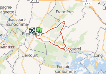
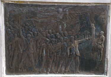
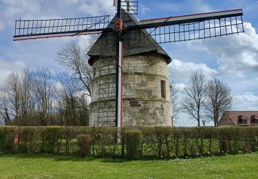
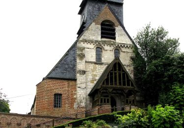
Randonnée Marche de 9,8 km à découvrir à Hauts-de-France, Somme, Pont-Remy. Cette randonnée est proposée par Luc Gengoux.
Description
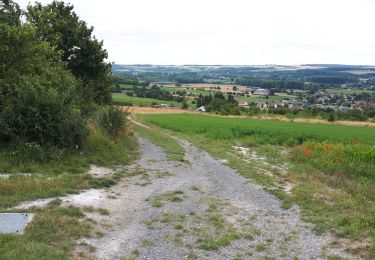
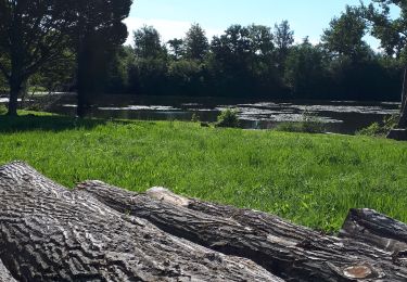
La randonnée commence le long de la somme avant de nous emmener dans les hauteurs. Le moment de vues imprenables sur la vallées.
Localisation
Pays :
France
Région :
Hauts-de-France
Département/Province :
Somme
Commune :
Pont-Remy
Localité :
Unknown
Départ:(Dec)
Départ:(UTM)
421662 ; 5545155 (31U) N.
Commentaires
Randonnées à proximité
![Randonnée A pied Eaucourt-sur-Somme - Le Moulin d'Eaucourt - Photo](https://media.geolcdn.com/t/375/260/9b9489ba-5456-4746-a4ec-6f9e1c594e14.jpeg&format=jpg&maxdim=2)
![A pied A pied](https://static1.geolcdn.com/sitytour/trail-icons/100.png)
Le Moulin d'Eaucourt
A pied
Facile
Eaucourt-sur-Somme,
Hauts-de-France,
Somme,
France
![](/images/other/stat-length.png)
5,8 km | 7,3 km-effort
1h 39min
![](https://static1.geolcdn.com/siteimages/upload/files/16400158638029165_repeat_loop_refresh_sync_direction_icon.png)
Oui
![Randonnée A pied Long - Les Bords de Somme - Photo](https://media.geolcdn.com/t/375/260/524a8fde-e553-41eb-af37-bc359713a178.jpeg&format=jpg&maxdim=2)
![A pied A pied](https://static1.geolcdn.com/sitytour/trail-icons/100.png)
Les Bords de Somme
A pied
Facile
Long,
Hauts-de-France,
Somme,
France
![](/images/other/stat-length.png)
7,9 km | 8,4 km-effort
1h 54min
![](https://static1.geolcdn.com/siteimages/upload/files/16400158638029165_repeat_loop_refresh_sync_direction_icon.png)
Oui
![Randonnée A pied Fontaine-sur-Somme - Les Hauts de Long - Photo](https://media.geolcdn.com/t/375/260/857ea661-13e1-4088-8b62-d697c76652e3.jpeg&format=jpg&maxdim=2)
![A pied A pied](https://static1.geolcdn.com/sitytour/trail-icons/100.png)
Les Hauts de Long
A pied
Facile
Fontaine-sur-Somme,
Hauts-de-France,
Somme,
France
![](/images/other/stat-length.png)
9,1 km | 11 km-effort
2h 29min
![](https://static1.geolcdn.com/siteimages/upload/files/16400158638029165_repeat_loop_refresh_sync_direction_icon.png)
Oui
![Randonnée Marche Eaucourt-sur-Somme - le moulin d'Eaucourt - Photo](https://media.geolcdn.com/t/375/260/4264d59a-a879-4d1d-a4fc-208df5e572be.jpg&format=jpg&maxdim=2)
![Marche Marche](https://static1.geolcdn.com/sitytour/trail-icons/101.png)
le moulin d'Eaucourt
Marche
Facile
Eaucourt-sur-Somme,
Hauts-de-France,
Somme,
France
![](/images/other/stat-length.png)
7,4 km | 9,1 km-effort
2h 23min
![](https://static1.geolcdn.com/siteimages/upload/files/16400158638029165_repeat_loop_refresh_sync_direction_icon.png)
Oui
![Randonnée Marche Long - Une randonnée rythmée par les étangs. - Photo](https://media.geolcdn.com/t/375/260/07cc8282-85e0-46da-9260-ab7cedc0be52.jpg&format=jpg&maxdim=2)
![Marche Marche](https://static1.geolcdn.com/sitytour/trail-icons/101.png)
Une randonnée rythmée par les étangs.
Marche
Très facile
Long,
Hauts-de-France,
Somme,
France
![](/images/other/stat-length.png)
6,7 km | 7,1 km-effort
1h 53min
![](https://static1.geolcdn.com/siteimages/upload/files/16400158638029165_repeat_loop_refresh_sync_direction_icon.png)
Non
![Randonnée Marche Eaucourt-sur-Somme - lp80_eaucourt - Photo](https://media.geolcdn.com/t/375/260/9ce553b3-b2ee-49ec-b994-ab1db0443503.jpg&format=jpg&maxdim=2)
![Marche Marche](https://static1.geolcdn.com/sitytour/trail-icons/101.png)
lp80_eaucourt
Marche
Moyen
Eaucourt-sur-Somme,
Hauts-de-France,
Somme,
France
![](/images/other/stat-length.png)
7,2 km | 8,9 km-effort
2h 1min
![](https://static1.geolcdn.com/siteimages/upload/files/16400158638029165_repeat_loop_refresh_sync_direction_icon.png)
Oui
![Randonnée A pied Mareuil-Caubert - Les Etangs et Marais de Mareuil-Caubert - Photo](https://media.geolcdn.com/t/375/260/cf87097c-bd8e-42ef-880c-3a413e4f1840.jpeg&format=jpg&maxdim=2)
![A pied A pied](https://static1.geolcdn.com/sitytour/trail-icons/100.png)
Les Etangs et Marais de Mareuil-Caubert
A pied
Facile
Mareuil-Caubert,
Hauts-de-France,
Somme,
France
![](/images/other/stat-length.png)
3,4 km | 3,6 km-effort
48min
![](https://static1.geolcdn.com/siteimages/upload/files/16400158638029165_repeat_loop_refresh_sync_direction_icon.png)
Non
![Randonnée A pied Bailleul - Autour du bois de Bailleul - Photo](https://media.geolcdn.com/t/375/260/49d7c3e4-d527-4b9b-80c7-8838ed7b7be9.jpeg&format=jpg&maxdim=2)
![A pied A pied](https://static1.geolcdn.com/sitytour/trail-icons/100.png)
Autour du bois de Bailleul
A pied
Facile
Bailleul,
Hauts-de-France,
Somme,
France
![](/images/other/stat-length.png)
7,6 km | 9,9 km-effort
2h 14min
![](https://static1.geolcdn.com/siteimages/upload/files/16400158638029165_repeat_loop_refresh_sync_direction_icon.png)
Non
![Randonnée A pied Pont-Remy - Les Hauts de Pont-Rémy - Photo](https://media.geolcdn.com/t/375/260/524a8fde-e553-41eb-af37-bc359713a178.jpeg&format=jpg&maxdim=2)
![A pied A pied](https://static1.geolcdn.com/sitytour/trail-icons/100.png)
Les Hauts de Pont-Rémy
A pied
Facile
Pont-Remy,
Hauts-de-France,
Somme,
France
![](/images/other/stat-length.png)
9,6 km | 11,4 km-effort
2h 35min
![](https://static1.geolcdn.com/siteimages/upload/files/16400158638029165_repeat_loop_refresh_sync_direction_icon.png)
Oui