![](/images/other/stat-length.png)
![Randonnée Marche Belforêt-en-Perche - 2-La Perrièe_Saint Germain-de-la-Coudre - Photo](https://media.geolcdn.com/t/1900/400/ext.pjpeg?maxdim=2&url=https%3A%2F%2Fstatic1.geolcdn.com%2Fsiteimages%2Fupload%2Ffiles%2F1553511878bg_sport_marche.png)
2-La Perrièe_Saint Germain-de-la-Coudre
jeanad
Utilisateur
![Longueur](/images/other/stat-length.png)
![Altitude max](https://static1.geolcdn.com/siteimages/upload/files/1508320355ic_sort_altitude_max_24dp.png)
![Dénivelé positif](https://static1.geolcdn.com/siteimages/upload/files/1508320355ic_sort_den_pos_24dp.png)
![Km-Effort](/images/other/stat-length.png)
![Altitude min](https://static1.geolcdn.com/siteimages/upload/files/1508320355ic_sort_altitude_min_24dp.png)
![Dénivelé négatif](https://static1.geolcdn.com/siteimages/upload/files/1508320355ic_sort_den_neg_24dp.png)
![Boucle](https://static1.geolcdn.com/siteimages/upload/files/16400158638029165_repeat_loop_refresh_sync_direction_icon.png)
![Marche](https://static1.geolcdn.com/sitytour/trail-icons/101.png)
--
Difficulté : Inconnu
![Scannez ce code QR pour ouvrir la randonnée dans l'application SityTrail](https://capi.geolives.com/qq0zvz2zws4bq2lad0pu/sitytour/trails/2475312/qr.png?size=200)
Application GPS de randonnée GRATUITE
À propos
Randonnée Marche de 28 km à découvrir à Normandie, Orne, Belforêt-en-Perche. Cette randonnée est proposée par jeanad.
Description
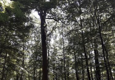
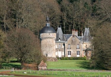
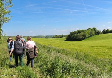
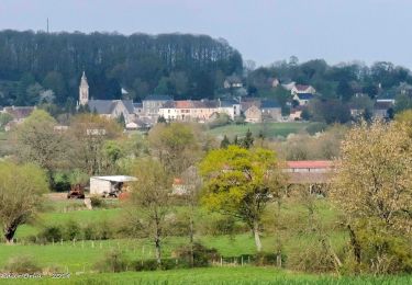
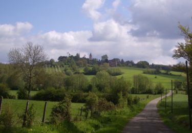
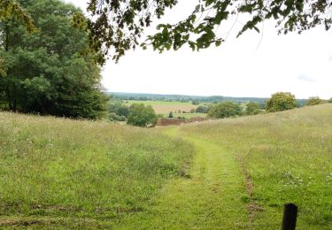
Cette randonnée, septième étape d’un circuit de huit jours et de 220km, le Tour des Collines du Perche, proposé par Itinéraires Ruraux, vous fera longer la forêt de Bellême jusqu’à atteindre l’un des fleurons du Perche ornais, Bellême, que vous ne manquerez pas de visiter. Puis la trace reprend une direction sud pour passer à La-Chapelle-Souëf puis St Germain de la Coudre. Un autre chemin, entre la Perrière et St Germain, via Vaunoise, vous est aussi proposé (voir le parcours sur ce même site).
L'ensemble des étapes du Tour des Collines du perche (disponibles sur ce même site) :
1 : Nogent le Rotrou Rémalard
2 : Rémalard - Moutiers au Perche
3 : Moutiers au Perche - La Ferté Vidame
4 : La Ferté Vidame - Tourouvre
5 : Tourouvre - Mortagne au Perche
6 : Mortagne au Perche - La Perrière
7 : La Perrière - Saint Germain de la coudre (deux variantes : via Vaunoise ou via Bellême)
8 : Saint Germain de la Coudre - Nogent le Rotrou
Localisation
Commentaires
Randonnées à proximité
![Randonnée Marche Belforêt-en-Perche - La Perrière, forêt et village - Photo](https://media.geolcdn.com/t/375/260/577dee63-88bb-4820-9f32-19708dbf9028.jpg&format=jpg&maxdim=2)
![Marche Marche](https://static1.geolcdn.com/sitytour/trail-icons/101.png)
Marche
![](/images/other/stat-length.png)
![](https://static1.geolcdn.com/siteimages/upload/files/16400158638029165_repeat_loop_refresh_sync_direction_icon.png)
![Randonnée Marche Belforêt-en-Perche - le chêne de l'école - Photo](https://media.geolcdn.com/t/375/260/ff98d102-5639-4196-8c72-5f92c76ce997.jpg&format=jpg&maxdim=2)
![Marche Marche](https://static1.geolcdn.com/sitytour/trail-icons/101.png)
Marche
![](/images/other/stat-length.png)
![](https://static1.geolcdn.com/siteimages/upload/files/16400158638029165_repeat_loop_refresh_sync_direction_icon.png)
![Randonnée Marche Belforêt-en-Perche - La Perrière - Saint-Germain-de-la-Coudre via Bellême (TCP) 28 km - Photo](https://media.geolcdn.com/t/375/260/f8f9cc81-98b3-4885-ae43-f599f03cc6ff.jpg&format=jpg&maxdim=2)
![Marche Marche](https://static1.geolcdn.com/sitytour/trail-icons/101.png)
Marche
![](/images/other/stat-length.png)
![](https://static1.geolcdn.com/siteimages/upload/files/16400158638029165_repeat_loop_refresh_sync_direction_icon.png)
![Randonnée Marche Belforêt-en-Perche - La Perrière - Saint-Germain-de-la-Coudre via Igé (TCP) 27 km - Photo](https://media.geolcdn.com/t/375/260/e70793eb-3e3a-4fb9-8791-69252ddd8772.jpg&format=jpg&maxdim=2)
![Marche Marche](https://static1.geolcdn.com/sitytour/trail-icons/101.png)
Marche
![](/images/other/stat-length.png)
![](https://static1.geolcdn.com/siteimages/upload/files/16400158638029165_repeat_loop_refresh_sync_direction_icon.png)
![Randonnée Marche Belforêt-en-Perche - La Perrière - Mortagne-au-Perche (TCP) 29 km - Photo](https://media.geolcdn.com/t/375/260/d8328879-50fd-44ca-9e33-04c0ec1d4331.jpg&format=jpg&maxdim=2)
![Marche Marche](https://static1.geolcdn.com/sitytour/trail-icons/101.png)
Marche
![](/images/other/stat-length.png)
![](https://static1.geolcdn.com/siteimages/upload/files/16400158638029165_repeat_loop_refresh_sync_direction_icon.png)
![Randonnée Marche Belforêt-en-Perche - La Perrière : village millénaire - Photo](https://media.geolcdn.com/t/375/260/ext.jpg?maxdim=2&url=https%3A%2F%2Fservices.sitytrail.com%2FGeolivesWS%2FDownloadMedia.ashx%3FTrailID%3D111665%26Media%3D7903_3.jpg)
![Marche Marche](https://static1.geolcdn.com/sitytour/trail-icons/101.png)
Marche
![](/images/other/stat-length.png)
![](https://static1.geolcdn.com/siteimages/upload/files/16400158638029165_repeat_loop_refresh_sync_direction_icon.png)
![Randonnée Marche Belforêt-en-Perche - la perrière par la forêt - Photo](https://media.geolcdn.com/t/375/260/dc5026c3-20c4-40ca-bab8-55b19f74d196.jpg&format=jpg&maxdim=2)
![Marche Marche](https://static1.geolcdn.com/sitytour/trail-icons/101.png)
Marche
![](/images/other/stat-length.png)
![](https://static1.geolcdn.com/siteimages/upload/files/16400158638029165_repeat_loop_refresh_sync_direction_icon.png)
![Randonnée Marche Belforêt-en-Perche - fourneaux gr jusqu'au ruisseau - Photo](https://media.geolcdn.com/t/375/260/b31f6ae7-3d4c-4741-ab3e-a7d27ca40061.jpg&format=jpg&maxdim=2)
![Marche Marche](https://static1.geolcdn.com/sitytour/trail-icons/101.png)
Marche
![](/images/other/stat-length.png)
![](https://static1.geolcdn.com/siteimages/upload/files/16400158638029165_repeat_loop_refresh_sync_direction_icon.png)
![Randonnée Voiture Belforêt-en-Perche - 2025-02-12 VduP les Chaises - Photo](https://media.geolcdn.com/t/375/260/ext.jpg?maxdim=2&url=https%3A%2F%2Fstatic1.geolcdn.com%2Fsiteimages%2Fupload%2Ffiles%2F15247431544x4.jpg)
![Voiture Voiture](https://static1.geolcdn.com/sitytour/trail-icons/401.png)
Voiture
![](/images/other/stat-length.png)
![](https://static1.geolcdn.com/siteimages/upload/files/16400158638029165_repeat_loop_refresh_sync_direction_icon.png)