Randonnée Marche Créhange - Créhange et environs - ballade 01 - Photo

Créhange et environs - ballade 01

 vinmed
vinmed

Utilisateur

© OpenStreetMap contributors
Longueur
Longueur
8,2 km
Altitude max
Altitude max
401 m
Dénivelé positif
Dénivelé positif
135 m
Km-Effort
Km-Effort  
10 km
Altitude min
Altitude min
308 m
Dénivelé négatif
Dénivelé négatif
137 m
Boucle
Boucle
Oui
Date de création :
2020-07-13 11:43:56.833
Dernière modification :
2020-07-13 16:31:12.716

(0 Avis)

Marche
Marche
1h43
Difficulté : Facile

Scannez ce code QR pour ouvrir la randonnée dans l'application SityTrail

Application GPS de randonnée GRATUITE

Logo SityTrail SityTrail

IGN / Instituts géographiques

Télécharger SityTrail sur l'App Store Télécharger SityTrail sur Google Play

Logo SityTrail SityTrail World

Le monde est à vous

Télécharger SityTrail sur l'App Store Télécharger SityTrail sur Google Play Télécharger SityTrail sur Huawei AppGallery

À propos

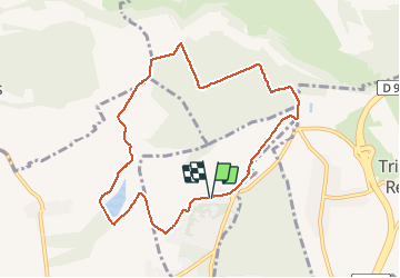
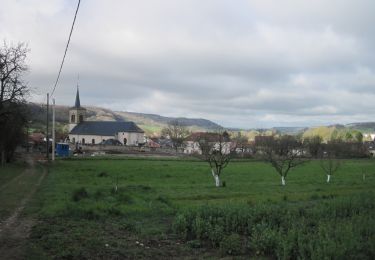
Randonnée Marche de 8,2 km à découvrir à Grand Est, Moselle, Créhange. Cette randonnée est proposée par vinmed.

Description

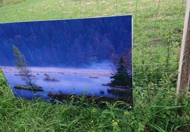
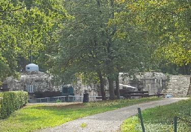
Promenade sympa à pied ou à vélo. Un tronçon sur une voie romaine. Au point culminant un beau panorama sur la vallée de la Nied, le Mont Saint Pierre et au loin les côtes de Moselle.

Profil altimétrique

Localisation

Pays :
France
Région :
Grand Est
Département/Province :
Moselle
Commune :
Créhange
Localité :
Unknown
Départ:(UTM)
323819 ; 5438763 (32U) N.

Randonnées à proximité

Randonnée Marche Bambiderstroff - Circuit de la Vallée du Bambesch - Bambiderstroff - Photo
Marche
tracegps

Marche

Moyen
(1)
Bambiderstroff, Grand Est, Moselle, France
16,5 km | 20 km-effort
4h 0min
Oui
Randonnée A pied Bambiderstroff - Circuit Vallée du Bambesh - Photo
A pied
GUIDE+

A pied

Facile
Bambiderstroff, Grand Est, Moselle, France
14,6 km | 17,9 km-effort
4h 3min
Oui
Randonnée A pied Pontpierre - Circuit du golf - Photo
A pied
GUIDE+

A pied

Facile
Pontpierre, Grand Est, Moselle, France
16 km | 19,4 km-effort
4h 24min
Oui
Randonnée Marche Pontpierre - expo nature Faulquemont  - Photo
Marche
Bob5757

Marche

Très facile
Pontpierre, Grand Est, Moselle, France
3,6 km | 4,3 km-effort
2h 46min
Non
Randonnée Marche Longeville-lès-Saint-Avold - Longeville - Bambiderstroff - Photo
Marche
oger_eric

Marche

Facile
(1)
Longeville-lès-Saint-Avold, Grand Est, Moselle, France
10,4 km | 13,7 km-effort
2h 56min
Oui
Randonnée Marche nordique Bambiderstroff - Eric Bambiderstroff  - Photo
Marche nordique
oger_eric

Marche nordique

Facile
Bambiderstroff, Grand Est, Moselle, France
14,8 km | 18,4 km-effort
2h 35min
Oui
Randonnée Marche Bambiderstroff - Tour de Bambiderstroff - Photo
Marche
piem

Marche

Moyen
Bambiderstroff, Grand Est, Moselle, France
12,8 km | 15,8 km-effort
3h 50min
Oui
Randonnée A pied Elvange - Circuit de Walving - Photo
A pied
GUIDE+

A pied

Facile
Elvange, Grand Est, Moselle, France
13,7 km | 16,7 km-effort
3h 47min
Oui
Randonnée A pied Longeville-lès-Saint-Avold - Circuit de St Martin-en-Glandière - Photo
A pied
GUIDE+

A pied

Facile
Longeville-lès-Saint-Avold, Grand Est, Moselle, France
4,3 km | 6,4 km-effort
1h 27min
Non


Fermer
Mes abonnements