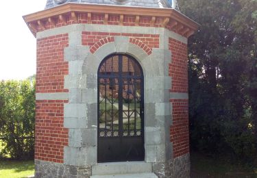
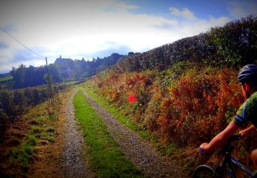
Randonnée Moteur Hestrud - RN_HW - Photo
 OPT
OPT

Utilisateur

© OpenStreetMap contributors
Longueur
Longueur
89 km
Altitude max
Altitude max
232 m
Dénivelé positif
Dénivelé positif
889 m
Km-Effort
Km-Effort  
101 km
Altitude min
Altitude min
101 m
Dénivelé négatif
Dénivelé négatif
953 m
Boucle
Boucle
Non
Date de création :
2014-12-10 00:00:00.0
Dernière modification :
2014-12-10 00:00:00.0

(0 Avis)

Moteur
Moteur
2h00
Difficulté : Moyen

Scannez ce code QR pour ouvrir la randonnée dans l'application SityTrail

Application GPS de randonnée GRATUITE

Logo SityTrail SityTrail

IGN / Instituts géographiques

Télécharger SityTrail sur l'App Store Télécharger SityTrail sur Google Play

Logo SityTrail SityTrail World

Le monde est à vous

Télécharger SityTrail sur l'App Store Télécharger SityTrail sur Google Play Télécharger SityTrail sur Huawei AppGallery

À propos

Randonnée Moteur de 89 km à découvrir à Hauts-de-France, Nord, Hestrud. Cette randonnée est proposée par OPT.

Description

Route Napoléon RN_H-W_15-01-2014

Profil altimétrique

Points d'intérêt

Point d'intérêt Genappe - FIG 51 - Photo
OPT
GENAPPE 
Point d'intérêt Genappe - FIG 53- 54- ?? - Photo
OPT
Point d'intérêt Waterloo - FIG 55 - Photo
OPT
WATERLOO 
Point d'intérêt Lasne - FIG 69 - Photo
OPT
LASNE 
Point d'intérêt Ham-sur-Heure-Nalinnes - Géolocalisation Chapelle Saint-Roch - Photo
OPT
HAM-SUR-HEURE-NALINNES 
Point d'intérêt Villers-la-Ville - Géolocalisation des monuments - Photo
OPT
Point d'intérêt Ham-sur-Heure-Nalinnes - Géolocalisation église Saint-André - Photo
OPT
HAM-SUR-HEURE-NALINNES 
Point d'intérêt Braine-l'Alleud - Géolocalisation FIG 55 - Photo
OPT
BRAINE-L'ALLEUD 
Point d'intérêt Charleroi - Historique - Photo
OPT
CHARLEROI 
Point d'intérêt Ham-sur-Heure-Nalinnes - Historique chapelle Saint-Roch - Photo
OPT
HAM-SUR-HEURE-NALINNES 
Point d'intérêt Ham-sur-Heure-Nalinnes - Historique église Saint-André - Photo
OPT
HAM-SUR-HEURE-NALINNES 
Point d'intérêt Villers-la-Ville - Historique Monuments - Photo
OPT
VILLERS-LA-VILLE 
Point d'intérêt Charleroi - Historique Napoléon - Photo
OPT
Point d'intérêt Lasne - HISTORIQUE. - Photo
OPT
Point d'intérêt Beaumont - La marzel - Photo
OPT
BEAUMONT 
Point d'intérêt Charleroi - Site bois du Cazier - Photo
OPT
Point d'intérêt Villers-la-Ville - Site de l' Abbaye De Villers - Photo
OPT
Point d'intérêt Ham-sur-Heure-Nalinnes - Site de la chapelle Saint-Roch - Photo
OPT
HAM-SUR-HEURE-NALINNES 
Point d'intérêt Ham-sur-Heure-Nalinnes - Site de l'église Saint-André - Photo
OPT
HAM-SUR-HEURE-NALINNES 

Localisation

Pays :
France
Région :
Hauts-de-France
Département/Province :
Nord
Commune :
Hestrud
Localité :
Unknown
Départ:(Dec)
Départ:(UTM)
581951 ; 5561274 (31U) N.

Randonnées à proximité

Randonnée Marche Sivry-Rance - Sivry-Rance (02) - Promenade du Mont Rosé - Photo
Marche
GUIDE+

Marche

Moyen
(1)
Sivry-Rance, Wallonie, Hainaut, Belgique
6,7 km | 7,9 km-effort
1h 45min
Oui
Randonnée Marche Solre-le-Château - Circuit du Biau Ri - Solre le Château - Photo
Marche
tracegps

Marche

Moyen
(2)
Solre-le-Château, Hauts-de-France, Nord, France
10 km | 11,5 km-effort
2h 30min
Oui
Randonnée Marche Sivry-Rance - Balade à Sivry - Photo
Marche
GUIDE
Desrumaux

Marche

Moyen
Sivry-Rance, Wallonie, Hainaut, Belgique
6,2 km | 7,1 km-effort
1h 36min
Oui
Randonnée Marche Beaumont - Leugnies-Leval - Photo
Marche
cvdb

Marche

Très facile
(1)
Beaumont, Wallonie, Hainaut, Belgique
8,3 km | 10 km-effort
2h 15min
Oui
Randonnée V.T.T. Sivry-Rance - VTT de Sivry Rance au lac du Val Joly  - Photo
V.T.T.
GUIDE
pascalou73

V.T.T.

Difficile
Sivry-Rance, Wallonie, Hainaut, Belgique
43 km | 52 km-effort
Inconnu
Oui
Randonnée Marche Sivry-Rance - Sivry 2019-5-21 - Photo
Marche
BERNA23

Marche

Très facile
(1)
Sivry-Rance, Wallonie, Hainaut, Belgique
4,9 km | 5,7 km-effort
1h 15min
Oui
Randonnée V.T.T. Solre-le-Château - VTT du Val joly - Photo
V.T.T.
GUIDE
pascalou73

V.T.T.

Moyen
Solre-le-Château, Hauts-de-France, Nord, France
42 km | 51 km-effort
3h 18min
Oui
Randonnée A pied Sivry-Rance - Promenade du Bois de Bruyère - Photo
A pied
GUIDE+

A pied

Facile
(1)
Sivry-Rance, Wallonie, Hainaut, Belgique
2,5 km | 2,9 km-effort
39min
Oui
Randonnée Marche Sivry-Rance - 2019-2-22 - Photo
Marche
BERNA23

Marche

Très facile
Sivry-Rance, Wallonie, Hainaut, Belgique
7,7 km | 8,7 km-effort
1h 54min
Oui


Fermer
Mes abonnements