Randonnée Vélo électrique Tonnay-Charente - Tonnay-Charente - Photo
 phil118
phil118

Utilisateur

© OpenStreetMap contributors
Longueur
Longueur
46 km
Altitude max
Altitude max
21 m
Dénivelé positif
Dénivelé positif
228 m
Km-Effort
Km-Effort  
49 km
Altitude min
Altitude min
-2 m
Dénivelé négatif
Dénivelé négatif
227 m
Boucle
Boucle
Oui
Date de création :
2020-07-12 12:04:12.482
Dernière modification :
2020-07-12 16:24:31.029

(0 Avis)

Vélo électrique
Vélo électrique
3h20
Difficulté : Facile

Scannez ce code QR pour ouvrir la randonnée dans l'application SityTrail

Application GPS de randonnée GRATUITE

Logo SityTrail SityTrail

IGN / Instituts géographiques

Télécharger SityTrail sur l'App Store Télécharger SityTrail sur Google Play

Logo SityTrail SityTrail World

Le monde est à vous

Télécharger SityTrail sur l'App Store Télécharger SityTrail sur Google Play Télécharger SityTrail sur Huawei AppGallery

À propos

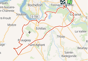
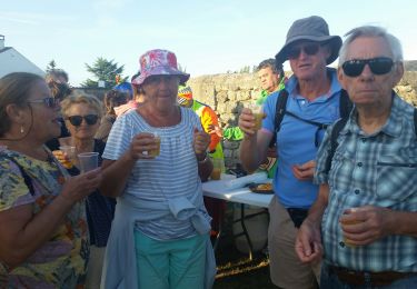
Randonnée Vélo électrique de 46 km à découvrir à Nouvelle-Aquitaine, Charente-Maritime, Tonnay-Charente. Cette randonnée est proposée par phil118.

Profil altimétrique

Photos

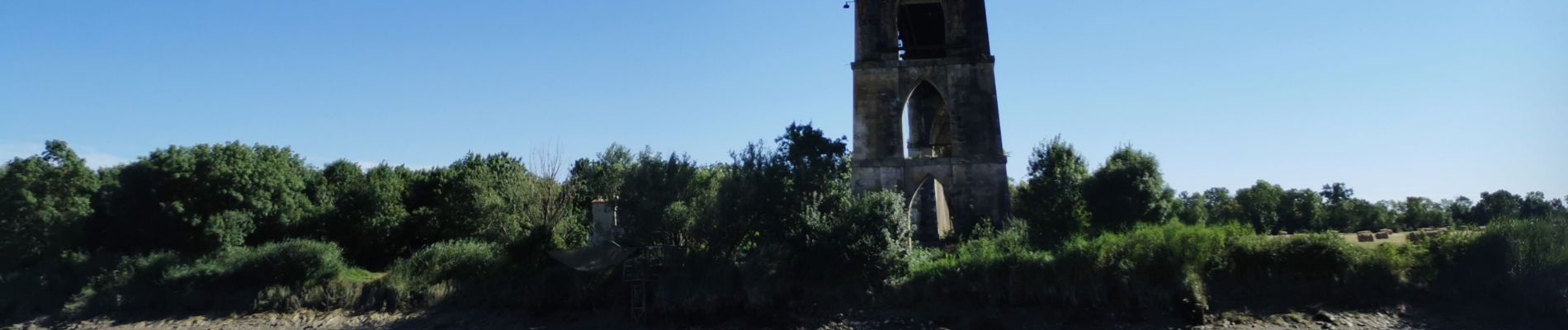
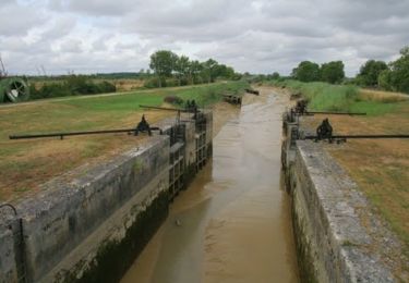
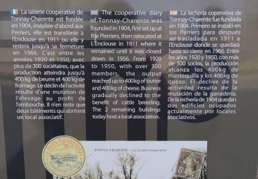
31 photos au total. Cliquez sur une photo pour les afficher toutes dans la galerie.

Localisation

Pays :
France
Région :
Nouvelle-Aquitaine
Département/Province :
Charente-Maritime
Commune :
Tonnay-Charente
Localité :
Unknown
Départ:(UTM)
664235 ; 5089522 (30T) N.

Randonnées à proximité

Randonnée V.T.T. Tonnay-Charente - Bois et étangs en pays rochefortais - Tonnay Charente - Photo
V.T.T.
tracegps

V.T.T.

Moyen
(1)
Tonnay-Charente, Nouvelle-Aquitaine, Charente-Maritime, France
46 km | 50 km-effort
3h 0min
Oui
Randonnée Marche Tonnay-Charente - balade a Thonet Charente  - Photo
Marche
Domdomii

Marche

Facile
(1)
Tonnay-Charente, Nouvelle-Aquitaine, Charente-Maritime, France
2,1 km | 2,4 km-effort
1h 34min
Oui
Randonnée Marche Tonnay-Charente - tonnay  Charente  - Photo
Marche
penaud

Marche

Très facile
Tonnay-Charente, Nouvelle-Aquitaine, Charente-Maritime, France
14,8 km | 15,8 km-effort
5h 17min
Oui
Randonnée Marche Saint-Hippolyte - pont suspendu  - Photo
Marche
chateauvieux59

Marche

Très facile
Saint-Hippolyte, Nouvelle-Aquitaine, Charente-Maritime, France
13,2 km | 14,1 km-effort
3h 16min
Oui
Randonnée Marche Saint-Hippolyte - Hippolyte  - Photo
Marche
gege92

Marche

Très facile
Saint-Hippolyte, Nouvelle-Aquitaine, Charente-Maritime, France
12,1 km | 13,1 km-effort
3h 40min
Oui
Randonnée V.T.C. Tonnay-Charente - Sainte - Saint savinien - Photo
V.T.C.
jh-caillotte

V.T.C.

Tonnay-Charente, Nouvelle-Aquitaine, Charente-Maritime, France
29 km | 31 km-effort
2h 30min
Non
Randonnée V.T.T. Tonnay-Charente - Liron - Cabane de Moins - Photo
V.T.T.
lantz

V.T.T.

Très facile
Tonnay-Charente, Nouvelle-Aquitaine, Charente-Maritime, France
32 km | 34 km-effort
2h 0min
Oui
Randonnée Marche Trizay - Echillais 9kms - Photo
Marche
Nadège17170

Marche

Facile
Trizay, Nouvelle-Aquitaine, Charente-Maritime, France
11 km | 11,8 km-effort
3h 27min
Non
Randonnée Marche Saint-Hippolyte - Gabarit tonnay-charente - Photo
Marche
jybaraton

Marche

Difficile
Saint-Hippolyte, Nouvelle-Aquitaine, Charente-Maritime, France
12,8 km | 13,8 km-effort
4h 56min
Oui


Fermer
Mes abonnements