![](/images/other/stat-length.png)
![Randonnée Marche Arâches-la-Frasse - Vernant Grands Vans Pelouse col pierre carrée - Photo](https://media.geolcdn.com/t/1900/400/ext.pjpeg?maxdim=2&url=https%3A%2F%2Fmedia.geolcdn.com%2Ff%2Fe9b01e7d-367b-4845-b508-861027ddd49d.jpg)
Vernant Grands Vans Pelouse col pierre carrée
reneperrin
Utilisateur
![Longueur](/images/other/stat-length.png)
![Altitude max](https://static1.geolcdn.com/siteimages/upload/files/1508320355ic_sort_altitude_max_24dp.png)
![Dénivelé positif](https://static1.geolcdn.com/siteimages/upload/files/1508320355ic_sort_den_pos_24dp.png)
![Km-Effort](/images/other/stat-length.png)
![Altitude min](https://static1.geolcdn.com/siteimages/upload/files/1508320355ic_sort_altitude_min_24dp.png)
![Dénivelé négatif](https://static1.geolcdn.com/siteimages/upload/files/1508320355ic_sort_den_neg_24dp.png)
![Boucle](https://static1.geolcdn.com/siteimages/upload/files/16400158638029165_repeat_loop_refresh_sync_direction_icon.png)
![Marche](https://static1.geolcdn.com/sitytour/trail-icons/101.png)
5h30
Difficulté : Moyen
![Scannez ce code QR pour ouvrir la randonnée dans l'application SityTrail](https://capi.geolives.com/qq0zvz2zws4bq2lad0pu/sitytour/trails/2465706/qr.png?size=200)
Application GPS de randonnée GRATUITE
À propos
Randonnée Marche de 13,6 km à découvrir à Auvergne-Rhône-Alpes, Haute-Savoie, Arâches-la-Frasse. Cette randonnée est proposée par reneperrin.
Description
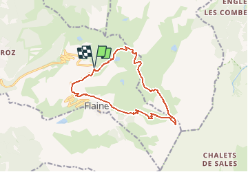
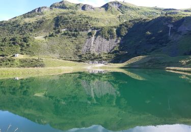
Départ du parking de Vernant. On monte vers le lac de Vernant, puis vers les grands Vans. Superbe vue sur le Mont Blanc. On redescend au col des grands Vans, puis on descend à gauche vers la vallée du Giffre. An début le chemin est assez facile, puis on traverse un cahos rocheux, et la fin de la descente devient assez raide avec quelques passages qui peuvent être délicats par mauvais temps. On rejoint le chemin qui vient de Sixt, puis on remonte par un large chemin bien tracé jusqu’(au col de Pelouse.
La descente vers Flaine se fait au pied de la tête de Balacha, on passe la cabane de Balacha. En arrivant à Flaine, on remonte à droite par le sentier vers le col de la pierre carrée. On y arrive juste derrière la base des chasseurs alpins. Ensuite le chemin passe derrière un grand parking et on rejoint un peu plus bas le parking de Vernant.
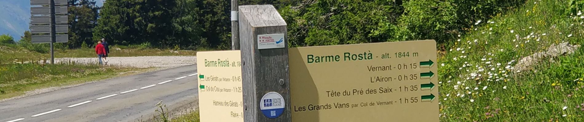
Localisation
Commentaires
Randonnées à proximité
![Randonnée Marche Samoëns - Lac de Gers - Photo](https://media.geolcdn.com/t/375/260/ext.jpg?maxdim=2&url=https%3A%2F%2Fmedia.geolcdn.com%2Ff%2F4f8c7a90-c8a6-4a64-bc22-de3fbc680b52.jpg)
![Marche Marche](https://static1.geolcdn.com/sitytour/trail-icons/101.png)
Marche
![](/images/other/stat-length.png)
![](https://static1.geolcdn.com/siteimages/upload/files/16400158638029165_repeat_loop_refresh_sync_direction_icon.png)
![Randonnée Marche Magland - belvédère d Aulp - Photo](https://media.geolcdn.com/t/375/260/ext.jpg?maxdim=2&url=https%3A%2F%2Fmedia.geolcdn.com%2Ff%2F3d7c42d4-f0a9-4769-9285-e47bef46b3ca.jpg)
![Marche Marche](https://static1.geolcdn.com/sitytour/trail-icons/101.png)
Marche
![](/images/other/stat-length.png)
![](https://static1.geolcdn.com/siteimages/upload/files/16400158638029165_repeat_loop_refresh_sync_direction_icon.png)
![Randonnée Marche Arâches-la-Frasse - Les Tronchets - Photo](https://media.geolcdn.com/t/375/260/ext.jpg?maxdim=2&url=https%3A%2F%2Fmedia.geolcdn.com%2Ff%2F1b22eca5-4d03-4493-9ac5-2c90d211f1bc.jpg)
![Marche Marche](https://static1.geolcdn.com/sitytour/trail-icons/101.png)
Marche
![](/images/other/stat-length.png)
![](https://static1.geolcdn.com/siteimages/upload/files/16400158638029165_repeat_loop_refresh_sync_direction_icon.png)
![Randonnée Marche Arâches-la-Frasse - Vernant Grands Vans par le col de Véret - Photo](https://media.geolcdn.com/t/375/260/ext.jpg?maxdim=2&url=https%3A%2F%2Fmedia.geolcdn.com%2Ff%2F06ee9b71-5751-4664-80a4-c98989797b70.jpg)
![Marche Marche](https://static1.geolcdn.com/sitytour/trail-icons/101.png)
Marche
![](/images/other/stat-length.png)
![](https://static1.geolcdn.com/siteimages/upload/files/16400158638029165_repeat_loop_refresh_sync_direction_icon.png)
![Randonnée Marche Arâches-la-Frasse - Les Carroz l'Arbaron en boucle - Photo](https://media.geolcdn.com/t/375/260/ext.jpg?maxdim=2&url=https%3A%2F%2Fmedia.geolcdn.com%2Ff%2F360e8a6b-b503-4616-ba4d-4d21ae7c55c0.jpg)
![Marche Marche](https://static1.geolcdn.com/sitytour/trail-icons/101.png)
Marche
![](/images/other/stat-length.png)
![](https://static1.geolcdn.com/siteimages/upload/files/16400158638029165_repeat_loop_refresh_sync_direction_icon.png)
![Randonnée Marche Arâches-la-Frasse - les Carroz, tête de Saix boucle - Photo](https://media.geolcdn.com/t/375/260/ext.jpg?maxdim=2&url=https%3A%2F%2Fmedia.geolcdn.com%2Ff%2Ffc10eab2-e7d0-43c5-ba5e-76349cca3bdc.jpg)
![Marche Marche](https://static1.geolcdn.com/sitytour/trail-icons/101.png)
Marche
![](/images/other/stat-length.png)
![](https://static1.geolcdn.com/siteimages/upload/files/16400158638029165_repeat_loop_refresh_sync_direction_icon.png)
![Randonnée Marche Sixt-Fer-à-Cheval - 2020-08-16 Balade Le Giffre Balme Dessus - Photo](https://media.geolcdn.com/t/375/260/ext.jpg?maxdim=2&url=https%3A%2F%2Fmedia.geolcdn.com%2Ff%2F601b2fa8-3a73-40e6-9f26-56e079a7bbe6.jpg)
![Marche Marche](https://static1.geolcdn.com/sitytour/trail-icons/101.png)
Marche
![](/images/other/stat-length.png)
![](https://static1.geolcdn.com/siteimages/upload/files/16400158638029165_repeat_loop_refresh_sync_direction_icon.png)
![Randonnée Marche Arâches-la-Frasse - Mont Jovy pierre à Laya - Photo](https://media.geolcdn.com/t/375/260/ext.jpg?maxdim=2&url=https%3A%2F%2Fmedia.geolcdn.com%2Ff%2Ff39bd061-a8cf-4891-84d8-c02820fed170.jpg)
![Marche Marche](https://static1.geolcdn.com/sitytour/trail-icons/101.png)
Marche
![](/images/other/stat-length.png)
![](https://static1.geolcdn.com/siteimages/upload/files/16400158638029165_repeat_loop_refresh_sync_direction_icon.png)
![Randonnée Marche Arâches-la-Frasse - randonnée en forêt, les Carroz, Araches, la Frasse - Photo](https://media.geolcdn.com/t/375/260/ext.jpg?maxdim=2&url=https%3A%2F%2Fmedia.geolcdn.com%2Ff%2F266ab88b-3ecc-4762-b4ff-c648b0c4392c.jpg)
![Marche Marche](https://static1.geolcdn.com/sitytour/trail-icons/101.png)
Marche
![](/images/other/stat-length.png)
![](https://static1.geolcdn.com/siteimages/upload/files/16400158638029165_repeat_loop_refresh_sync_direction_icon.png)