![](/images/other/stat-length.png)
![Randonnée Marche Mas-Saint-Chély - Mas St Chely Mont Servy 5 km - Photo](https://media.geolcdn.com/t/1900/400/af00a001-80c4-4ac5-94a0-430ed07578bd.jpg&format=pjpeg&maxdim=2)
Mas St Chely Mont Servy 5 km
rvapeldo
Utilisateur GUIDE
![Longueur](/images/other/stat-length.png)
Longueur
5,5 km
![Altitude max](https://static1.geolcdn.com/siteimages/upload/files/1508320355ic_sort_altitude_max_24dp.png)
Altitude max
1106 m
![Dénivelé positif](https://static1.geolcdn.com/siteimages/upload/files/1508320355ic_sort_den_pos_24dp.png)
Dénivelé positif
173 m
![Km-Effort](/images/other/stat-length.png)
Km-Effort
7,8 km
![Altitude min](https://static1.geolcdn.com/siteimages/upload/files/1508320355ic_sort_altitude_min_24dp.png)
Altitude min
946 m
![Dénivelé négatif](https://static1.geolcdn.com/siteimages/upload/files/1508320355ic_sort_den_neg_24dp.png)
Dénivelé négatif
172 m
![Boucle](https://static1.geolcdn.com/siteimages/upload/files/16400158638029165_repeat_loop_refresh_sync_direction_icon.png)
Boucle
Oui
Date de création :
2020-07-07 07:47:12.0
Dernière modification :
2020-07-11 20:45:22.881
![Marche](https://static1.geolcdn.com/sitytour/trail-icons/101.png)
1h38
Difficulté : Facile
![Scannez ce code QR pour ouvrir la randonnée dans l'application SityTrail](https://capi.geolives.com/qq0zvz2zws4bq2lad0pu/sitytour/trails/2465480/qr.png?size=200)
Application GPS de randonnée GRATUITE
À propos
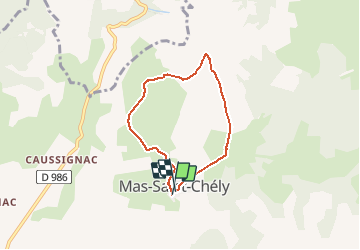
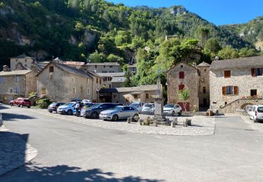
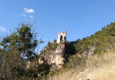
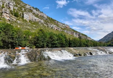
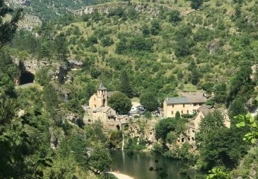
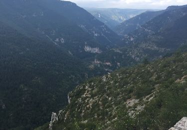
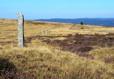
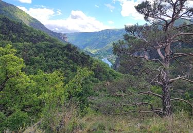
Randonnée Marche de 5,5 km à découvrir à Occitanie, Lozère, Mas-Saint-Chély. Cette randonnée est proposée par rvapeldo.
Description
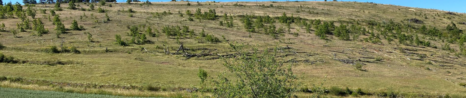
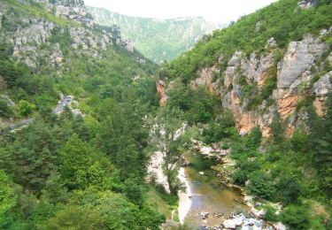
petite promenade au Mont Servy, qui est aussi le nom de l'hotel local, d'où une vue agréable attend le marcheur. Retour par le GR de pays.
Localisation
Pays :
France
Région :
Occitanie
Département/Province :
Lozère
Commune :
Mas-Saint-Chély
Localité :
Unknown
Départ:(Dec)
Départ:(UTM)
531541 ; 4906212 (31T) N.
Commentaires
Randonnées à proximité
![Randonnée Marche Gorges du Tarn Causses - Sentier de St-Chély du Tarn - Photo](https://media.geolcdn.com/t/375/260/ext.jpg?maxdim=2&url=https%3A%2F%2Fservices.sitytrail.com%2FGeolivesWS%2FDownloadMedia.ashx%3FTrailID%3D111743%26Media%3D8149_6.jpg)
![Marche Marche](https://static1.geolcdn.com/sitytour/trail-icons/101.png)
Sentier de St-Chély du Tarn
Marche
Très difficile
(3)
Gorges du Tarn Causses,
Occitanie,
Lozère,
France
![](/images/other/stat-length.png)
15,8 km | 25 km-effort
4h 30min
![](https://static1.geolcdn.com/siteimages/upload/files/16400158638029165_repeat_loop_refresh_sync_direction_icon.png)
Oui
![Randonnée Marche Gorges du Tarn Causses - Saint Chely 17 km - Photo](https://media.geolcdn.com/t/375/260/fd8a2a6b-4459-4f35-901e-690e418ad6dc.jpg&format=jpg&maxdim=2)
![Marche Marche](https://static1.geolcdn.com/sitytour/trail-icons/101.png)
Saint Chely 17 km
Marche
Moyen
Gorges du Tarn Causses,
Occitanie,
Lozère,
France
![](/images/other/stat-length.png)
17,1 km | 27 km-effort
6h 7min
![](https://static1.geolcdn.com/siteimages/upload/files/16400158638029165_repeat_loop_refresh_sync_direction_icon.png)
Oui
![Randonnée Marche Gorges du Tarn Causses - rando saint Charly du Tarn par le haut et retour par le bas - Photo](https://media.geolcdn.com/t/375/260/ext.jpg?maxdim=2&url=https%3A%2F%2Fservices.sitytrail.com%2FGeolivesWS%2FDownloadMedia.ashx%3FTrailID%3D1029620%26Media%3Dfix__20180827152528.jpg)
![Marche Marche](https://static1.geolcdn.com/sitytour/trail-icons/101.png)
rando saint Charly du Tarn par le haut et retour par le bas
Marche
Moyen
Gorges du Tarn Causses,
Occitanie,
Lozère,
France
![](/images/other/stat-length.png)
16,7 km | 26 km-effort
6h 3min
![](https://static1.geolcdn.com/siteimages/upload/files/16400158638029165_repeat_loop_refresh_sync_direction_icon.png)
Oui
![Randonnée Marche Mas-Saint-Chély - 2023/09 Tarn. la malene - Photo](https://media.geolcdn.com/t/375/260/585a2f6b-7c17-4390-9b10-ab1e6a527020.jpg&format=jpg&maxdim=2)
![Marche Marche](https://static1.geolcdn.com/sitytour/trail-icons/101.png)
2023/09 Tarn. la malene
Marche
Difficile
Mas-Saint-Chély,
Occitanie,
Lozère,
France
![](/images/other/stat-length.png)
21 km | 31 km-effort
6h 52min
![](https://static1.geolcdn.com/siteimages/upload/files/16400158638029165_repeat_loop_refresh_sync_direction_icon.png)
Oui
![Randonnée Canoë - kayak Gorges du Tarn Causses - Descente du Tarn - Photo](https://media.geolcdn.com/t/375/260/927e2dd5-b45a-426d-ac63-13be2e6378df.jpg&format=jpg&maxdim=2)
![Canoë - kayak Canoë - kayak](https://static1.geolcdn.com/sitytour/trail-icons/703.png)
Descente du Tarn
Canoë - kayak
Facile
Gorges du Tarn Causses,
Occitanie,
Lozère,
France
![](/images/other/stat-length.png)
18,7 km | 23 km-effort
4h 41min
![](https://static1.geolcdn.com/siteimages/upload/files/16400158638029165_repeat_loop_refresh_sync_direction_icon.png)
Non
![Randonnée Marche Gorges du Tarn Causses - St Chély du Tarn sentier du cirque - Photo](https://media.geolcdn.com/t/375/260/d1e0b352-9279-49a7-af06-dd61814c1a0d.jpg&format=jpg&maxdim=2)
![Marche Marche](https://static1.geolcdn.com/sitytour/trail-icons/101.png)
St Chély du Tarn sentier du cirque
Marche
Moyen
Gorges du Tarn Causses,
Occitanie,
Lozère,
France
![](/images/other/stat-length.png)
16,6 km | 26 km-effort
5h 48min
![](https://static1.geolcdn.com/siteimages/upload/files/16400158638029165_repeat_loop_refresh_sync_direction_icon.png)
Oui
![Randonnée Marche Gorges du Tarn Causses - Laval du Tarn (boucle) - Photo](https://media.geolcdn.com/t/375/260/ext.jpg?maxdim=2&url=https%3A%2F%2Fservices.sitytrail.com%2FGeolivesWS%2FDownloadMedia.ashx%3FTrailID%3D1019167%26Media%3D20180809092152.jpg)
![Marche Marche](https://static1.geolcdn.com/sitytour/trail-icons/101.png)
Laval du Tarn (boucle)
Marche
Facile
Gorges du Tarn Causses,
Occitanie,
Lozère,
France
![](/images/other/stat-length.png)
11,5 km | 15,9 km-effort
2h 48min
![](https://static1.geolcdn.com/siteimages/upload/files/16400158638029165_repeat_loop_refresh_sync_direction_icon.png)
Oui
![Randonnée Marche Mas-Saint-Chély - La draille du Languedoc PR® - Photo](https://media.geolcdn.com/t/375/260/ext.jpg?maxdim=2&url=https%3A%2F%2Fservices.sitytrail.com%2FGeolivesWS%2FDownloadMedia.ashx%3FTrailID%3D316751%26Media%3D4665_1.jpg)
![Marche Marche](https://static1.geolcdn.com/sitytour/trail-icons/101.png)
La draille du Languedoc PR®
Marche
Très difficile
Mas-Saint-Chély,
Occitanie,
Lozère,
France
![](/images/other/stat-length.png)
19,7 km | 31 km-effort
6h 0min
![](https://static1.geolcdn.com/siteimages/upload/files/16400158638029165_repeat_loop_refresh_sync_direction_icon.png)
Oui
![Randonnée Marche Gorges du Tarn Causses - les vignes - Photo](https://media.geolcdn.com/t/375/260/330cf850-dffc-429c-b010-e1f9337b383c.jpg&format=jpg&maxdim=2)
![Marche Marche](https://static1.geolcdn.com/sitytour/trail-icons/101.png)
les vignes
Marche
Très difficile
Gorges du Tarn Causses,
Occitanie,
Lozère,
France
![](/images/other/stat-length.png)
24 km | 34 km-effort
8h 51min
![](https://static1.geolcdn.com/siteimages/upload/files/16400158638029165_repeat_loop_refresh_sync_direction_icon.png)
Non