Randonnée Marche Montrozier - Gages Campeyroux - Photo
 Rere1947
Rere1947

Utilisateur

© OpenStreetMap contributors
Longueur
Longueur
8,4 km
Altitude max
Altitude max
638 m
Dénivelé positif
Dénivelé positif
102 m
Km-Effort
Km-Effort  
9,7 km
Altitude min
Altitude min
589 m
Dénivelé négatif
Dénivelé négatif
102 m
Boucle
Boucle
Oui
Date de création :
2020-07-05 12:39:28.0
Dernière modification :
2020-07-05 14:35:14.816

(0 Avis)

Marche
Marche
1h52
Difficulté : Inconnu

Scannez ce code QR pour ouvrir la randonnée dans l'application SityTrail

Application GPS de randonnée GRATUITE

Logo SityTrail SityTrail

IGN / Instituts géographiques

Télécharger SityTrail sur l'App Store Télécharger SityTrail sur Google Play

Logo SityTrail SityTrail World

Le monde est à vous

Télécharger SityTrail sur l'App Store Télécharger SityTrail sur Google Play Télécharger SityTrail sur Huawei AppGallery

À propos

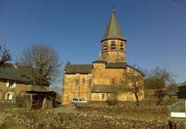
Randonnée Marche de 8,4 km à découvrir à Occitanie, Aveyron, Montrozier. Cette randonnée est proposée par Rere1947.

Description

Circuit Roquebrune Calpeyroux. Circuit ombragé et sans aucune difficulté

Profil altimétrique

Localisation

Pays :
France
Région :
Occitanie
Département/Province :
Aveyron
Commune :
Montrozier
Localité :
Unknown
Départ:(Dec)
Départ:(UTM)
476066 ; 4915938 (31T) N.

Randonnées à proximité

Randonnée Marche Bozouls - Horizons et Clochers du Rouergue - Gillorgues - Photo
Marche
tracegps

Marche

Moyen
Bozouls, Occitanie, Aveyron, France
11,9 km | 15,5 km-effort
3h 0min
Oui
Randonnée Moto-cross Montrozier - av cl 2024 - Photo
Moto-cross
frank12

Moto-cross

Très facile
Montrozier, Occitanie, Aveyron, France
30 km | 42 km-effort
1h 0min
Non
Randonnée V.T.T. Montrozier - VTT  de Gages à la forêt des Palanges 38km  - Photo
V.T.T.
Levillefranchois

V.T.T.

Moyen
Montrozier, Occitanie, Aveyron, France
38 km | 47 km-effort
Inconnu
Oui
Randonnée Marche La Loubière - Espace naturel sensible - Photo
Marche
Lacaze

Marche

Très facile
La Loubière, Occitanie, Aveyron, France
7,4 km | 8,6 km-effort
1h 54min
Oui
Randonnée Marche Bozouls - Gillorgues - Photo
Marche
Lacaze

Marche

Moyen
Bozouls, Occitanie, Aveyron, France
10,9 km | 14,1 km-effort
3h 11min
Oui
Randonnée Marche Montrozier - causse comtal - Photo
Marche
Lacaze

Marche

Facile
Montrozier, Occitanie, Aveyron, France
7 km | 8,1 km-effort
1h 46min
Oui
Randonnée V.T.T. Bozouls - Aboul - Photo
V.T.T.
bonnetchristian

V.T.T.

Très facile
Bozouls, Occitanie, Aveyron, France
5,4 km | 6,9 km-effort
Inconnu
Oui
Randonnée V.T.T. Montrozier - La Combe - Photo
V.T.T.
bonnetchristian

V.T.T.

Très facile
Montrozier, Occitanie, Aveyron, France
4,5 km | 5,4 km-effort
Inconnu
Oui
Randonnée V.T.T. Montrozier - Gages - Photo
V.T.T.
bonnetchristian

V.T.T.

Très facile
Montrozier, Occitanie, Aveyron, France
4,7 km | 6 km-effort
Inconnu
Oui


Fermer
Mes abonnements