![](/images/other/stat-length.png)
![Randonnée Marche Champagney - Grotte prisonniers allemands - château Etobon - Etobon - Photo](https://media.geolcdn.com/t/1900/400/f76125a8-85be-43f8-b3b5-d887afc7fd40.jpg&format=pjpeg&maxdim=2)
Grotte prisonniers allemands - château Etobon - Etobon
Bart2015
Utilisateur
![Longueur](/images/other/stat-length.png)
Longueur
15 km
![Altitude max](https://static1.geolcdn.com/siteimages/upload/files/1508320355ic_sort_altitude_max_24dp.png)
Altitude max
585 m
![Dénivelé positif](https://static1.geolcdn.com/siteimages/upload/files/1508320355ic_sort_den_pos_24dp.png)
Dénivelé positif
533 m
![Km-Effort](/images/other/stat-length.png)
Km-Effort
22 km
![Altitude min](https://static1.geolcdn.com/siteimages/upload/files/1508320355ic_sort_altitude_min_24dp.png)
Altitude min
365 m
![Dénivelé négatif](https://static1.geolcdn.com/siteimages/upload/files/1508320355ic_sort_den_neg_24dp.png)
Dénivelé négatif
534 m
![Boucle](https://static1.geolcdn.com/siteimages/upload/files/16400158638029165_repeat_loop_refresh_sync_direction_icon.png)
Boucle
Oui
Date de création :
2020-07-05 08:52:11.083
Dernière modification :
2020-08-16 06:55:57.52
![Marche](https://static1.geolcdn.com/sitytour/trail-icons/101.png)
4h36
Difficulté : Moyen
![Scannez ce code QR pour ouvrir la randonnée dans l'application SityTrail](https://capi.geolives.com/qq0zvz2zws4bq2lad0pu/sitytour/trails/2462873/qr.png?size=200)
Application GPS de randonnée GRATUITE
À propos
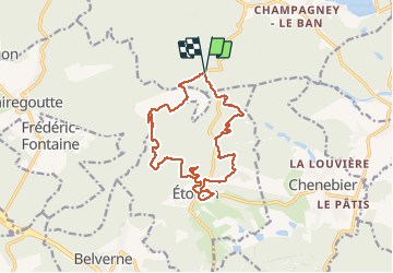
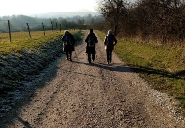
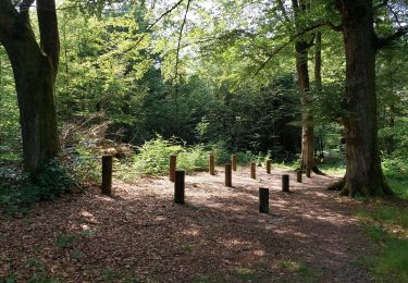
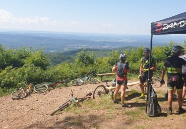
Randonnée Marche de 15 km à découvrir à Bourgogne-Franche-Comté, Haute-Saône, Champagney. Cette randonnée est proposée par Bart2015.
Description
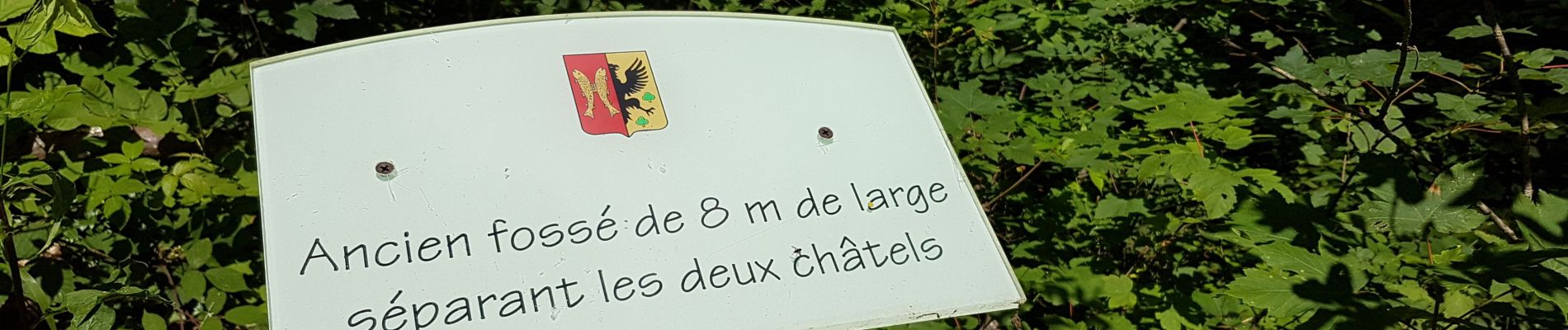
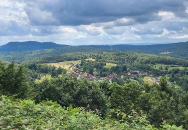
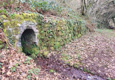
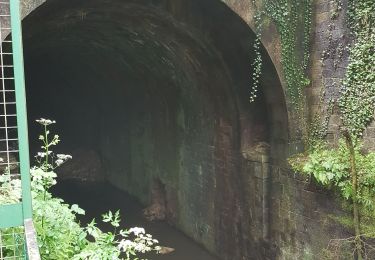
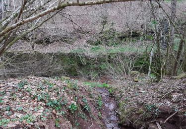
Belle balade avec vue sur la Chapelle de Ronchamp, découverte de la grotte où ont été gardés prisonniers des soldats allemands pendant la 2è guerre mondiale. Passage par les ruines du château d'Etobon puis visite du village.
Bonne randonnée
Localisation
Pays :
France
Région :
Bourgogne-Franche-Comté
Département/Province :
Haute-Saône
Commune :
Champagney
Localité :
Unknown
Départ:(Dec)
Départ:(UTM)
325730 ; 5282210 (32T) N.
Commentaires
Randonnées à proximité
![Randonnée Marche Ronchamp - le tour par la chapelle Ronchamp - Photo](https://media.geolcdn.com/t/375/260/ext.jpg?maxdim=2&url=https%3A%2F%2Fservices.sitytrail.com%2FGeolivesWS%2FDownloadMedia.ashx%3FTrailID%3D200144%26Media%3D20130623170833.jpeg)
![Marche Marche](https://static1.geolcdn.com/sitytour/trail-icons/101.png)
le tour par la chapelle Ronchamp
Marche
Facile
(1)
Ronchamp,
Bourgogne-Franche-Comté,
Haute-Saône,
France
![](/images/other/stat-length.png)
4,2 km | 5,8 km-effort
1h 16min
![](https://static1.geolcdn.com/siteimages/upload/files/16400158638029165_repeat_loop_refresh_sync_direction_icon.png)
Oui
![Randonnée Marche Belverne - Belverne - grotte des prisonniers allemands - Etobon - Photo](https://media.geolcdn.com/t/375/260/672bce46-e385-463a-848a-615cbdc257e6.jpg&format=jpg&maxdim=2)
![Marche Marche](https://static1.geolcdn.com/sitytour/trail-icons/101.png)
Belverne - grotte des prisonniers allemands - Etobon
Marche
Moyen
Belverne,
Bourgogne-Franche-Comté,
Haute-Saône,
France
![](/images/other/stat-length.png)
15 km | 21 km-effort
2h 56min
![](https://static1.geolcdn.com/siteimages/upload/files/16400158638029165_repeat_loop_refresh_sync_direction_icon.png)
Oui
![Randonnée Marche Ronchamp - Ronchamp - Chapelle ND du Haut - sentier de l'Etançon (puits de mines) - Photo](https://media.geolcdn.com/t/375/260/17f2d8a4-0385-46eb-a4ac-833c4b43d439.jpg&format=jpg&maxdim=2)
![Marche Marche](https://static1.geolcdn.com/sitytour/trail-icons/101.png)
Ronchamp - Chapelle ND du Haut - sentier de l'Etançon (puits de mines)
Marche
Difficile
Ronchamp,
Bourgogne-Franche-Comté,
Haute-Saône,
France
![](/images/other/stat-length.png)
10,3 km | 13,6 km-effort
3h 5min
![](https://static1.geolcdn.com/siteimages/upload/files/16400158638029165_repeat_loop_refresh_sync_direction_icon.png)
Oui
![Randonnée Marche Champagney - Canal souterrain de la Haute-Saône - Photo](https://media.geolcdn.com/t/375/260/04c8dd3d-861a-49bc-aa06-88e783162bdc.jpg&format=jpg&maxdim=2)
![Marche Marche](https://static1.geolcdn.com/sitytour/trail-icons/101.png)
Canal souterrain de la Haute-Saône
Marche
Difficile
Champagney,
Bourgogne-Franche-Comté,
Haute-Saône,
France
![](/images/other/stat-length.png)
10,1 km | 13,4 km-effort
3h 3min
![](https://static1.geolcdn.com/siteimages/upload/files/16400158638029165_repeat_loop_refresh_sync_direction_icon.png)
Oui
![Randonnée Marche Frahier-et-Chatebier - frahier - Photo](https://media.geolcdn.com/t/375/260/95f0d94d-e209-4293-8856-d410c2620589.jpg&format=jpg&maxdim=2)
![Marche Marche](https://static1.geolcdn.com/sitytour/trail-icons/101.png)
frahier
Marche
Moyen
(1)
Frahier-et-Chatebier,
Bourgogne-Franche-Comté,
Haute-Saône,
France
![](/images/other/stat-length.png)
5,6 km | 6,8 km-effort
1h 44min
![](https://static1.geolcdn.com/siteimages/upload/files/16400158638029165_repeat_loop_refresh_sync_direction_icon.png)
Oui
![Randonnée Marche Champagney - Champagney - canal de la Haute-Saône - tunnel - Photo](https://media.geolcdn.com/t/375/260/53752e24-7a78-44c3-b746-8236e26bab64.jpg&format=jpg&maxdim=2)
![Marche Marche](https://static1.geolcdn.com/sitytour/trail-icons/101.png)
Champagney - canal de la Haute-Saône - tunnel
Marche
Moyen
Champagney,
Bourgogne-Franche-Comté,
Haute-Saône,
France
![](/images/other/stat-length.png)
5,5 km | 7,5 km-effort
1h 10min
![](https://static1.geolcdn.com/siteimages/upload/files/16400158638029165_repeat_loop_refresh_sync_direction_icon.png)
Oui
![Randonnée Marche Étobon - Etobon - Photo](https://media.geolcdn.com/t/375/260/ext.jpg?maxdim=2&url=https%3A%2F%2Fstatic1.geolcdn.com%2Fsiteimages%2Fupload%2Ffiles%2F1553511878bg_sport_marche.png)
![Marche Marche](https://static1.geolcdn.com/sitytour/trail-icons/101.png)
Etobon
Marche
Très facile
(2)
Étobon,
Bourgogne-Franche-Comté,
Haute-Saône,
France
![](/images/other/stat-length.png)
8,9 km | 12,8 km-effort
4h 0min
![](https://static1.geolcdn.com/siteimages/upload/files/16400158638029165_repeat_loop_refresh_sync_direction_icon.png)
Oui
![Randonnée Marche Champagney - parcours sportif des Épaisses à Champagney - Photo](https://media.geolcdn.com/t/375/260/5ea0a359-1d7e-46eb-81bb-44044f5bf7c9.jpg&format=jpg&maxdim=2)
![Marche Marche](https://static1.geolcdn.com/sitytour/trail-icons/101.png)
parcours sportif des Épaisses à Champagney
Marche
Facile
Champagney,
Bourgogne-Franche-Comté,
Haute-Saône,
France
![](/images/other/stat-length.png)
1,7 km | 2 km-effort
36min
![](https://static1.geolcdn.com/siteimages/upload/files/16400158638029165_repeat_loop_refresh_sync_direction_icon.png)
Oui
![Randonnée V.T.T. Ronchamp - rando VTT club lure, ronchamp la filature, le plainet - Photo](https://media.geolcdn.com/t/375/260/74582360-9399-4bb9-bd36-d524b524a244.jpg&format=jpg&maxdim=2)
![V.T.T. V.T.T.](https://static1.geolcdn.com/sitytour/trail-icons/202.png)
rando VTT club lure, ronchamp la filature, le plainet
V.T.T.
Très difficile
(1)
Ronchamp,
Bourgogne-Franche-Comté,
Haute-Saône,
France
![](/images/other/stat-length.png)
40 km | 54 km-effort
5h 32min
![](https://static1.geolcdn.com/siteimages/upload/files/16400158638029165_repeat_loop_refresh_sync_direction_icon.png)
Oui