![](/images/other/stat-length.png)
![Randonnée Autre activité Villefontaine - C1-45-VILLEFONTAINE-VELIN-DECH - Photo](https://media.geolcdn.com/t/1900/400/ext.pjpeg?maxdim=2&url=https%3A%2F%2Fstatic1.geolcdn.com%2Fsiteimages%2Fupload%2Ffiles%2F1545311037marcheuse_200dpi.jpg)
C1-45-VILLEFONTAINE-VELIN-DECH
amelard
Utilisateur
![Longueur](/images/other/stat-length.png)
Longueur
1 km
![Altitude max](https://static1.geolcdn.com/siteimages/upload/files/1508320355ic_sort_altitude_max_24dp.png)
Altitude max
272 m
![Dénivelé positif](https://static1.geolcdn.com/siteimages/upload/files/1508320355ic_sort_den_pos_24dp.png)
Dénivelé positif
8 m
![Km-Effort](/images/other/stat-length.png)
Km-Effort
1,2 km
![Altitude min](https://static1.geolcdn.com/siteimages/upload/files/1508320355ic_sort_altitude_min_24dp.png)
Altitude min
246 m
![Dénivelé négatif](https://static1.geolcdn.com/siteimages/upload/files/1508320355ic_sort_den_neg_24dp.png)
Dénivelé négatif
24 m
![Boucle](https://static1.geolcdn.com/siteimages/upload/files/16400158638029165_repeat_loop_refresh_sync_direction_icon.png)
Boucle
Non
Date de création :
2014-12-10 00:00:00.0
Dernière modification :
2014-12-10 00:00:00.0
![Autre activité](https://static1.geolcdn.com/sitytour/trail-icons/900.png)
45m
Difficulté : Facile
![Scannez ce code QR pour ouvrir la randonnée dans l'application SityTrail](https://capi.geolives.com/qq0zvz2zws4bq2lad0pu/sitytour/trails/246062/qr.png?size=200)
Application GPS de randonnée GRATUITE
À propos
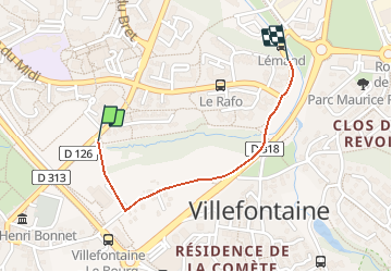
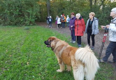
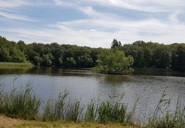
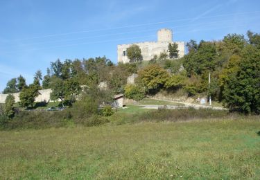
Randonnée Autre activité de 1 km à découvrir à Auvergne-Rhône-Alpes, Isère, Villefontaine. Cette randonnée est proposée par amelard.
Description
Difficulté: Classe 1
Durée: 45mn
Ville: Villefontaine
Départ: Stade Vélin
Arrivée: Route Déchetterie
Localisation
Pays :
France
Région :
Auvergne-Rhône-Alpes
Département/Province :
Isère
Commune :
Villefontaine
Localité :
Unknown
Départ:(Dec)
Départ:(UTM)
667762 ; 5053629 (31T) N.
Commentaires
Randonnées à proximité
![Randonnée Marche Bonnefamille - Bonne Famille - Photo](https://media.geolcdn.com/t/375/260/ext.jpg?maxdim=2&url=https%3A%2F%2Fstatic1.geolcdn.com%2Fsiteimages%2Fupload%2Ffiles%2F1553511878bg_sport_marche.png)
![Marche Marche](https://static1.geolcdn.com/sitytour/trail-icons/101.png)
Bonne Famille
Marche
Très facile
(1)
Bonnefamille,
Auvergne-Rhône-Alpes,
Isère,
France
![](/images/other/stat-length.png)
8,4 km | 10,6 km-effort
2h 23min
![](https://static1.geolcdn.com/siteimages/upload/files/16400158638029165_repeat_loop_refresh_sync_direction_icon.png)
Oui
![V.T.T. V.T.T.](https://static1.geolcdn.com/sitytour/trail-icons/202.png)
Les étangs et le golf
V.T.T.
Vaulx-Milieu,
Auvergne-Rhône-Alpes,
Isère,
France
![](/images/other/stat-length.png)
13,1 km | 16,1 km-effort
1h 18min
![](https://static1.geolcdn.com/siteimages/upload/files/16400158638029165_repeat_loop_refresh_sync_direction_icon.png)
Non
![Randonnée Marche Vaulx-Milieu - vaulx - Photo](https://media.geolcdn.com/t/375/260/ext.jpg?maxdim=2&url=https%3A%2F%2Fservices.sitytrail.com%2FGeolivesWS%2FDownloadMedia.ashx%3FTrailID%3D367906%26Media%3Dfix__20141202151815.jpg)
![Marche Marche](https://static1.geolcdn.com/sitytour/trail-icons/101.png)
vaulx
Marche
Très facile
Vaulx-Milieu,
Auvergne-Rhône-Alpes,
Isère,
France
![](/images/other/stat-length.png)
7,1 km | 9 km-effort
2h 2min
![](https://static1.geolcdn.com/siteimages/upload/files/16400158638029165_repeat_loop_refresh_sync_direction_icon.png)
Oui
![Randonnée Marche Villefontaine - LAETITIA - Photo](https://media.geolcdn.com/t/375/260/756ccec6-e022-4cb5-ade1-8bf07d670600.jpg&format=jpg&maxdim=2)
![Marche Marche](https://static1.geolcdn.com/sitytour/trail-icons/101.png)
LAETITIA
Marche
Très facile
Villefontaine,
Auvergne-Rhône-Alpes,
Isère,
France
![](/images/other/stat-length.png)
3,2 km | 3,9 km-effort
1h 3min
![](https://static1.geolcdn.com/siteimages/upload/files/16400158638029165_repeat_loop_refresh_sync_direction_icon.png)
Oui
![Randonnée Marche Saint-Quentin-Fallavier - Saint Quantin Falavier - Photo](https://media.geolcdn.com/t/375/260/3f5cd956-d678-4c6a-aed9-961da9dce621.jpg&format=jpg&maxdim=2)
![Marche Marche](https://static1.geolcdn.com/sitytour/trail-icons/101.png)
Saint Quantin Falavier
Marche
Moyen
Saint-Quentin-Fallavier,
Auvergne-Rhône-Alpes,
Isère,
France
![](/images/other/stat-length.png)
10,8 km | 13,4 km-effort
3h 8min
![](https://static1.geolcdn.com/siteimages/upload/files/16400158638029165_repeat_loop_refresh_sync_direction_icon.png)
Oui
![Randonnée Cyclotourisme Vaulx-Milieu - Vaulx-Milieu - Hauterives - Photo](https://media.geolcdn.com/t/375/260/748d830b-5085-42c2-ad8c-645514155463.jpg&format=jpg&maxdim=2)
![Cyclotourisme Cyclotourisme](https://static1.geolcdn.com/sitytour/trail-icons/204.png)
Vaulx-Milieu - Hauterives
Cyclotourisme
Difficile
Vaulx-Milieu,
Auvergne-Rhône-Alpes,
Isère,
France
![](/images/other/stat-length.png)
61 km | 75 km-effort
3h 19min
![](https://static1.geolcdn.com/siteimages/upload/files/16400158638029165_repeat_loop_refresh_sync_direction_icon.png)
Non
![Randonnée Vélo Villefontaine - Villages et Châteaux - Photo](https://media.geolcdn.com/t/375/260/ext.jpg?maxdim=2&url=https%3A%2F%2Fservices.sitytrail.com%2FGeolivesWS%2FDownloadMedia.ashx%3FTrailID%3D401336%26Media%3Dfix__20150327133622.jpg)
![Vélo Vélo](https://static1.geolcdn.com/sitytour/trail-icons/200.png)
Villages et Châteaux
Vélo
Moyen
Villefontaine,
Auvergne-Rhône-Alpes,
Isère,
France
![](/images/other/stat-length.png)
49 km | 57 km-effort
3h 18min
![](https://static1.geolcdn.com/siteimages/upload/files/16400158638029165_repeat_loop_refresh_sync_direction_icon.png)
Oui
![Randonnée V.T.T. Diémoz - De Saint Georges d'Espéranche à Artas - Photo](https://media.geolcdn.com/t/375/260/ext.jpg?maxdim=2&url=https%3A%2F%2Fservices.sitytrail.com%2FGeolivesWS%2FDownloadMedia.ashx%3FTrailID%3D103074%26Media%3D4765_1.jpg)
![V.T.T. V.T.T.](https://static1.geolcdn.com/sitytour/trail-icons/202.png)
De Saint Georges d'Espéranche à Artas
V.T.T.
Moyen
Diémoz,
Auvergne-Rhône-Alpes,
Isère,
France
![](/images/other/stat-length.png)
33 km | 41 km-effort
2h 30min
![](https://static1.geolcdn.com/siteimages/upload/files/16400158638029165_repeat_loop_refresh_sync_direction_icon.png)
Oui
![Randonnée V.T.T. Saint-Quentin-Fallavier - La St Quentinoise 2008 - Photo](https://media.geolcdn.com/t/375/260/ext.jpg?maxdim=2&url=https%3A%2F%2Fservices.sitytrail.com%2FGeolivesWS%2FDownloadMedia.ashx%3FTrailID%3D102873%26Media%3D4080_1.jpg)
![V.T.T. V.T.T.](https://static1.geolcdn.com/sitytour/trail-icons/202.png)
La St Quentinoise 2008
V.T.T.
Difficile
Saint-Quentin-Fallavier,
Auvergne-Rhône-Alpes,
Isère,
France
![](/images/other/stat-length.png)
47 km | 60 km-effort
4h 0min
![](https://static1.geolcdn.com/siteimages/upload/files/16400158638029165_repeat_loop_refresh_sync_direction_icon.png)
Oui