![](/images/other/stat-length.png)
![Randonnée Marche Zwalin - Ommetje Ter Biestmolen - Photo](https://media.geolcdn.com/t/1900/400/f78d78ff-3fe7-492e-8201-bf11f7876cf4.jpg&format=pjpeg&maxdim=2)
Ommetje Ter Biestmolen
bboydens
Utilisateur
![Longueur](/images/other/stat-length.png)
Longueur
1 km
![Altitude max](https://static1.geolcdn.com/siteimages/upload/files/1508320355ic_sort_altitude_max_24dp.png)
Altitude max
14 m
![Dénivelé positif](https://static1.geolcdn.com/siteimages/upload/files/1508320355ic_sort_den_pos_24dp.png)
Dénivelé positif
4 m
![Km-Effort](/images/other/stat-length.png)
Km-Effort
1,1 km
![Altitude min](https://static1.geolcdn.com/siteimages/upload/files/1508320355ic_sort_altitude_min_24dp.png)
Altitude min
10 m
![Dénivelé négatif](https://static1.geolcdn.com/siteimages/upload/files/1508320355ic_sort_den_neg_24dp.png)
Dénivelé négatif
3 m
![Boucle](https://static1.geolcdn.com/siteimages/upload/files/16400158638029165_repeat_loop_refresh_sync_direction_icon.png)
Boucle
Oui
Date de création :
2020-06-29 16:03:02.94
Dernière modification :
2020-06-29 16:18:04.23
![Marche](https://static1.geolcdn.com/sitytour/trail-icons/101.png)
14m
Difficulté : Facile
![Scannez ce code QR pour ouvrir la randonnée dans l'application SityTrail](https://capi.geolives.com/qq0zvz2zws4bq2lad0pu/sitytour/trails/2455284/qr.png?size=200)
Application GPS de randonnée GRATUITE
À propos
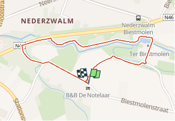
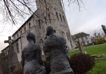
Randonnée Marche de 1 km à découvrir à Flandre, Flandre orientale, Zwalin. Cette randonnée est proposée par bboydens.
Description
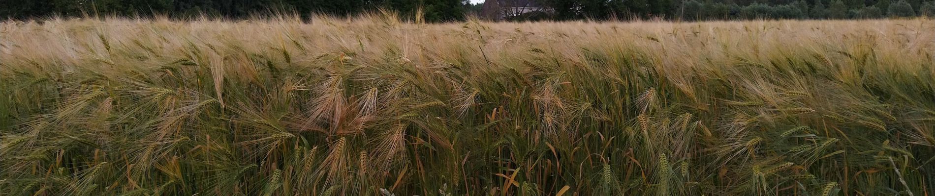
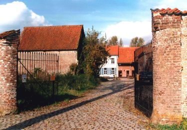
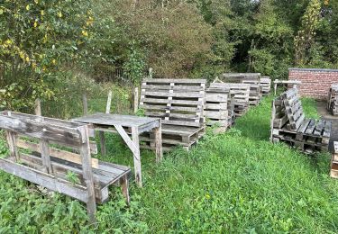
Get a fresh nose while stretching your leggs for 15 minutesover this walking trail in nature around Ter Biestmolen and B&B De Notelaar.
Localisation
Pays :
Belgique
Région :
Flandre
Département/Province :
Flandre orientale
Commune :
Zwalin
Localité :
Nederzwalm-Hermelgem
Départ:(Dec)
Départ:(UTM)
548555 ; 5637152 (31U) N.
Commentaires
Randonnées à proximité
![Randonnée A pied Kruisem - Wannenlappersroute - Photo](https://media.geolcdn.com/t/375/260/9cc6bd5f-c4ad-444a-810b-8d9582f61d50.jpeg&format=jpg&maxdim=2)
![A pied A pied](https://static1.geolcdn.com/sitytour/trail-icons/100.png)
Wannenlappersroute
A pied
Facile
Kruisem,
Flandre,
Flandre orientale,
Belgique
![](/images/other/stat-length.png)
9,6 km | 10,3 km-effort
2h 20min
![](https://static1.geolcdn.com/siteimages/upload/files/16400158638029165_repeat_loop_refresh_sync_direction_icon.png)
Oui
![Randonnée Marche Zwalin - Sint-Blasius Boeckel 16,2 km - Photo](https://media.geolcdn.com/t/375/260/a23d2ae7-4c1c-4f06-8319-0207cd98ef62.jpg&format=jpg&maxdim=2)
![Marche Marche](https://static1.geolcdn.com/sitytour/trail-icons/101.png)
Sint-Blasius Boeckel 16,2 km
Marche
Moyen
Zwalin,
Flandre,
Flandre orientale,
Belgique
![](/images/other/stat-length.png)
16,2 km | 19,5 km-effort
4h 40min
![](https://static1.geolcdn.com/siteimages/upload/files/16400158638029165_repeat_loop_refresh_sync_direction_icon.png)
Oui
![Randonnée Marche Audenarde - Ename 13,5 km - Photo](https://media.geolcdn.com/t/375/260/7a8ce4f2-9472-418d-8d4d-b1ad03c191eb.jpg&format=jpg&maxdim=2)
![Marche Marche](https://static1.geolcdn.com/sitytour/trail-icons/101.png)
Ename 13,5 km
Marche
Facile
Audenarde,
Flandre,
Flandre orientale,
Belgique
![](/images/other/stat-length.png)
13,5 km | 15,6 km-effort
5h 10min
![](https://static1.geolcdn.com/siteimages/upload/files/16400158638029165_repeat_loop_refresh_sync_direction_icon.png)
Oui
![Randonnée Marche Zwalin - Sint-blasius Boeckel 18,6 km - Photo](https://media.geolcdn.com/t/375/260/7ed549ef-1597-4734-8445-4049ae1d40cb.jpg&format=jpg&maxdim=2)
![Marche Marche](https://static1.geolcdn.com/sitytour/trail-icons/101.png)
Sint-blasius Boeckel 18,6 km
Marche
Facile
Zwalin,
Flandre,
Flandre orientale,
Belgique
![](/images/other/stat-length.png)
18,6 km | 22 km-effort
4h 26min
![](https://static1.geolcdn.com/siteimages/upload/files/16400158638029165_repeat_loop_refresh_sync_direction_icon.png)
Oui
![Randonnée Marche Audenarde - Ename 18,5 km - Photo](https://media.geolcdn.com/t/375/260/ext.jpg?maxdim=2&url=https%3A%2F%2Fservices.sitytrail.com%2FGeolivesWS%2FDownloadMedia.ashx%3FTrailID%3D1146746%26Media%3D20190501152240.jpg)
![Marche Marche](https://static1.geolcdn.com/sitytour/trail-icons/101.png)
Ename 18,5 km
Marche
Très facile
Audenarde,
Flandre,
Flandre orientale,
Belgique
![](/images/other/stat-length.png)
19 km | 21 km-effort
5h 6min
![](https://static1.geolcdn.com/siteimages/upload/files/16400158638029165_repeat_loop_refresh_sync_direction_icon.png)
Oui
![Randonnée Marche Audenarde - Welden 21 km - Photo](https://media.geolcdn.com/t/375/260/ext.jpg?maxdim=2&url=https%3A%2F%2Fservices.sitytrail.com%2FGeolivesWS%2FDownloadMedia.ashx%3FTrailID%3D1090008%26Media%3D20181230152121.jpg)
![Marche Marche](https://static1.geolcdn.com/sitytour/trail-icons/101.png)
Welden 21 km
Marche
Facile
Audenarde,
Flandre,
Flandre orientale,
Belgique
![](/images/other/stat-length.png)
22 km | 24 km-effort
5h 20min
![](https://static1.geolcdn.com/siteimages/upload/files/16400158638029165_repeat_loop_refresh_sync_direction_icon.png)
Oui
![Randonnée Marche Zwalin - langs de Zwalmmolen - Photo](https://media.geolcdn.com/t/375/260/ext.jpg?maxdim=2&url=https%3A%2F%2Fservices.sitytrail.com%2FGeolivesWS%2FDownloadMedia.ashx%3FTrailID%3D1012110%26Media%3D20180728173545.jpg)
![Marche Marche](https://static1.geolcdn.com/sitytour/trail-icons/101.png)
langs de Zwalmmolen
Marche
Très facile
Zwalin,
Flandre,
Flandre orientale,
Belgique
![](/images/other/stat-length.png)
6 km | 6,7 km-effort
2h 16min
![](https://static1.geolcdn.com/siteimages/upload/files/16400158638029165_repeat_loop_refresh_sync_direction_icon.png)
Oui
![Randonnée Marche Audenarde - Bos van Ename (Oudenaarde) - Photo](https://media.geolcdn.com/t/375/260/e5c54ac0-06b5-4e06-8d2b-adc34b0e44d7.jpg&format=jpg&maxdim=2)
![Marche Marche](https://static1.geolcdn.com/sitytour/trail-icons/101.png)
Bos van Ename (Oudenaarde)
Marche
Moyen
Audenarde,
Flandre,
Flandre orientale,
Belgique
![](/images/other/stat-length.png)
6,6 km | 7,9 km-effort
1h 48min
![](https://static1.geolcdn.com/siteimages/upload/files/16400158638029165_repeat_loop_refresh_sync_direction_icon.png)
Oui
![Randonnée Marche Zwalin - Rozebeke 15 km - Photo](https://media.geolcdn.com/t/375/260/ext.jpg?maxdim=2&url=https%3A%2F%2Fstatic1.geolcdn.com%2Fsiteimages%2Fupload%2Ffiles%2F1553511878bg_sport_marche.png)
![Marche Marche](https://static1.geolcdn.com/sitytour/trail-icons/101.png)
Rozebeke 15 km
Marche
Très facile
Zwalin,
Flandre,
Flandre orientale,
Belgique
![](/images/other/stat-length.png)
15,2 km | 17,3 km-effort
3h 27min
![](https://static1.geolcdn.com/siteimages/upload/files/16400158638029165_repeat_loop_refresh_sync_direction_icon.png)
Oui