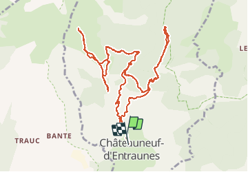
![](/images/other/stat-length.png)
![Randonnée Marche Châteauneuf-d'Entraunes - Châteauneuf d'Entraunes Gorges de Saucha Negra, vers Cime Chamoussillon - Photo](https://media.geolcdn.com/t/1900/400/eb6886cf-9755-480b-a06f-27ce2f70c557.jpg&format=pjpeg&maxdim=2)
Châteauneuf d'Entraunes Gorges de Saucha Negra, vers Cime Chamoussillon
GrouGary
Utilisateur
![Longueur](/images/other/stat-length.png)
![Altitude max](https://static1.geolcdn.com/siteimages/upload/files/1508320355ic_sort_altitude_max_24dp.png)
![Dénivelé positif](https://static1.geolcdn.com/siteimages/upload/files/1508320355ic_sort_den_pos_24dp.png)
![Km-Effort](/images/other/stat-length.png)
![Altitude min](https://static1.geolcdn.com/siteimages/upload/files/1508320355ic_sort_altitude_min_24dp.png)
![Dénivelé négatif](https://static1.geolcdn.com/siteimages/upload/files/1508320355ic_sort_den_neg_24dp.png)
![Boucle](https://static1.geolcdn.com/siteimages/upload/files/16400158638029165_repeat_loop_refresh_sync_direction_icon.png)
![Marche](https://static1.geolcdn.com/sitytour/trail-icons/101.png)
7h02
Difficulté : Très facile
![Scannez ce code QR pour ouvrir la randonnée dans l'application SityTrail](https://capi.geolives.com/qq0zvz2zws4bq2lad0pu/sitytour/trails/2451293/qr.png?size=200)
Application GPS de randonnée GRATUITE
À propos
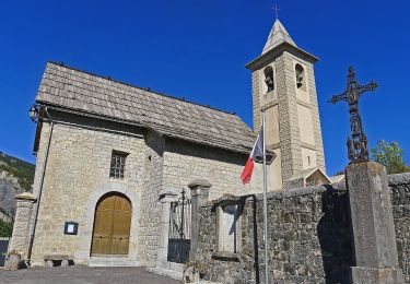
Randonnée Marche de 15,2 km à découvrir à Provence-Alpes-Côte d'Azur, Alpes-Maritimes, Châteauneuf-d'Entraunes. Cette randonnée est proposée par GrouGary.
Description
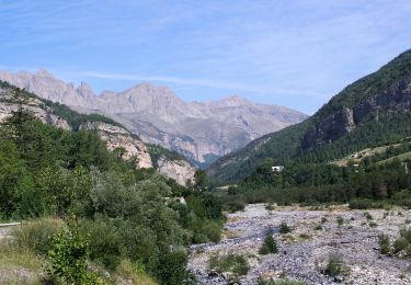
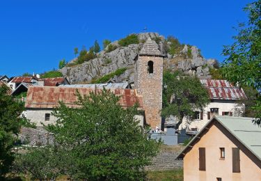
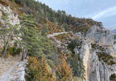
Une belle découverte des Gorges de Saucha Negra, où niche dans les falaises le Tichodrome Echelette, un oiseau rare dans la région, espèce paléomontagnarde strictement paléarctique, sans équivalent dans le reste du monde. C'est un passereau gris et rouge en-dessous.
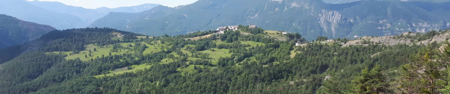
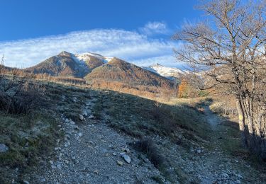
Puis montée chaude en cette fin juin vers la Coletta.
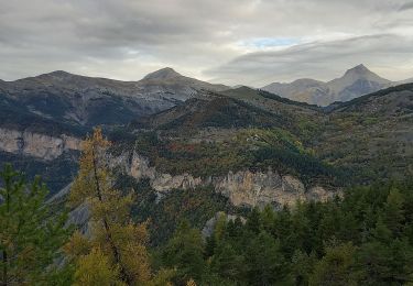
Retour par une piste originale dans les marnes noires (roubines)
Localisation
Commentaires
Randonnées à proximité
![Randonnée A pied Villeneuve-d'Entraunes - Circuit Enaux-Sussis - Photo](https://media.geolcdn.com/t/375/260/8f87238f-42fa-40a1-a80f-8030601f802a.jpeg&format=jpg&maxdim=2)
![A pied A pied](https://static1.geolcdn.com/sitytour/trail-icons/100.png)
A pied
![](/images/other/stat-length.png)
![](https://static1.geolcdn.com/siteimages/upload/files/16400158638029165_repeat_loop_refresh_sync_direction_icon.png)
![Randonnée A pied Sauze - Hameaux de Sauze - Photo](https://media.geolcdn.com/t/375/260/8de1e0fb-d754-4ba0-84e6-05cab893c487.jpeg&format=jpg&maxdim=2)
![A pied A pied](https://static1.geolcdn.com/sitytour/trail-icons/100.png)
A pied
![](/images/other/stat-length.png)
![](https://static1.geolcdn.com/siteimages/upload/files/16400158638029165_repeat_loop_refresh_sync_direction_icon.png)
![Randonnée Marche Sauze - Mont St Honorât - Photo](https://media.geolcdn.com/t/375/260/60060653-5e59-4e6b-ba0a-f1f4b45ca880.jpg&format=jpg&maxdim=2)
![Marche Marche](https://static1.geolcdn.com/sitytour/trail-icons/101.png)
Marche
![](/images/other/stat-length.png)
![](https://static1.geolcdn.com/siteimages/upload/files/16400158638029165_repeat_loop_refresh_sync_direction_icon.png)
![Randonnée Marche Châteauneuf-d'Entraunes - Cime de l’Aspre - Photo](https://media.geolcdn.com/t/375/260/9165f8a5-3868-4e25-b7f0-6a7fc7a7b2b6.jpg&format=jpg&maxdim=2)
![Marche Marche](https://static1.geolcdn.com/sitytour/trail-icons/101.png)
Marche
![](/images/other/stat-length.png)
![](https://static1.geolcdn.com/siteimages/upload/files/16400158638029165_repeat_loop_refresh_sync_direction_icon.png)
![Randonnée A pied Châteauneuf-d'Entraunes - Boucle de la Barlatte - Photo](https://media.geolcdn.com/t/375/260/aff95dff-f01d-44c8-8159-2c0a42fccf8f.jpeg&format=jpg&maxdim=2)
![A pied A pied](https://static1.geolcdn.com/sitytour/trail-icons/100.png)
A pied
![](/images/other/stat-length.png)
![](https://static1.geolcdn.com/siteimages/upload/files/16400158638029165_repeat_loop_refresh_sync_direction_icon.png)
![Randonnée Marche Guillaumes - Ruines de Theoulins - Photo](https://media.geolcdn.com/t/375/260/3edf72db-8239-4d85-bded-6988e7526b3a.jpg&format=jpg&maxdim=2)
![Marche Marche](https://static1.geolcdn.com/sitytour/trail-icons/101.png)
Marche
![](/images/other/stat-length.png)
![](https://static1.geolcdn.com/siteimages/upload/files/16400158638029165_repeat_loop_refresh_sync_direction_icon.png)
![Randonnée sport Villeneuve-d'Entraunes - Bouquetin - Photo](https://media.geolcdn.com/t/375/260/ext.jpg?maxdim=2&url=https%3A%2F%2Fsecurestorage.geolives.com%2Fsitytour%2Ftrail-bg%2Fdefault.jpg)
sport
![](/images/other/stat-length.png)
![](https://static1.geolcdn.com/siteimages/upload/files/16400158638029165_repeat_loop_refresh_sync_direction_icon.png)
![Randonnée Marche Villeneuve-d'Entraunes - le pas Roubinous - Photo](https://media.geolcdn.com/t/375/260/ext.jpg?maxdim=2&url=https%3A%2F%2Fstatic1.geolcdn.com%2Fsiteimages%2Fupload%2Ffiles%2F1553511878bg_sport_marche.png)
![Marche Marche](https://static1.geolcdn.com/sitytour/trail-icons/101.png)
Marche
![](/images/other/stat-length.png)
![](https://static1.geolcdn.com/siteimages/upload/files/16400158638029165_repeat_loop_refresh_sync_direction_icon.png)
![Randonnée Marche Sauze - 20190511 CAF big boucle Sauze - gorges Daluis - Photo](https://media.geolcdn.com/t/375/260/ext.jpg?maxdim=2&url=https%3A%2F%2Fstatic1.geolcdn.com%2Fsiteimages%2Fupload%2Ffiles%2F1553511878bg_sport_marche.png)
![Marche Marche](https://static1.geolcdn.com/sitytour/trail-icons/101.png)
Marche
![](/images/other/stat-length.png)
![](https://static1.geolcdn.com/siteimages/upload/files/16400158638029165_repeat_loop_refresh_sync_direction_icon.png)