![](/images/other/stat-length.png)
![Randonnée Marche Termes - Termes ( Aude ) + les gorges de Terminet +le Nitable roc - Photo](https://media.geolcdn.com/t/1900/400/3c7c76e3-a6e6-4917-9585-a86189afa3e6.jpg&format=pjpeg&maxdim=2)
Termes ( Aude ) + les gorges de Terminet +le Nitable roc
MarieFrancoise
Utilisateur
![Longueur](/images/other/stat-length.png)
![Altitude max](https://static1.geolcdn.com/siteimages/upload/files/1508320355ic_sort_altitude_max_24dp.png)
![Dénivelé positif](https://static1.geolcdn.com/siteimages/upload/files/1508320355ic_sort_den_pos_24dp.png)
![Km-Effort](/images/other/stat-length.png)
![Altitude min](https://static1.geolcdn.com/siteimages/upload/files/1508320355ic_sort_altitude_min_24dp.png)
![Dénivelé négatif](https://static1.geolcdn.com/siteimages/upload/files/1508320355ic_sort_den_neg_24dp.png)
![Boucle](https://static1.geolcdn.com/siteimages/upload/files/16400158638029165_repeat_loop_refresh_sync_direction_icon.png)
![Marche](https://static1.geolcdn.com/sitytour/trail-icons/101.png)
6h57
Difficulté : Moyen
![Scannez ce code QR pour ouvrir la randonnée dans l'application SityTrail](https://capi.geolives.com/qq0zvz2zws4bq2lad0pu/sitytour/trails/2442224/qr.png?size=200)
Application GPS de randonnée GRATUITE
À propos
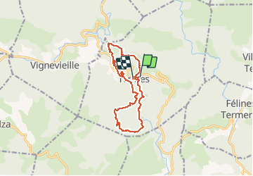
Randonnée Marche de 15,8 km à découvrir à Occitanie, Aude, Termes. Cette randonnée est proposée par MarieFrancoise.
Description
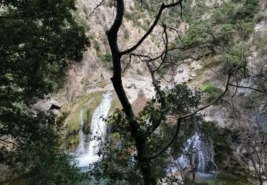
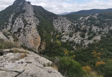
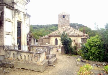
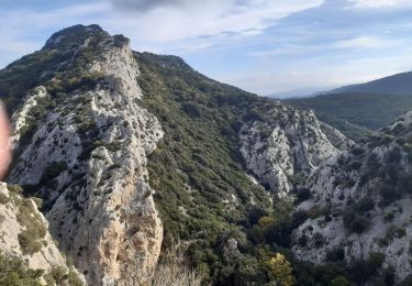
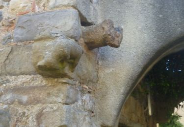
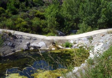
Départ du parking à l entrée de Termes.la rando se compose de 2 parties .les gorges de Termenet et le château puis en second le Nitable roc .La 1ère partie est plus jolie et on peut se baigner dans les magnifiques gorges .si on ne souhaite pas faire la seconde partie qui compte 200 m de dénivelé et environ 7 km)on peut après le château rentrer au village qui est très typique .il y a un café .
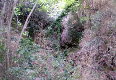
déconseillé l 'été bien que le parcours se fasse en grande partie en forêt.
il y a dans chaque partie une descente assez raide à signaler.
Localisation
Commentaires
Randonnées à proximité
![Randonnée Marche Termes - Termes Nitable Roc - Photo](https://media.geolcdn.com/t/375/260/1e846430-9c95-4083-8998-af241687d490.jpg&format=jpg&maxdim=2)
![Marche Marche](https://static1.geolcdn.com/sitytour/trail-icons/101.png)
![Randonnée Marche Termes - Termes Nitable Roc - Photo](https://media.geolcdn.com/t/375/260/05d263cd-66c0-4a9b-b66b-1220e1255d5e.jpg&format=jpg&maxdim=2)
![Marche Marche](https://static1.geolcdn.com/sitytour/trail-icons/101.png)
![Randonnée Marche Termes - Termes Christophe - Photo](https://media.geolcdn.com/t/375/260/afe8174b-5e88-441e-b93d-7b8d107fe93e.jpg&format=jpg&maxdim=2)
![Marche Marche](https://static1.geolcdn.com/sitytour/trail-icons/101.png)
![Randonnée A pied Félines-Termenès - Au Fil du Temps - Photo](https://media.geolcdn.com/t/375/260/6df64c81-4f12-457f-ad6a-247c9b1f1cff.jpeg&format=jpg&maxdim=2)
![A pied A pied](https://static1.geolcdn.com/sitytour/trail-icons/100.png)
A pied
![](/images/other/stat-length.png)
![](https://static1.geolcdn.com/siteimages/upload/files/16400158638029165_repeat_loop_refresh_sync_direction_icon.png)
![Randonnée Divers Termes - termes 1ere boucle - Photo](https://media.geolcdn.com/t/375/260/e26ca2a0-c961-4141-9e5d-edd75ef5262f.jpg&format=jpg&maxdim=2)
![Divers Divers](https://static1.geolcdn.com/sitytour/trail-icons/900.png)
![Marche Marche](https://static1.geolcdn.com/sitytour/trail-icons/101.png)
Marche
![](/images/other/stat-length.png)
![](https://static1.geolcdn.com/siteimages/upload/files/16400158638029165_repeat_loop_refresh_sync_direction_icon.png)
![Randonnée Marche Davejean - DAVEJEAN - Les petits chemins de Davejean - Photo](https://media.geolcdn.com/t/375/260/badd948f-60b6-4449-ae7e-ae4e5eeb8a04.jpg&format=jpg&maxdim=2)
![Marche Marche](https://static1.geolcdn.com/sitytour/trail-icons/101.png)
Marche
![](/images/other/stat-length.png)
![](https://static1.geolcdn.com/siteimages/upload/files/16400158638029165_repeat_loop_refresh_sync_direction_icon.png)
![Randonnée Marche Félines-Termenès - FELINES TERMENES - au fil du temps la pierre - Photo](https://media.geolcdn.com/t/375/260/d59645b7-7e66-47ca-bb06-8a5d10f4cd47.jpg&format=jpg&maxdim=2)
![Marche Marche](https://static1.geolcdn.com/sitytour/trail-icons/101.png)
Marche
![](/images/other/stat-length.png)
![](https://static1.geolcdn.com/siteimages/upload/files/16400158638029165_repeat_loop_refresh_sync_direction_icon.png)
![Randonnée Marche Termes - 11-Termes-Nitable Roc-Gorge du Terminet-30:08:2015* - Photo](https://media.geolcdn.com/t/375/260/ext.jpg?maxdim=2&url=https%3A%2F%2Fstatic1.geolcdn.com%2Fsiteimages%2Fupload%2Ffiles%2F1553511878bg_sport_marche.png)
![Marche Marche](https://static1.geolcdn.com/sitytour/trail-icons/101.png)
Marche
![](/images/other/stat-length.png)
![](https://static1.geolcdn.com/siteimages/upload/files/16400158638029165_repeat_loop_refresh_sync_direction_icon.png)