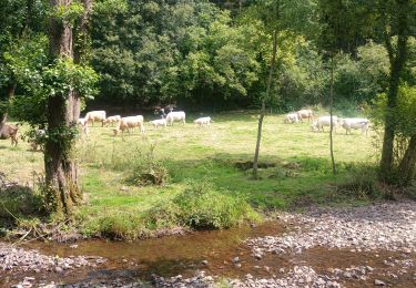
12,6 km | 15,9 km-effort
Moulin Pinel- la souleuve
cecirealain
Utilisateur
Longueur
9,6 km
Altitude max
190 m
Dénivelé positif
240 m
Km-Effort
12,8 km
Altitude min
91 m
Dénivelé négatif
243 m
Boucle
Oui
Date de création :
2020-06-18 06:56:38.126
Dernière modification :
2020-06-18 13:05:44.958
2h53
Difficulté : Difficile
Application GPS de randonnée GRATUITE
À propos
Randonnée Marche de 9,6 km à découvrir à Normandie, Calvados, Souleuvre-en-Bocage. Cette randonnée est proposée par cecirealain.
Localisation
Pays :
France
Région :
Normandie
Département/Province :
Calvados
Commune :
Souleuvre-en-Bocage
Localité :
Le Tourneur
Départ:(Dec)
Départ:(UTM)
658879 ; 5424806 (30U) N.
Commentaires
Randonnées à proximité
rando de la souleuvre
V.T.T.
Moyen
(1)
Souleuvre-en-Bocage,
Normandie,
Calvados,
France
25 km | 32 km-effort
2h 7min
Oui
SAINT PIERRE TARENTAINE
Marche
Très difficile
(1)
Souleuvre-en-Bocage,
Normandie,
Calvados,
France
19,7 km | 26 km-effort
5h 47min
Oui
La vire
Marche
Moyen
Souleuvre-en-Bocage,
Normandie,
Calvados,
France
22 km | 28 km-effort
5h 0min
Oui
Première
Moto
Facile
Souleuvre-en-Bocage,
Normandie,
Calvados,
France
39 km | 50 km-effort
2h 4min
Non
Rando Viaduc de la souleuvre
Marche
Facile
Souleuvre-en-Bocage,
Normandie,
Calvados,
France
9,6 km | 12,2 km-effort
3h 2min
Non
LA SOULEUVRE EN BOUCLE
Marche
Très difficile
Souleuvre-en-Bocage,
Normandie,
Calvados,
France
19,7 km | 25 km-effort
5h 40min
Oui
La souleuvre 2
Marche
Moyen
Souleuvre-en-Bocage,
Normandie,
Calvados,
France
7,7 km | 10,6 km-effort
2h 23min
Oui
La souleuvre 1
Marche
Difficile
Souleuvre-en-Bocage,
Normandie,
Calvados,
France
12,5 km | 16,5 km-effort
3h 44min
Oui