![](/images/other/stat-length.png)
![Randonnée Vélo électrique Roquestéron - Boucle Roquesteron - Collongues - St Auban - Aiglun - Roquesteron - Photo](https://media.geolcdn.com/t/1900/400/ext.pjpeg?maxdim=2&url=https%3A%2F%2Fstatic1.geolcdn.com%2Fsiteimages%2Fupload%2Ffiles%2F1524743154velo.jpg)
Boucle Roquesteron - Collongues - St Auban - Aiglun - Roquesteron
franquen
Utilisateur
![Longueur](/images/other/stat-length.png)
Longueur
72 km
![Altitude max](https://static1.geolcdn.com/siteimages/upload/files/1508320355ic_sort_altitude_max_24dp.png)
Altitude max
1167 m
![Dénivelé positif](https://static1.geolcdn.com/siteimages/upload/files/1508320355ic_sort_den_pos_24dp.png)
Dénivelé positif
1831 m
![Km-Effort](/images/other/stat-length.png)
Km-Effort
97 km
![Altitude min](https://static1.geolcdn.com/siteimages/upload/files/1508320355ic_sort_altitude_min_24dp.png)
Altitude min
342 m
![Dénivelé négatif](https://static1.geolcdn.com/siteimages/upload/files/1508320355ic_sort_den_neg_24dp.png)
Dénivelé négatif
1862 m
![Boucle](https://static1.geolcdn.com/siteimages/upload/files/16400158638029165_repeat_loop_refresh_sync_direction_icon.png)
Boucle
Oui
Date de création :
2020-06-14 07:56:16.302
Dernière modification :
2020-06-14 15:58:23.907
![Vélo électrique](https://static1.geolcdn.com/sitytour/trail-icons/205.png)
5h02
Difficulté : Moyen
![Scannez ce code QR pour ouvrir la randonnée dans l'application SityTrail](https://capi.geolives.com/qq0zvz2zws4bq2lad0pu/sitytour/trails/2436124/qr.png?size=200)
Application GPS de randonnée GRATUITE
À propos
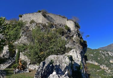
Randonnée Vélo électrique de 72 km à découvrir à Provence-Alpes-Côte d'Azur, Alpes-Maritimes, Roquestéron. Cette randonnée est proposée par franquen.
Description
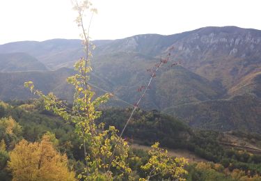
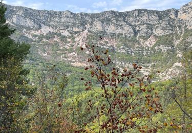
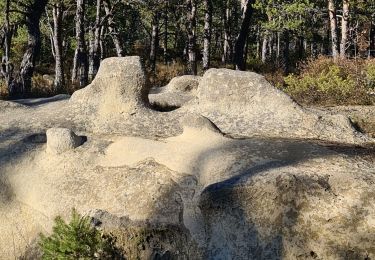
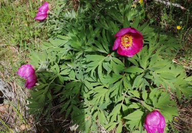
belle balade forêts pour l'aller et très minéral au retour . de belles clues (St Auban, Le Mas, Aiglun)
économiser la batterie car pas mal de dénivelé !
Localisation
Pays :
France
Région :
Provence-Alpes-Côte d'Azur
Département/Province :
Alpes-Maritimes
Commune :
Roquestéron
Localité :
Unknown
Départ:(Dec)
Départ:(UTM)
339529 ; 4859916 (32T) N.
Commentaires
Randonnées à proximité
![Randonnée A pied Cuébris - Traversée de l'Estéron - Etape 4 - Photo](https://media.geolcdn.com/t/375/260/f8de4af9-418d-46b2-8971-b8252c239bb2.jpeg&format=jpg&maxdim=2)
![A pied A pied](https://static1.geolcdn.com/sitytour/trail-icons/100.png)
Traversée de l'Estéron - Etape 4
A pied
Très difficile
Cuébris,
Provence-Alpes-Côte d'Azur,
Alpes-Maritimes,
France
![](/images/other/stat-length.png)
24 km | 46 km-effort
10h 21min
![](https://static1.geolcdn.com/siteimages/upload/files/16400158638029165_repeat_loop_refresh_sync_direction_icon.png)
Non
![Randonnée A pied Sigale - Circuit de la Cacia - Photo](https://media.geolcdn.com/t/375/260/af8f583b-85f0-4a9c-891f-ad74e419fc87.jpeg&format=jpg&maxdim=2)
![A pied A pied](https://static1.geolcdn.com/sitytour/trail-icons/100.png)
Circuit de la Cacia
A pied
Facile
Sigale,
Provence-Alpes-Côte d'Azur,
Alpes-Maritimes,
France
![](/images/other/stat-length.png)
9,6 km | 18,7 km-effort
4h 15min
![](https://static1.geolcdn.com/siteimages/upload/files/16400158638029165_repeat_loop_refresh_sync_direction_icon.png)
Oui
![Randonnée Marche Sigale - Cime CACCIA, SIGALE (06) - Photo](https://media.geolcdn.com/t/375/260/ext.jpg?maxdim=2&url=https%3A%2F%2Fservices.sitytrail.com%2FGeolivesWS%2FDownloadMedia.ashx%3FTrailID%3D497165%26Media%3Dfix__20151125111722.jpg)
![Marche Marche](https://static1.geolcdn.com/sitytour/trail-icons/101.png)
Cime CACCIA, SIGALE (06)
Marche
Moyen
(1)
Sigale,
Provence-Alpes-Côte d'Azur,
Alpes-Maritimes,
France
![](/images/other/stat-length.png)
9,3 km | 17,7 km-effort
3h 42min
![](https://static1.geolcdn.com/siteimages/upload/files/16400158638029165_repeat_loop_refresh_sync_direction_icon.png)
Oui
![Randonnée Marche Gréolières - Cretes du Cheiron - Photo](https://media.geolcdn.com/t/375/260/88c8f012-b9cc-414c-b278-7a06867d8cc1.jpg&format=jpg&maxdim=2)
![Marche Marche](https://static1.geolcdn.com/sitytour/trail-icons/101.png)
Cretes du Cheiron
Marche
Facile
Gréolières,
Provence-Alpes-Côte d'Azur,
Alpes-Maritimes,
France
![](/images/other/stat-length.png)
11,8 km | 18,1 km-effort
5h 5min
![](https://static1.geolcdn.com/siteimages/upload/files/16400158638029165_repeat_loop_refresh_sync_direction_icon.png)
Oui
![Randonnée Marche Sigale - Sigale, Cime Caccia, Clue Riolan - Photo](https://media.geolcdn.com/t/375/260/84c34767-08d5-415b-9b57-1ef1e0464efe.jpg&format=jpg&maxdim=2)
![Marche Marche](https://static1.geolcdn.com/sitytour/trail-icons/101.png)
Sigale, Cime Caccia, Clue Riolan
Marche
Facile
Sigale,
Provence-Alpes-Côte d'Azur,
Alpes-Maritimes,
France
![](/images/other/stat-length.png)
10,9 km | 20 km-effort
3h 44min
![](https://static1.geolcdn.com/siteimages/upload/files/16400158638029165_repeat_loop_refresh_sync_direction_icon.png)
Oui
![Randonnée Marche Roquestéron - Roquesteron : la cime de la Cacia - Photo](https://media.geolcdn.com/t/375/260/5b4bd870-0e3f-40d7-b02e-71dce0b18c61.jpg&format=jpg&maxdim=2)
![Marche Marche](https://static1.geolcdn.com/sitytour/trail-icons/101.png)
Roquesteron : la cime de la Cacia
Marche
Difficile
Roquestéron,
Provence-Alpes-Côte d'Azur,
Alpes-Maritimes,
France
![](/images/other/stat-length.png)
22 km | 39 km-effort
6h 9min
![](https://static1.geolcdn.com/siteimages/upload/files/16400158638029165_repeat_loop_refresh_sync_direction_icon.png)
Oui
![Randonnée Marche Roquestéron - mont auviere de roquesteron - Photo](https://media.geolcdn.com/t/375/260/4e4b5cca-21a1-4d3e-af8b-c74d25458d28.jpg&format=jpg&maxdim=2)
![Marche Marche](https://static1.geolcdn.com/sitytour/trail-icons/101.png)
mont auviere de roquesteron
Marche
Très difficile
Roquestéron,
Provence-Alpes-Côte d'Azur,
Alpes-Maritimes,
France
![](/images/other/stat-length.png)
14,3 km | 0 m-effort
6h 0min
![](https://static1.geolcdn.com/siteimages/upload/files/16400158638029165_repeat_loop_refresh_sync_direction_icon.png)
Oui
![Randonnée Marche Cuébris - cuebris st antonin - Photo](https://media.geolcdn.com/t/375/260/a11ecbdb-fca2-4914-acc5-9438b1dcc93d.jpg&format=jpg&maxdim=2)
![Marche Marche](https://static1.geolcdn.com/sitytour/trail-icons/101.png)
cuebris st antonin
Marche
Très difficile
Cuébris,
Provence-Alpes-Côte d'Azur,
Alpes-Maritimes,
France
![](/images/other/stat-length.png)
12 km | 21 km-effort
4h 38min
![](https://static1.geolcdn.com/siteimages/upload/files/16400158638029165_repeat_loop_refresh_sync_direction_icon.png)
Oui
![Randonnée Marche Gréolières - Greolieres les neiges, le sentier des pivoines et les crêtes - Photo](https://media.geolcdn.com/t/375/260/c11ad7ff-bb00-4fc8-b8ff-7319437c24af.jpg&format=jpg&maxdim=2)
![Marche Marche](https://static1.geolcdn.com/sitytour/trail-icons/101.png)
Greolieres les neiges, le sentier des pivoines et les crêtes
Marche
Moyen
Gréolières,
Provence-Alpes-Côte d'Azur,
Alpes-Maritimes,
France
![](/images/other/stat-length.png)
14 km | 22 km-effort
5h 25min
![](https://static1.geolcdn.com/siteimages/upload/files/16400158638029165_repeat_loop_refresh_sync_direction_icon.png)
Oui