![](/images/other/stat-length.png)
![Randonnée Marche Grimbergen - Grimbergen 8 km - Photo](https://media.geolcdn.com/t/1900/400/b35b3f1b-a699-43d6-969b-1639eabce32f.jpg&format=pjpeg&maxdim=2)
Grimbergen 8 km
rvapeldo
Utilisateur GUIDE
![Longueur](/images/other/stat-length.png)
Longueur
8,1 km
![Altitude max](https://static1.geolcdn.com/siteimages/upload/files/1508320355ic_sort_altitude_max_24dp.png)
Altitude max
23 m
![Dénivelé positif](https://static1.geolcdn.com/siteimages/upload/files/1508320355ic_sort_den_pos_24dp.png)
Dénivelé positif
39 m
![Km-Effort](/images/other/stat-length.png)
Km-Effort
8,6 km
![Altitude min](https://static1.geolcdn.com/siteimages/upload/files/1508320355ic_sort_altitude_min_24dp.png)
Altitude min
5 m
![Dénivelé négatif](https://static1.geolcdn.com/siteimages/upload/files/1508320355ic_sort_den_neg_24dp.png)
Dénivelé négatif
38 m
![Boucle](https://static1.geolcdn.com/siteimages/upload/files/16400158638029165_repeat_loop_refresh_sync_direction_icon.png)
Boucle
Non
Date de création :
2020-06-12 16:32:00.0
Dernière modification :
2020-06-14 20:45:17.332
![Marche](https://static1.geolcdn.com/sitytour/trail-icons/101.png)
1h23
Difficulté : Moyen
![Scannez ce code QR pour ouvrir la randonnée dans l'application SityTrail](https://capi.geolives.com/qq0zvz2zws4bq2lad0pu/sitytour/trails/2433769/qr.png?size=200)
Application GPS de randonnée GRATUITE
À propos
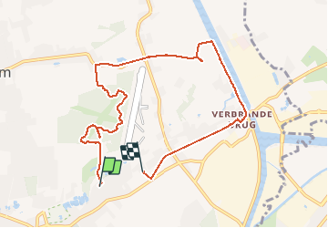
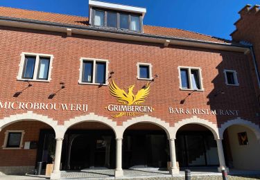
Randonnée Marche de 8,1 km à découvrir à Flandre, Brabant flamand, Grimbergen. Cette randonnée est proposée par rvapeldo.
Description
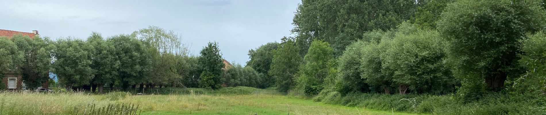
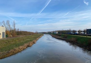
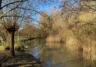
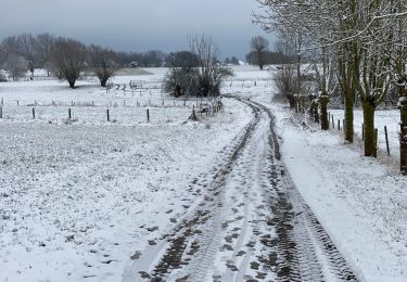
Un petit tour dans les bois près de l’aérodrome de Grimbergen, puis le long du canal et petit bonjour au pont brûlé (qui ne l’est plus), et beau sentier rectiligne entre le fond de jardin et les champs. Quelques fermes remarquables sur le parcours.
Localisation
Pays :
Belgique
Région :
Flandre
Département/Province :
Brabant flamand
Commune :
Grimbergen
Localité :
Grimbergen
Départ:(Dec)
Départ:(UTM)
597322 ; 5643964 (31U) N.
Commentaires
Randonnées à proximité
![Randonnée Marche Ville de Bruxelles - RB-Br-02 - Photo](https://media.geolcdn.com/t/375/260/ext.jpg?maxdim=2&url=https%3A%2F%2Fservices.sitytrail.com%2FGeolivesWS%2FDownloadMedia.ashx%3FTrailID%3D247873%26Media%3Ddfaf2d4a-e0b3-4c36-97b5-3b14c6762b25.jpg)
![Marche Marche](https://static1.geolcdn.com/sitytour/trail-icons/101.png)
RB-Br-02
Marche
Moyen
(1)
Ville de Bruxelles,
Bruxelles-Capitale,
Inconnu,
Belgique
![](/images/other/stat-length.png)
21 km | 24 km-effort
5h 32min
![](https://static1.geolcdn.com/siteimages/upload/files/16400158638029165_repeat_loop_refresh_sync_direction_icon.png)
Oui
![Randonnée Marche Meysse - Meise 2 - 7,3 Km - Photo](https://media.geolcdn.com/t/375/260/5b2154f2-ba55-4513-bd2f-9db37eb5ea90.jpg&format=jpg&maxdim=2)
![Marche Marche](https://static1.geolcdn.com/sitytour/trail-icons/101.png)
Meise 2 - 7,3 Km
Marche
Facile
(1)
Meysse,
Flandre,
Brabant flamand,
Belgique
![](/images/other/stat-length.png)
7,3 km | 8 km-effort
2h 34min
![](https://static1.geolcdn.com/siteimages/upload/files/16400158638029165_repeat_loop_refresh_sync_direction_icon.png)
Oui
![Randonnée Marche Vilvorde - Vilvoorde 19,4 km - Photo](https://media.geolcdn.com/t/375/260/8074fc11-08d7-4b93-891e-032223b215f5.jpg&format=jpg&maxdim=2)
![Marche Marche](https://static1.geolcdn.com/sitytour/trail-icons/101.png)
Vilvoorde 19,4 km
Marche
Facile
Vilvorde,
Flandre,
Brabant flamand,
Belgique
![](/images/other/stat-length.png)
19,5 km | 21 km-effort
4h 46min
![](https://static1.geolcdn.com/siteimages/upload/files/16400158638029165_repeat_loop_refresh_sync_direction_icon.png)
Oui
![Randonnée Marche Grimbergen - Humbeek naar Gravenbos- 6 km RT - Photo](https://media.geolcdn.com/t/375/260/ext.jpg?maxdim=2&url=https%3A%2F%2Fstatic1.geolcdn.com%2Fsiteimages%2Fupload%2Ffiles%2F1553511878bg_sport_marche.png)
![Marche Marche](https://static1.geolcdn.com/sitytour/trail-icons/101.png)
Humbeek naar Gravenbos- 6 km RT
Marche
Très facile
(1)
Grimbergen,
Flandre,
Brabant flamand,
Belgique
![](/images/other/stat-length.png)
5,6 km | 6,2 km-effort
Inconnu
![](https://static1.geolcdn.com/siteimages/upload/files/16400158638029165_repeat_loop_refresh_sync_direction_icon.png)
Oui
![Randonnée Marche Ville de Bruxelles - RF-BB-01 - Bruxelles - Atomium - 2024-11-06 - Photo](https://media.geolcdn.com/t/375/260/bbcfa625-112e-43fa-84e9-bafaca96f9e5.jpeg&format=jpg&maxdim=2)
![Marche Marche](https://static1.geolcdn.com/sitytour/trail-icons/101.png)
RF-BB-01 - Bruxelles - Atomium - 2024-11-06
Marche
Moyen
Ville de Bruxelles,
Bruxelles-Capitale,
Inconnu,
Belgique
![](/images/other/stat-length.png)
7 km | 8,4 km-effort
1h 54min
![](https://static1.geolcdn.com/siteimages/upload/files/16400158638029165_repeat_loop_refresh_sync_direction_icon.png)
Oui
![Randonnée Marche Ville de Bruxelles - GR126 : Atomium - Merchtem - Photo](https://media.geolcdn.com/t/375/260/b1e98a05-9745-4c70-8c39-b70b2ec99d10.jpeg&format=jpg&maxdim=2)
![Marche Marche](https://static1.geolcdn.com/sitytour/trail-icons/101.png)
GR126 : Atomium - Merchtem
Marche
Facile
Ville de Bruxelles,
Bruxelles-Capitale,
Inconnu,
Belgique
![](/images/other/stat-length.png)
24 km | 27 km-effort
6h 14min
![](https://static1.geolcdn.com/siteimages/upload/files/16400158638029165_repeat_loop_refresh_sync_direction_icon.png)
Non
![Randonnée Marche Vilvorde - Walk Vilvoorde - Grimbergen II - Photo](https://media.geolcdn.com/t/375/260/ext.jpg?maxdim=2&url=https%3A%2F%2Fstatic1.geolcdn.com%2Fsiteimages%2Fupload%2Ffiles%2F1553511878bg_sport_marche.png)
![Marche Marche](https://static1.geolcdn.com/sitytour/trail-icons/101.png)
Walk Vilvoorde - Grimbergen II
Marche
Facile
(1)
Vilvorde,
Flandre,
Brabant flamand,
Belgique
![](/images/other/stat-length.png)
17,6 km | 20 km-effort
4h 14min
![](https://static1.geolcdn.com/siteimages/upload/files/16400158638029165_repeat_loop_refresh_sync_direction_icon.png)
Oui
![Randonnée Marche Grimbergen - Grimbergen - Photo](https://media.geolcdn.com/t/375/260/3f7f127b-7af0-435a-890c-7f4ea5aecc6a.jpeg&format=jpg&maxdim=2)
![Marche Marche](https://static1.geolcdn.com/sitytour/trail-icons/101.png)
Grimbergen
Marche
Facile
Grimbergen,
Flandre,
Brabant flamand,
Belgique
![](/images/other/stat-length.png)
15,5 km | 16,8 km-effort
3h 50min
![](https://static1.geolcdn.com/siteimages/upload/files/16400158638029165_repeat_loop_refresh_sync_direction_icon.png)
Oui
![Randonnée Marche Meysse - Meise 10,5 km - Photo](https://media.geolcdn.com/t/375/260/ca2083ab-7489-42e6-91b5-9a4338ad605f.jpg&format=jpg&maxdim=2)
![Marche Marche](https://static1.geolcdn.com/sitytour/trail-icons/101.png)
Meise 10,5 km
Marche
Très facile
Meysse,
Flandre,
Brabant flamand,
Belgique
![](/images/other/stat-length.png)
10,5 km | 12,3 km-effort
2h 55min
![](https://static1.geolcdn.com/siteimages/upload/files/16400158638029165_repeat_loop_refresh_sync_direction_icon.png)
Oui
superbe balade
Super, belle randonnée!
nice walk through wood and small roads. took us 2h.