![](/images/other/stat-length.png)
![Randonnée Marche Gerpinnes - Fromiée - Le Ban - Tournibus - Photo](https://media.geolcdn.com/t/1900/400/803a6281-e0d0-4668-89ad-101e5efc0553.jpg&format=pjpeg&maxdim=2)
Fromiée - Le Ban - Tournibus
Michel Tondus
Utilisateur
![Longueur](/images/other/stat-length.png)
Longueur
9,2 km
![Altitude max](https://static1.geolcdn.com/siteimages/upload/files/1508320355ic_sort_altitude_max_24dp.png)
Altitude max
274 m
![Dénivelé positif](https://static1.geolcdn.com/siteimages/upload/files/1508320355ic_sort_den_pos_24dp.png)
Dénivelé positif
145 m
![Km-Effort](/images/other/stat-length.png)
Km-Effort
11,2 km
![Altitude min](https://static1.geolcdn.com/siteimages/upload/files/1508320355ic_sort_altitude_min_24dp.png)
Altitude min
220 m
![Dénivelé négatif](https://static1.geolcdn.com/siteimages/upload/files/1508320355ic_sort_den_neg_24dp.png)
Dénivelé négatif
147 m
![Boucle](https://static1.geolcdn.com/siteimages/upload/files/16400158638029165_repeat_loop_refresh_sync_direction_icon.png)
Boucle
Oui
Date de création :
2020-06-09 09:44:32.0
Dernière modification :
2020-06-11 06:03:37.959
![Marche](https://static1.geolcdn.com/sitytour/trail-icons/101.png)
2h00
Difficulté : Moyen
![Course à pied](https://static1.geolcdn.com/sitytour/trail-icons/103.png)
1h01
Difficulté : Facile
![Scannez ce code QR pour ouvrir la randonnée dans l'application SityTrail](https://capi.geolives.com/qq0zvz2zws4bq2lad0pu/sitytour/trails/2429900/qr.png?size=200)
Application GPS de randonnée GRATUITE
À propos
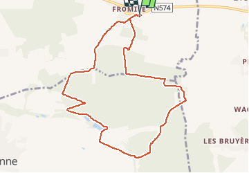
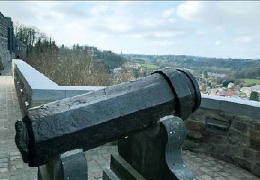
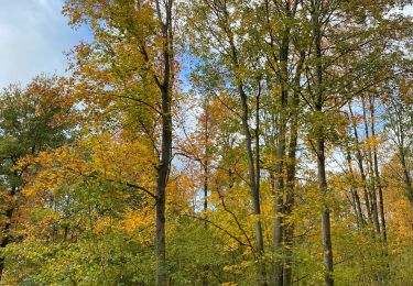
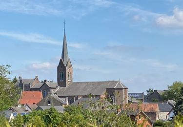
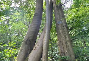
Randonnée Marche de 9,2 km à découvrir à Wallonie, Hainaut, Gerpinnes. Cette randonnée est proposée par Michel Tondus.
Description
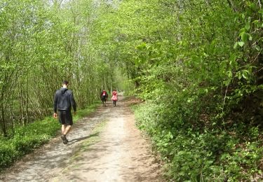
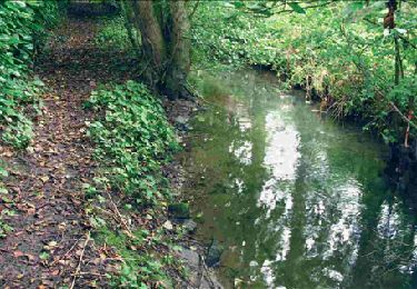
Balade entièrement forestière. Parcours sur la limite provinciale Hainaut - Namur (sentier barré sans raison valable). Passage près des étangs du Ban. Retour par le Tournibus.
Localisation
Pays :
Belgique
Région :
Wallonie
Département/Province :
Hainaut
Commune :
Gerpinnes
Localité :
Gerpinnes
Départ:(Dec)
Départ:(UTM)
612428 ; 5576681 (31U) N.
Commentaires
Randonnées à proximité
![Randonnée Marche Fosses-la-Ville - Balade à Sart-Eustache - Photo](https://media.geolcdn.com/t/375/260/ext.jpg?maxdim=2&url=https%3A%2F%2Fservices.sitytrail.com%2FGeolivesWS%2FDownloadMedia.ashx%3FTrailID%3D745477%26Media%3D0d9905aa-0e68-4255-ba20-1d4f668867f0.JPG)
![Marche Marche](https://static1.geolcdn.com/sitytour/trail-icons/101.png)
Balade à Sart-Eustache
Marche
Facile
(1)
Fosses-la-Ville,
Wallonie,
Namur,
Belgique
![](/images/other/stat-length.png)
11,2 km | 13,9 km-effort
2h 59min
![](https://static1.geolcdn.com/siteimages/upload/files/16400158638029165_repeat_loop_refresh_sync_direction_icon.png)
Oui
![Randonnée Marche Gerpinnes - RB-Ha-07 - Gerpinnes - Via allongement - Photo](https://media.geolcdn.com/t/375/260/ext.jpg?maxdim=2&url=https%3A%2F%2Fservices.sitytrail.com%2FGeolivesWS%2FDownloadMedia.ashx%3FTrailID%3D218725%26Media%3D62f2327c-676f-4ebe-a1e1-c69d1a3c316d.jpg)
![Marche Marche](https://static1.geolcdn.com/sitytour/trail-icons/101.png)
RB-Ha-07 - Gerpinnes - Via allongement
Marche
Très difficile
(3)
Gerpinnes,
Wallonie,
Hainaut,
Belgique
![](/images/other/stat-length.png)
19,9 km | 25 km-effort
5h 36min
![](https://static1.geolcdn.com/siteimages/upload/files/16400158638029165_repeat_loop_refresh_sync_direction_icon.png)
Oui
![Randonnée Marche Florennes - RB-Na-15_Hanzinelle - Photo](https://media.geolcdn.com/t/375/260/ext.jpg?maxdim=2&url=https%3A%2F%2Fservices.sitytrail.com%2FGeolivesWS%2FDownloadMedia.ashx%3FTrailID%3D179641%26Media%3Dcd0eccee-617e-4840-aac3-bf752b2b2900.jpg)
![Marche Marche](https://static1.geolcdn.com/sitytour/trail-icons/101.png)
RB-Na-15_Hanzinelle
Marche
Facile
(7)
Florennes,
Wallonie,
Namur,
Belgique
![](/images/other/stat-length.png)
23 km | 27 km-effort
5h 59min
![](https://static1.geolcdn.com/siteimages/upload/files/16400158638029165_repeat_loop_refresh_sync_direction_icon.png)
Oui
![Randonnée Marche Gerpinnes - RB-Ha-07 - Gerpinnes - Photo](https://media.geolcdn.com/t/375/260/ext.jpg?maxdim=2&url=https%3A%2F%2Fservices.sitytrail.com%2FGeolivesWS%2FDownloadMedia.ashx%3FTrailID%3D179600%26Media%3D62f2327c-676f-4ebe-a1e1-c69d1a3c316d.jpg)
![Marche Marche](https://static1.geolcdn.com/sitytour/trail-icons/101.png)
RB-Ha-07 - Gerpinnes
Marche
Très difficile
(3)
Gerpinnes,
Wallonie,
Hainaut,
Belgique
![](/images/other/stat-length.png)
17,8 km | 22 km-effort
4h 58min
![](https://static1.geolcdn.com/siteimages/upload/files/16400158638029165_repeat_loop_refresh_sync_direction_icon.png)
Oui
![Randonnée Marche Gerpinnes - 100 pc forestier - Photo](https://media.geolcdn.com/t/375/260/359c3f01-a3f3-427a-96cf-dcc1c9f53ce0.jpg&format=jpg&maxdim=2)
![Marche Marche](https://static1.geolcdn.com/sitytour/trail-icons/101.png)
100 pc forestier
Marche
Difficile
(1)
Gerpinnes,
Wallonie,
Hainaut,
Belgique
![](/images/other/stat-length.png)
10,3 km | 12,7 km-effort
2h 45min
![](https://static1.geolcdn.com/siteimages/upload/files/16400158638029165_repeat_loop_refresh_sync_direction_icon.png)
Oui
![Marche Marche](https://static1.geolcdn.com/sitytour/trail-icons/101.png)
Fromiée Gougnies
Marche
Moyen
(1)
Gerpinnes,
Wallonie,
Hainaut,
Belgique
![](/images/other/stat-length.png)
6,7 km | 8,2 km-effort
1h 40min
![](https://static1.geolcdn.com/siteimages/upload/files/16400158638029165_repeat_loop_refresh_sync_direction_icon.png)
Oui
![Randonnée Marche Gerpinnes - Fromiée Belle haie GR129 - Photo](https://media.geolcdn.com/t/375/260/ef988689-339a-488a-975c-45144631053a.jpg&format=jpg&maxdim=2)
![Marche Marche](https://static1.geolcdn.com/sitytour/trail-icons/101.png)
Fromiée Belle haie GR129
Marche
Difficile
(1)
Gerpinnes,
Wallonie,
Hainaut,
Belgique
![](/images/other/stat-length.png)
7,1 km | 8,6 km-effort
1h 20min
![](https://static1.geolcdn.com/siteimages/upload/files/16400158638029165_repeat_loop_refresh_sync_direction_icon.png)
Oui
![Randonnée Marche Florennes - RB-Na-15_Hanzinelle_via-racc - Photo](https://media.geolcdn.com/t/375/260/ext.jpg?maxdim=2&url=https%3A%2F%2Fservices.sitytrail.com%2FGeolivesWS%2FDownloadMedia.ashx%3FTrailID%3D213765%26Media%3Dbdd90a99-a997-460a-a12d-eae6fea055d6.jpg)
![Marche Marche](https://static1.geolcdn.com/sitytour/trail-icons/101.png)
RB-Na-15_Hanzinelle_via-racc
Marche
Très facile
(3)
Florennes,
Wallonie,
Namur,
Belgique
![](/images/other/stat-length.png)
13,8 km | 16,5 km-effort
3h 27min
![](https://static1.geolcdn.com/siteimages/upload/files/16400158638029165_repeat_loop_refresh_sync_direction_icon.png)
Oui
![Randonnée Vélo de route Gerpinnes - Biesme-Prée-Wagnèe-Mettet-Oret et retour - Photo](https://media.geolcdn.com/t/375/260/5584c0c6-120b-437c-af02-3c7470394634.jpg&format=jpg&maxdim=2)
![Vélo de route Vélo de route](https://static1.geolcdn.com/sitytour/trail-icons/201.png)
Biesme-Prée-Wagnèe-Mettet-Oret et retour
Vélo de route
(1)
Gerpinnes,
Wallonie,
Hainaut,
Belgique
![](/images/other/stat-length.png)
18,8 km | 22 km-effort
1h 30min
![](https://static1.geolcdn.com/siteimages/upload/files/16400158638029165_repeat_loop_refresh_sync_direction_icon.png)
Oui