![](/images/other/stat-length.png)
![Randonnée Marche Silly - Wapi 3.41 - Bassilly Hellebecq - Photo](https://media.geolcdn.com/t/1900/400/ext.pjpeg?maxdim=2&url=https%3A%2F%2Fstatic1.geolcdn.com%2Fsiteimages%2Fupload%2Ffiles%2F1553511878bg_sport_marche.png)
Wapi 3.41 - Bassilly Hellebecq
rfnet
Utilisateur
![Longueur](/images/other/stat-length.png)
Longueur
9,4 km
![Altitude max](https://static1.geolcdn.com/siteimages/upload/files/1508320355ic_sort_altitude_max_24dp.png)
Altitude max
53 m
![Dénivelé positif](https://static1.geolcdn.com/siteimages/upload/files/1508320355ic_sort_den_pos_24dp.png)
Dénivelé positif
49 m
![Km-Effort](/images/other/stat-length.png)
Km-Effort
10,1 km
![Altitude min](https://static1.geolcdn.com/siteimages/upload/files/1508320355ic_sort_altitude_min_24dp.png)
Altitude min
33 m
![Dénivelé négatif](https://static1.geolcdn.com/siteimages/upload/files/1508320355ic_sort_den_neg_24dp.png)
Dénivelé négatif
48 m
![Boucle](https://static1.geolcdn.com/siteimages/upload/files/16400158638029165_repeat_loop_refresh_sync_direction_icon.png)
Boucle
Oui
Date de création :
2020-06-06 14:50:23.511
Dernière modification :
2020-06-07 09:43:36.822
![Marche](https://static1.geolcdn.com/sitytour/trail-icons/101.png)
2h52
Difficulté : Très facile
![Scannez ce code QR pour ouvrir la randonnée dans l'application SityTrail](https://capi.geolives.com/qq0zvz2zws4bq2lad0pu/sitytour/trails/2426791/qr.png?size=200)
Application GPS de randonnée GRATUITE
À propos
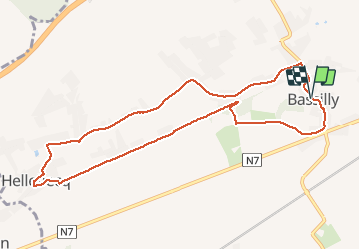
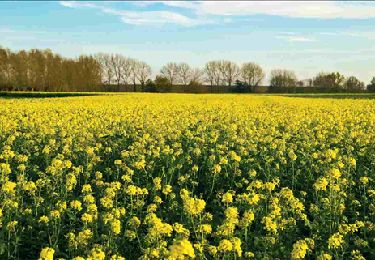
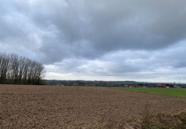
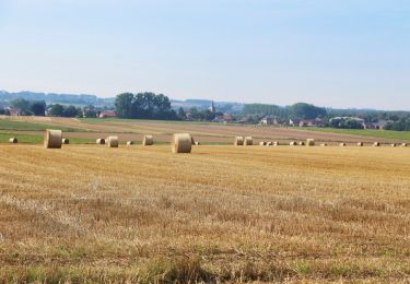
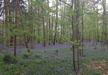
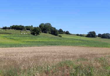
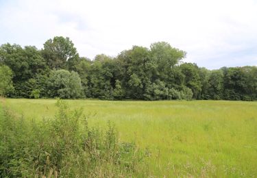
Randonnée Marche de 9,4 km à découvrir à Wallonie, Hainaut, Silly. Cette randonnée est proposée par rfnet.
Description
Randonnée sur le trajet partiel de la 3.41 éditée par la Wapi.
Beaucoup de panneaux ne sont plus visibles ou tombés emportés par un tracteur. Être attentif aux changements de direction. Rando facile et accessible à tous.
Localisation
Pays :
Belgique
Région :
Wallonie
Département/Province :
Hainaut
Commune :
Silly
Localité :
Bassilly
Départ:(Dec)
Départ:(UTM)
566124 ; 5613817 (31U) N.
Commentaires
Randonnées à proximité
![Randonnée Marche Silly - RL-GG-06_Silly_Enghien - Photo](https://media.geolcdn.com/t/375/260/f966d4d2-0dc0-4cd6-bca7-03c18785f611.jpg&format=jpg&maxdim=2)
![Marche Marche](https://static1.geolcdn.com/sitytour/trail-icons/101.png)
RL-GG-06_Silly_Enghien
Marche
Très difficile
(5)
Silly,
Wallonie,
Hainaut,
Belgique
![](/images/other/stat-length.png)
22 km | 26 km-effort
5h 41min
![](https://static1.geolcdn.com/siteimages/upload/files/16400158638029165_repeat_loop_refresh_sync_direction_icon.png)
Non
![Randonnée Marche Silly - Graty - bois d’Enghien - Graty - Photo](https://media.geolcdn.com/t/375/260/7271ef7d-a5b1-459f-b9eb-91dd19972deb.jpg&format=jpg&maxdim=2)
![Marche Marche](https://static1.geolcdn.com/sitytour/trail-icons/101.png)
Graty - bois d’Enghien - Graty
Marche
(1)
Silly,
Wallonie,
Hainaut,
Belgique
![](/images/other/stat-length.png)
10,1 km | 11,8 km-effort
1h 55min
![](https://static1.geolcdn.com/siteimages/upload/files/16400158638029165_repeat_loop_refresh_sync_direction_icon.png)
Oui
![Randonnée Marche Silly - Wapi 3.02 - La promenade des Princes - Silly - Photo](https://media.geolcdn.com/t/375/260/98872b19-6c1a-4965-9bd7-5d3e9b88372a.jpg&format=jpg&maxdim=2)
![Marche Marche](https://static1.geolcdn.com/sitytour/trail-icons/101.png)
Wapi 3.02 - La promenade des Princes - Silly
Marche
Facile
(2)
Silly,
Wallonie,
Hainaut,
Belgique
![](/images/other/stat-length.png)
8,6 km | 10,4 km-effort
2h 34min
![](https://static1.geolcdn.com/siteimages/upload/files/16400158638029165_repeat_loop_refresh_sync_direction_icon.png)
Oui
![Randonnée Marche Silly - RB-Ha-03 - Silly - Via raccourci - Photo](https://media.geolcdn.com/t/375/260/ext.jpg?maxdim=2&url=https%3A%2F%2Fservices.sitytrail.com%2FGeolivesWS%2FDownloadMedia.ashx%3FTrailID%3D217835%26Media%3Dd7099cfa-d7c9-4bf3-bdfa-78aa37eb10bb.jpg)
![Marche Marche](https://static1.geolcdn.com/sitytour/trail-icons/101.png)
RB-Ha-03 - Silly - Via raccourci
Marche
Très difficile
(2)
Silly,
Wallonie,
Hainaut,
Belgique
![](/images/other/stat-length.png)
15,9 km | 19,6 km-effort
4h 26min
![](https://static1.geolcdn.com/siteimages/upload/files/16400158638029165_repeat_loop_refresh_sync_direction_icon.png)
Oui
![Randonnée Marche Ath - Dimanche 20/12/2020 - Photo](https://media.geolcdn.com/t/375/260/e7853499-b082-4f1a-bcac-5b446950aa41.jpg&format=jpg&maxdim=2)
![Marche Marche](https://static1.geolcdn.com/sitytour/trail-icons/101.png)
Dimanche 20/12/2020
Marche
Facile
(1)
Ath,
Wallonie,
Hainaut,
Belgique
![](/images/other/stat-length.png)
12,9 km | 14,4 km-effort
2h 42min
![](https://static1.geolcdn.com/siteimages/upload/files/16400158638029165_repeat_loop_refresh_sync_direction_icon.png)
Oui
![Randonnée A pied Silly - Hameaux et points culminants de Bassily-Hellebecq - Photo](https://media.geolcdn.com/t/375/260/ext.jpg?maxdim=2&url=https%3A%2F%2Fpivotmedia.tourismewallonie.be%2FANX-02-04K1-001F%2FANX-02-04K1-001F.JPG)
![A pied A pied](https://static1.geolcdn.com/sitytour/trail-icons/100.png)
Hameaux et points culminants de Bassily-Hellebecq
A pied
Facile
Silly,
Wallonie,
Hainaut,
Belgique
![](/images/other/stat-length.png)
15,8 km | 17,2 km-effort
3h 55min
![](https://static1.geolcdn.com/siteimages/upload/files/16400158638029165_repeat_loop_refresh_sync_direction_icon.png)
Oui
![Randonnée A pied Silly - Promenade du Maquis de Saint-Marcoult - Photo](https://media.geolcdn.com/t/375/260/ext.jpg?maxdim=2&url=https%3A%2F%2Fpivotmedia.tourismewallonie.be%2FANX-02-04OQ-005G%2FANX-02-04OQ-005G.JPG)
![A pied A pied](https://static1.geolcdn.com/sitytour/trail-icons/100.png)
Promenade du Maquis de Saint-Marcoult
A pied
Facile
(1)
Silly,
Wallonie,
Hainaut,
Belgique
![](/images/other/stat-length.png)
5,3 km | 6,4 km-effort
1h 27min
![](https://static1.geolcdn.com/siteimages/upload/files/16400158638029165_repeat_loop_refresh_sync_direction_icon.png)
Oui
![Randonnée A pied Silly - Promenade des Princes - Photo](https://media.geolcdn.com/t/375/260/ext.jpg?maxdim=2&url=https%3A%2F%2Fpivotmedia.tourismewallonie.be%2FANX-02-04OT-001F%2FANX-02-04OT-001F.JPG)
![A pied A pied](https://static1.geolcdn.com/sitytour/trail-icons/100.png)
Promenade des Princes
A pied
Facile
Silly,
Wallonie,
Hainaut,
Belgique
![](/images/other/stat-length.png)
8,1 km | 9,9 km-effort
2h 15min
![](https://static1.geolcdn.com/siteimages/upload/files/16400158638029165_repeat_loop_refresh_sync_direction_icon.png)
Oui
![Randonnée A pied Lessines - Promenade de l'Arbre de la Liberté - Photo](https://media.geolcdn.com/t/375/260/ext.jpg?maxdim=2&url=https%3A%2F%2Fpivotmedia.tourismewallonie.be%2FANX-02-04JQ-001F%2FANX-02-04JQ-001F.JPG)
![A pied A pied](https://static1.geolcdn.com/sitytour/trail-icons/100.png)
Promenade de l'Arbre de la Liberté
A pied
Facile
Lessines,
Wallonie,
Hainaut,
Belgique
![](/images/other/stat-length.png)
7,2 km | 8,4 km-effort
1h 54min
![](https://static1.geolcdn.com/siteimages/upload/files/16400158638029165_repeat_loop_refresh_sync_direction_icon.png)
Oui