![](/images/other/stat-length.png)
Cimes de Ventabren et Mangiabo depuis l'Authion
aris
Utilisateur
![Longueur](/images/other/stat-length.png)
![Altitude max](https://static1.geolcdn.com/siteimages/upload/files/1508320355ic_sort_altitude_max_24dp.png)
![Dénivelé positif](https://static1.geolcdn.com/siteimages/upload/files/1508320355ic_sort_den_pos_24dp.png)
![Km-Effort](/images/other/stat-length.png)
![Altitude min](https://static1.geolcdn.com/siteimages/upload/files/1508320355ic_sort_altitude_min_24dp.png)
![Dénivelé négatif](https://static1.geolcdn.com/siteimages/upload/files/1508320355ic_sort_den_neg_24dp.png)
![Boucle](https://static1.geolcdn.com/siteimages/upload/files/16400158638029165_repeat_loop_refresh_sync_direction_icon.png)
![Marche](https://static1.geolcdn.com/sitytour/trail-icons/101.png)
6h01
Difficulté : Moyen
![Scannez ce code QR pour ouvrir la randonnée dans l'application SityTrail](https://capi.geolives.com/qq0zvz2zws4bq2lad0pu/sitytour/trails/2421319/qr.png?size=200)
Application GPS de randonnée GRATUITE
À propos
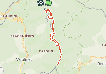
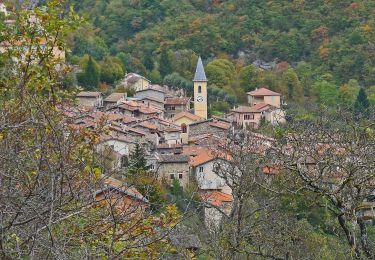
Randonnée Marche de 15,7 km à découvrir à Provence-Alpes-Côte d'Azur, Alpes-Maritimes, Moulinet. Cette randonnée est proposée par aris.
Description
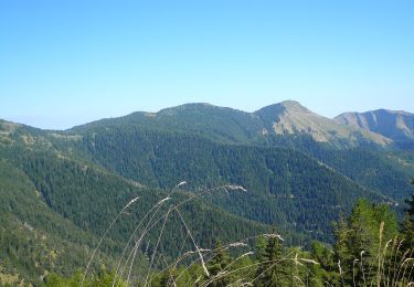
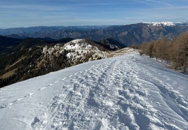
Parcours en crête à partir des cabanes vieilles sur le circuit de l'Authion. Circuit très agréable, en partie en forêt. Retour par la piste qui contourne les sommets.
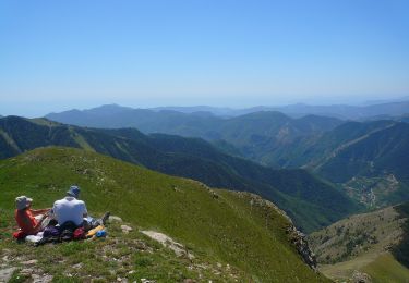
Potentielle vue panoramique sur les sommets alentours, mais nous avons eu du brouillard.
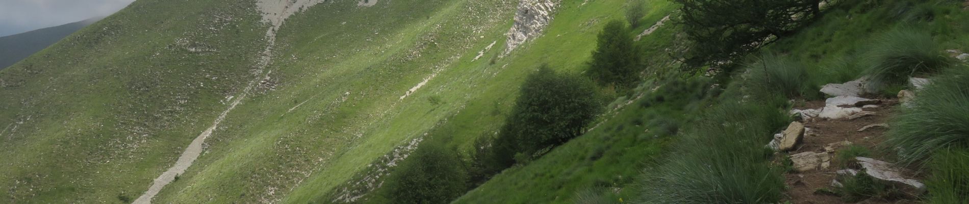
La montée à la cime de Ventabren se fait hors sentier dans l'alpage. Attention à la descente, bien suivre la trace (barres de rochers).
Localisation
Commentaires
Randonnées à proximité
![Randonnée A pied Breil-sur-Roya - Circuit de la Déa - Photo](https://media.geolcdn.com/t/375/260/15d73491-8abb-4be2-abb9-38a85c62a210.jpeg&format=jpg&maxdim=2)
![A pied A pied](https://static1.geolcdn.com/sitytour/trail-icons/100.png)
A pied
![](/images/other/stat-length.png)
![](https://static1.geolcdn.com/siteimages/upload/files/16400158638029165_repeat_loop_refresh_sync_direction_icon.png)
![Randonnée A pied Moulinet - Crêtes de l'Arpiha - Photo](https://media.geolcdn.com/t/375/260/c07cc7b3-d5b2-4e51-bdf4-03929243643c.jpeg&format=jpg&maxdim=2)
![A pied A pied](https://static1.geolcdn.com/sitytour/trail-icons/100.png)
A pied
![](/images/other/stat-length.png)
![](https://static1.geolcdn.com/siteimages/upload/files/16400158638029165_repeat_loop_refresh_sync_direction_icon.png)
![Randonnée A pied Moulinet - Tour de la Calmette - Photo](https://media.geolcdn.com/t/375/260/f1319e6f-f58e-4543-ba7d-7f850f27f51a.jpeg&format=jpg&maxdim=2)
![A pied A pied](https://static1.geolcdn.com/sitytour/trail-icons/100.png)
A pied
![](/images/other/stat-length.png)
![](https://static1.geolcdn.com/siteimages/upload/files/16400158638029165_repeat_loop_refresh_sync_direction_icon.png)
![Randonnée A pied Moulinet - Cime du Diable - Photo](https://media.geolcdn.com/t/375/260/94134920-c5fc-4b95-a9f6-aeabb0ba95c2.jpeg&format=jpg&maxdim=2)
![A pied A pied](https://static1.geolcdn.com/sitytour/trail-icons/100.png)
A pied
![](/images/other/stat-length.png)
![](https://static1.geolcdn.com/siteimages/upload/files/16400158638029165_repeat_loop_refresh_sync_direction_icon.png)
![Randonnée Raquettes à neige Moulinet - Baisse Cavaline - Photo](https://media.geolcdn.com/t/375/260/b5a21962-1dcd-409b-822e-6e34602431de.jpg&format=jpg&maxdim=2)
![Raquettes à neige Raquettes à neige](https://static1.geolcdn.com/sitytour/trail-icons/504.png)
Raquettes à neige
![](/images/other/stat-length.png)
![](https://static1.geolcdn.com/siteimages/upload/files/16400158638029165_repeat_loop_refresh_sync_direction_icon.png)
![Randonnée Marche Moulinet - Grand Tour de Lauthion - Photo](https://media.geolcdn.com/t/375/260/fc421b10-23aa-4b7a-b4cf-80322f7edc29.jpg&format=jpg&maxdim=2)
![Marche Marche](https://static1.geolcdn.com/sitytour/trail-icons/101.png)
Marche
![](/images/other/stat-length.png)
![](https://static1.geolcdn.com/siteimages/upload/files/16400158638029165_repeat_loop_refresh_sync_direction_icon.png)
![Randonnée A pied Moulinet - Baisse de Peira Cava - Photo](https://media.geolcdn.com/t/375/260/dbec6e0a-5512-4263-b11e-6e8d3e38cd6e.jpeg&format=jpg&maxdim=2)
![A pied A pied](https://static1.geolcdn.com/sitytour/trail-icons/100.png)
A pied
![](/images/other/stat-length.png)
![](https://static1.geolcdn.com/siteimages/upload/files/16400158638029165_repeat_loop_refresh_sync_direction_icon.png)
![Randonnée Marche Moulinet - Turini- tour de la Calmette - Photo](https://media.geolcdn.com/t/375/260/65c623cf-7185-4ec8-a258-6191b868284a.jpg&format=jpg&maxdim=2)
![Marche Marche](https://static1.geolcdn.com/sitytour/trail-icons/101.png)
Marche
![](/images/other/stat-length.png)
![](https://static1.geolcdn.com/siteimages/upload/files/16400158638029165_repeat_loop_refresh_sync_direction_icon.png)
![Randonnée Marche Moulinet - Baisse de Bécass - Photo](https://media.geolcdn.com/t/375/260/10e54f39-88d4-4b84-9364-47a11d8f39f0.jpg&format=jpg&maxdim=2)
![Marche Marche](https://static1.geolcdn.com/sitytour/trail-icons/101.png)
Marche
![](/images/other/stat-length.png)
![](https://static1.geolcdn.com/siteimages/upload/files/16400158638029165_repeat_loop_refresh_sync_direction_icon.png)