![](/images/other/stat-length.png)
![Randonnée Marche Laître-sous-Amance - Laître sous Amance déf - Photo](https://media.geolcdn.com/t/1900/400/ext.pjpeg?maxdim=2&url=https%3A%2F%2Fstatic1.geolcdn.com%2Fsiteimages%2Fupload%2Ffiles%2F1553511878bg_sport_marche.png)
Laître sous Amance déf
joelclaudel
Utilisateur
![Longueur](/images/other/stat-length.png)
Longueur
9,2 km
![Altitude max](https://static1.geolcdn.com/siteimages/upload/files/1508320355ic_sort_altitude_max_24dp.png)
Altitude max
352 m
![Dénivelé positif](https://static1.geolcdn.com/siteimages/upload/files/1508320355ic_sort_den_pos_24dp.png)
Dénivelé positif
190 m
![Km-Effort](/images/other/stat-length.png)
Km-Effort
11,7 km
![Altitude min](https://static1.geolcdn.com/siteimages/upload/files/1508320355ic_sort_altitude_min_24dp.png)
Altitude min
211 m
![Dénivelé négatif](https://static1.geolcdn.com/siteimages/upload/files/1508320355ic_sort_den_neg_24dp.png)
Dénivelé négatif
191 m
![Boucle](https://static1.geolcdn.com/siteimages/upload/files/16400158638029165_repeat_loop_refresh_sync_direction_icon.png)
Boucle
Oui
Date de création :
2020-05-24 16:25:00.536
Dernière modification :
2020-05-24 16:27:58.723
![Marche](https://static1.geolcdn.com/sitytour/trail-icons/101.png)
2h31
Difficulté : Moyen
![Scannez ce code QR pour ouvrir la randonnée dans l'application SityTrail](https://capi.geolives.com/qq0zvz2zws4bq2lad0pu/sitytour/trails/2409630/qr.png?size=200)
Application GPS de randonnée GRATUITE
À propos
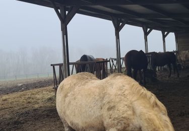
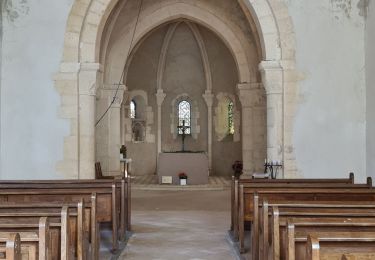
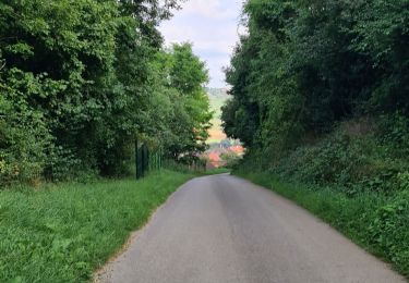
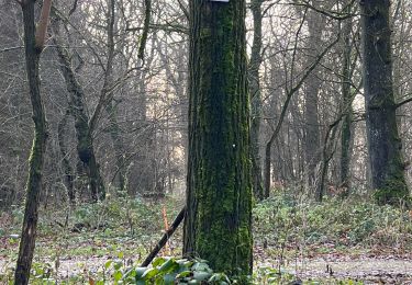
Randonnée Marche de 9,2 km à découvrir à Grand Est, Meurthe-et-Moselle, Laître-sous-Amance. Cette randonnée est proposée par joelclaudel.
Description
Circuit en passant par le balcon d'Amance, Amance, Petit Mont d'Amance, la Coriche, GRP, et retour voie Verte
Localisation
Pays :
France
Région :
Grand Est
Département/Province :
Meurthe-et-Moselle
Commune :
Laître-sous-Amance
Localité :
Unknown
Départ:(Dec)
Départ:(UTM)
300426 ; 5402347 (32U) N.
Commentaires
Randonnées à proximité
![Randonnée A pied Agincourt - Circuit M - Photo](https://media.geolcdn.com/t/375/260/af3027bd-6d38-4135-8a9f-8cca4de624d0.jpeg&format=jpg&maxdim=2)
![A pied A pied](https://static1.geolcdn.com/sitytour/trail-icons/100.png)
Circuit M
A pied
Facile
Agincourt,
Grand Est,
Meurthe-et-Moselle,
France
![](/images/other/stat-length.png)
13,3 km | 17,8 km-effort
4h 3min
![](https://static1.geolcdn.com/siteimages/upload/files/16400158638029165_repeat_loop_refresh_sync_direction_icon.png)
Non
![Randonnée Marche Eulmont - Eulmont_La tour du Crany_10kms - Photo](https://media.geolcdn.com/t/375/260/ext.jpg?maxdim=2&url=https%3A%2F%2Fstatic1.geolcdn.com%2Fsiteimages%2Fupload%2Ffiles%2F1553511878bg_sport_marche.png)
![Marche Marche](https://static1.geolcdn.com/sitytour/trail-icons/101.png)
Eulmont_La tour du Crany_10kms
Marche
Difficile
(2)
Eulmont,
Grand Est,
Meurthe-et-Moselle,
France
![](/images/other/stat-length.png)
9,6 km | 12,6 km-effort
2h 51min
![](https://static1.geolcdn.com/siteimages/upload/files/16400158638029165_repeat_loop_refresh_sync_direction_icon.png)
Oui
![Randonnée V.T.C. Seichamps - Tonnoy - Photo](https://media.geolcdn.com/t/375/260/ext.jpg?maxdim=2&url=https%3A%2F%2Fstatic1.geolcdn.com%2Fsiteimages%2Fupload%2Ffiles%2F1524743154velo.jpg)
![V.T.C. V.T.C.](https://static1.geolcdn.com/sitytour/trail-icons/203.png)
Tonnoy
V.T.C.
Moyen
(1)
Seichamps,
Grand Est,
Meurthe-et-Moselle,
France
![](/images/other/stat-length.png)
54 km | 61 km-effort
3h 42min
![](https://static1.geolcdn.com/siteimages/upload/files/16400158638029165_repeat_loop_refresh_sync_direction_icon.png)
Oui
![Randonnée Marche Bouxières-aux-Chênes - tour crany 29/5/2019 - Photo](https://media.geolcdn.com/t/375/260/ext.jpg?maxdim=2&url=https%3A%2F%2Fstatic1.geolcdn.com%2Fsiteimages%2Fupload%2Ffiles%2F1553511878bg_sport_marche.png)
![Marche Marche](https://static1.geolcdn.com/sitytour/trail-icons/101.png)
tour crany 29/5/2019
Marche
Très facile
(1)
Bouxières-aux-Chênes,
Grand Est,
Meurthe-et-Moselle,
France
![](/images/other/stat-length.png)
11,1 km | 14 km-effort
3h 42min
![](https://static1.geolcdn.com/siteimages/upload/files/16400158638029165_repeat_loop_refresh_sync_direction_icon.png)
Oui
![Randonnée Marche Bouxières-aux-Chênes - Amance blanzey boucles des amance - Photo](https://media.geolcdn.com/t/375/260/682c5f23-15d3-4fdf-8eeb-a74f6e61dda1.jpg&format=jpg&maxdim=2)
![Marche Marche](https://static1.geolcdn.com/sitytour/trail-icons/101.png)
Amance blanzey boucles des amance
Marche
Moyen
Bouxières-aux-Chênes,
Grand Est,
Meurthe-et-Moselle,
France
![](/images/other/stat-length.png)
9,2 km | 12,5 km-effort
4h 52min
![](https://static1.geolcdn.com/siteimages/upload/files/16400158638029165_repeat_loop_refresh_sync_direction_icon.png)
Oui
![Randonnée Marche Bouxières-aux-Chênes - bouxieres aux chênes - Blanzey - Photo](https://media.geolcdn.com/t/375/260/53a8e14a-fcca-41b7-ba10-e0d8828d01da.jpg&format=jpg&maxdim=2)
![Marche Marche](https://static1.geolcdn.com/sitytour/trail-icons/101.png)
bouxieres aux chênes - Blanzey
Marche
Moyen
Bouxières-aux-Chênes,
Grand Est,
Meurthe-et-Moselle,
France
![](/images/other/stat-length.png)
12 km | 14,7 km-effort
19h 32min
![](https://static1.geolcdn.com/siteimages/upload/files/16400158638029165_repeat_loop_refresh_sync_direction_icon.png)
Oui
![Randonnée Marche Bouxières-aux-Chênes - bouxieres aux chênes - la tour de crany - Photo](https://media.geolcdn.com/t/375/260/a86bdc52-4815-4222-8ee6-18cca8f402a0.jpg&format=jpg&maxdim=2)
![Marche Marche](https://static1.geolcdn.com/sitytour/trail-icons/101.png)
bouxieres aux chênes - la tour de crany
Marche
Facile
Bouxières-aux-Chênes,
Grand Est,
Meurthe-et-Moselle,
France
![](/images/other/stat-length.png)
11,2 km | 14,2 km-effort
4h 52min
![](https://static1.geolcdn.com/siteimages/upload/files/16400158638029165_repeat_loop_refresh_sync_direction_icon.png)
Oui
![Randonnée Marche nordique Pulnoy - Foulée des Rois Pulnoy 2024 - Photo](https://media.geolcdn.com/t/375/260/0aebb121-6259-49b0-a2db-f92183a3506b.jpg&format=jpg&maxdim=2)
![Marche nordique Marche nordique](https://static1.geolcdn.com/sitytour/trail-icons/102.png)
Foulée des Rois Pulnoy 2024
Marche nordique
Moyen
Pulnoy,
Grand Est,
Meurthe-et-Moselle,
France
![](/images/other/stat-length.png)
9,9 km | 12,5 km-effort
1h 45min
![](https://static1.geolcdn.com/siteimages/upload/files/16400158638029165_repeat_loop_refresh_sync_direction_icon.png)
Oui