![](/images/other/stat-length.png)
![Randonnée V.T.T. Saint-Rome-de-Tarn - Relais st Rome petit tour - Photo](https://media.geolcdn.com/t/1900/400/d88dcbb2-57c6-4d73-bb19-c80fc8e7f46c.jpg&format=pjpeg&maxdim=2)
Relais st Rome petit tour
ZITO12
Utilisateur
![Longueur](/images/other/stat-length.png)
Longueur
10,4 km
![Altitude max](https://static1.geolcdn.com/siteimages/upload/files/1508320355ic_sort_altitude_max_24dp.png)
Altitude max
658 m
![Dénivelé positif](https://static1.geolcdn.com/siteimages/upload/files/1508320355ic_sort_den_pos_24dp.png)
Dénivelé positif
315 m
![Km-Effort](/images/other/stat-length.png)
Km-Effort
14,6 km
![Altitude min](https://static1.geolcdn.com/siteimages/upload/files/1508320355ic_sort_altitude_min_24dp.png)
Altitude min
391 m
![Dénivelé négatif](https://static1.geolcdn.com/siteimages/upload/files/1508320355ic_sort_den_neg_24dp.png)
Dénivelé négatif
313 m
![Boucle](https://static1.geolcdn.com/siteimages/upload/files/16400158638029165_repeat_loop_refresh_sync_direction_icon.png)
Boucle
Oui
Date de création :
2020-05-23 12:33:02.145
Dernière modification :
2020-05-23 13:30:54.022
![V.T.T.](https://static1.geolcdn.com/sitytour/trail-icons/202.png)
57m
Difficulté : Facile
![Scannez ce code QR pour ouvrir la randonnée dans l'application SityTrail](https://capi.geolives.com/qq0zvz2zws4bq2lad0pu/sitytour/trails/2407233/qr.png?size=200)
Application GPS de randonnée GRATUITE
À propos
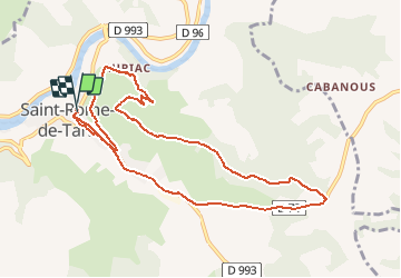
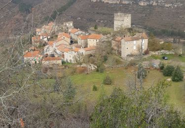
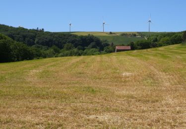
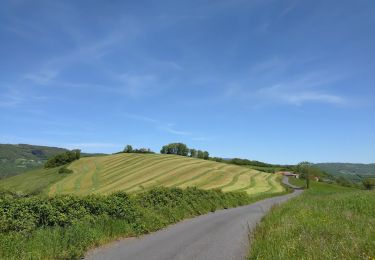
Randonnée V.T.T. de 10,4 km à découvrir à Occitanie, Aveyron, Saint-Rome-de-Tarn. Cette randonnée est proposée par ZITO12.
Description
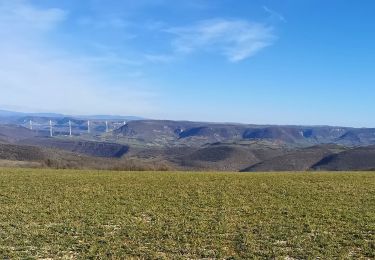
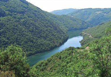
Circuit d'entretien avec de jolies vues sur le Levezou. Montée par la route et chemin agricole, descente en monotrace. Court passage delicat
Localisation
Pays :
France
Région :
Occitanie
Département/Province :
Aveyron
Commune :
Saint-Rome-de-Tarn
Localité :
Unknown
Départ:(Dec)
Départ:(UTM)
491820 ; 4877393 (31T) N.
Commentaires
Randonnées à proximité
![Randonnée Marche Montjaux - Concoules Montjaux - Photo](https://media.geolcdn.com/t/375/260/6744d9af-c2c8-4c45-9f05-8593c462ebb9.jpg&format=jpg&maxdim=2)
![Marche Marche](https://static1.geolcdn.com/sitytour/trail-icons/101.png)
Concoules Montjaux
Marche
Facile
Montjaux,
Occitanie,
Aveyron,
France
![](/images/other/stat-length.png)
10,8 km | 14,7 km-effort
3h 10min
![](https://static1.geolcdn.com/siteimages/upload/files/16400158638029165_repeat_loop_refresh_sync_direction_icon.png)
Oui
![Randonnée Marche Saint-Rome-de-Tarn - Au long du Tarn: de St-Rome-de-Tarn à Ayssènes - Photo](https://media.geolcdn.com/t/375/260/161b4c71-cb1b-4710-a622-a2007823687d.jpg&format=jpg&maxdim=2)
![Marche Marche](https://static1.geolcdn.com/sitytour/trail-icons/101.png)
Au long du Tarn: de St-Rome-de-Tarn à Ayssènes
Marche
Difficile
Saint-Rome-de-Tarn,
Occitanie,
Aveyron,
France
![](/images/other/stat-length.png)
22 km | 35 km-effort
7h 53min
![](https://static1.geolcdn.com/siteimages/upload/files/16400158638029165_repeat_loop_refresh_sync_direction_icon.png)
Non
![Randonnée Marche Saint-Rome-de-Tarn - Saint Rome de Tarn - Photo](https://media.geolcdn.com/t/375/260/504bbf4a-8a97-4f07-9f51-ffb0f0e46ee9.jpg&format=jpg&maxdim=2)
![Marche Marche](https://static1.geolcdn.com/sitytour/trail-icons/101.png)
Saint Rome de Tarn
Marche
Difficile
Saint-Rome-de-Tarn,
Occitanie,
Aveyron,
France
![](/images/other/stat-length.png)
11,2 km | 15,7 km-effort
3h 14min
![](https://static1.geolcdn.com/siteimages/upload/files/16400158638029165_repeat_loop_refresh_sync_direction_icon.png)
Oui
![Randonnée V.T.C. Saint-Rome-de-Tarn - Le crayon - Photo](https://media.geolcdn.com/t/375/260/f8ce5a02-6b10-47e6-9147-72f9d24566c4.jpg&format=jpg&maxdim=2)
![V.T.C. V.T.C.](https://static1.geolcdn.com/sitytour/trail-icons/203.png)
Le crayon
V.T.C.
Moyen
Saint-Rome-de-Tarn,
Occitanie,
Aveyron,
France
![](/images/other/stat-length.png)
44 km | 58 km-effort
4h 14min
![](https://static1.geolcdn.com/siteimages/upload/files/16400158638029165_repeat_loop_refresh_sync_direction_icon.png)
Oui
![Randonnée Vélo de route Saint-Rome-de-Tarn - Raspes du Tarn Pinet - Photo](https://media.geolcdn.com/t/375/260/36891b1a-9c66-4ed8-a3de-f51d39f939cf.jpg&format=jpg&maxdim=2)
![Vélo de route Vélo de route](https://static1.geolcdn.com/sitytour/trail-icons/201.png)
Raspes du Tarn Pinet
Vélo de route
Moyen
Saint-Rome-de-Tarn,
Occitanie,
Aveyron,
France
![](/images/other/stat-length.png)
33 km | 44 km-effort
4h 13min
![](https://static1.geolcdn.com/siteimages/upload/files/16400158638029165_repeat_loop_refresh_sync_direction_icon.png)
Oui
![Randonnée Vélo de route Saint-Rome-de-Tarn - castelnau Pegairolles - Photo](https://media.geolcdn.com/t/375/260/6bd21d13-5dad-4337-997a-401d6bd86279.jpg&format=jpg&maxdim=2)
![Vélo de route Vélo de route](https://static1.geolcdn.com/sitytour/trail-icons/201.png)
castelnau Pegairolles
Vélo de route
Facile
Saint-Rome-de-Tarn,
Occitanie,
Aveyron,
France
![](/images/other/stat-length.png)
47 km | 59 km-effort
3h 39min
![](https://static1.geolcdn.com/siteimages/upload/files/16400158638029165_repeat_loop_refresh_sync_direction_icon.png)
Oui
![Randonnée Marche Viala-du-Tarn - Via la du Tarn - Photo](https://media.geolcdn.com/t/375/260/e5d3932f-f8dd-41bd-a731-203731b62770.jpg&format=jpg&maxdim=2)
![Marche Marche](https://static1.geolcdn.com/sitytour/trail-icons/101.png)
Via la du Tarn
Marche
Très facile
Viala-du-Tarn,
Occitanie,
Aveyron,
France
![](/images/other/stat-length.png)
14,1 km | 19,6 km-effort
4h 0min
![](https://static1.geolcdn.com/siteimages/upload/files/16400158638029165_repeat_loop_refresh_sync_direction_icon.png)
Oui
![Randonnée Vélo électrique Saint-Rome-de-Tarn - St Victor Genève st Etienne carotte roubiere truelle St Victor - Photo](https://media.geolcdn.com/t/375/260/0682b38d-97a4-4b73-9d0a-ee6b0a2deb76.jpg&format=jpg&maxdim=2)
![Vélo électrique Vélo électrique](https://static1.geolcdn.com/sitytour/trail-icons/205.png)
St Victor Genève st Etienne carotte roubiere truelle St Victor
Vélo électrique
Difficile
(1)
Saint-Rome-de-Tarn,
Occitanie,
Aveyron,
France
![](/images/other/stat-length.png)
60 km | 82 km-effort
6h 41min
![](https://static1.geolcdn.com/siteimages/upload/files/16400158638029165_repeat_loop_refresh_sync_direction_icon.png)
Oui
![Randonnée Marche Viala-du-Tarn - le Viala du Tarn - Photo](https://media.geolcdn.com/t/375/260/2d3bba2b-6543-40f4-95e3-be9cf6117f5b.jpg&format=jpg&maxdim=2)
![Marche Marche](https://static1.geolcdn.com/sitytour/trail-icons/101.png)
le Viala du Tarn
Marche
Très difficile
Viala-du-Tarn,
Occitanie,
Aveyron,
France
![](/images/other/stat-length.png)
15,9 km | 0 m-effort
5h 34min
![](https://static1.geolcdn.com/siteimages/upload/files/16400158638029165_repeat_loop_refresh_sync_direction_icon.png)
Oui